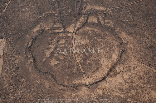
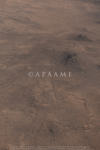
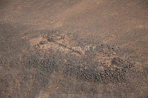
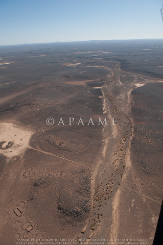
Showing posts with label Kites. Show all posts

Monday, 7 January 2019

Enter the U2 Spyplane Aerial Photography

Even if you are not old enough to remember the shooting down of Gary Powers and the huge international crisis that followed in 1960, you may have seen the more recent movie Bridge of Spies (culminating in the exchange of Powers for a Soviet spy).

A few years ago, while at a conference, Jesse Casana told me that U2 aerial photos of 1958-1960 had now been declassified and included aerial photos – not the satellite photos of the Corona programme and its successors, of parts of the Middle East. Declassified but not catalogued and hard to actually access.

Emily Hammer and Jason Ur have created a spatial index to the declassified U2 Aerial Photos for the Middle East available in the National Archives (NARA), and this can be accessed at https://scholar.harvard.edu/jasonur/u2-aerial-photography-middle-east

At least one product of that work has now been published (Hammer and Lauricella 2017) – though not by Jesse Casana. It is plainly a laborious task still to use the material but the quality is very good and – of particular interest to me, is a flight of 1960 down the Jordanian panhandle from east to west and over and beyond Azraq. The Hunting Aerial Survey of 1953 is a little earlier in date but the quality is evidently poorer and it did not extend much east of Azraq. There will be particularly useful work to be done on that key area west of Azraq where the HAS material is very useful but poor quality combining it with the better U2 material of parts of the area. It is precisely there – with better quality soils and more precipitation, that the expansion of agriculture and removal of the basalt covering has damaged and destroyed many hundreds of sites of all kinds. As we know from our AAJ project, it is often difficult today to find traces of even the large Kites visible on the Hunting photos of 1953 and many have gone entirely.

Hammer, E. and A. Lauricella. 2017. “Historical Imagery of Desert Kites in Eastern Jordan.” NearEastern Archaeology 80.2: 74-83. Available on JSTOR.
Hammer, E. and J. Ur. In press. “Near Eastern Landscapes and Declassified U2 Aerial Imagery.” Advances in Archaeological Practice.


-DLK

Tuesday, 25 October 2016

Publications - 'Kites in Arabia' iBook now free to download

Back in 2014 we launched an iBook that brought together a lot of our research on Kites (see our blog http://www.apaame.org/2014/09/publications-kites-in-arabia-ibook.html).

The iBook is now FREE TO DOWNLOAD!

You may also be interested in the following:
The Global Kites Project: http://www.globalkites.fr/
Arabian Archaeology and Epigraphy Special Issue Desert Kites - Old Structures, New Research: http://onlinelibrary.wiley.com/doi/10.1111/aae.2015.26.issue-2/issuetoc (Pay Wall)

You can browse thousands of photographs of Kites from Jordan in our archive.

Friday, 23 October 2015

Publications: Kites in Saudi Arabia

The November 2015 Special Issue of 'Arabian Archaeology and Epigraphy' Desert Kites - Old Structures, New Research contains a paper on this project's research into the Kites in Saudi Arabia conducted by David Kennedy, Rebecca Banks and Matthew Dalton. The paper specifically focuses on the case study area of Harret Khaybar.

The collection of papers is the result of a stimulating workshop on Kites organised by Dr. Ueli Brunner and held at ICAANE IX in Basel, Switzerland (See blogs: May 2, 2014, and June 23, 2014).

David Kennedy, Rebecca Banks & Matthew Dalton
Kites in Saudi Arabia
Arabian Archaeology and Epigraphy Vol. 26 iss. 2
Pages 177-195
DOI: 10.1111/aae.12053

The paper can be accessed through Wiley Online Library.

Saturday, 25 October 2014

Filming in Azraq

Friday 24th October. Up before sunrise, left Amman with a film crew and headed east to Azraq.

David Kennedy on the Umayyad reservoir wall - Azraq Wetland Reserve.
The day began with some shooting at Azraq Wetland Reserve. While there we took the opportunity to photograph the Umayyad reservoir wall. Sadly the oasis has greatly diminished in size in the last twenty years. Despite the Water authority pumping 1.5 to 2.5 million cubic metres of water into the wetlands each year, it is not enough to replenish the excessive pumping of water out of the oasis and, sadly, it is still shrinking in size.

Filming at Azraq Wheel 82
From there we headed out into the basalt desert to visit a Wheel and a Kite. We drove as far as the 4WD could take us across the mudflats, from there a somewhat arduous trek across the volcanic rocks to the site of interest. Even in this rather remote location we saw signs of recent looting – a bucket and pick axe inside the Wheel!


Looter's tools - Azraq Wheel 82
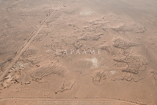
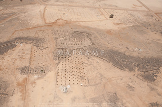
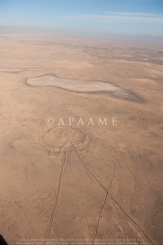
As one can see from the ground photo above, these stone structures don’t look very impressive, if they are noticed at all, when on foot. However, when seen from above, through aerial photography or satellite imagery, a very different picture emerges.
Azraq Wheel Group B. © APAAME_19970527_DLK-0157
Azraq Kite 81, Wheels 191, 192, 193. ©APAAME_20120522_DLK-0589
Returning to the Azraq Lodge (converted former British military hospital) in the evening for some final recording before heading back to Amman for a well earned dinner. 

Friday, 17 October 2014

Flight 20141015 - The Longest Day?

Flight track log from 20141015 - the survey of the basalt near Uweinid we conducted is particularly prominent.
A day’s flying always starts with the rigmarole of having to get through the security gate at Marka airbase. This year we were waved through on the first day as I was being asked if I wanted ‘Eight Squadron” and I said yes; not really knowing the exact details of what had just happened (as my Arabic is non-existent). The second day I blew it but today, having learnt what the question would be, and having memorized the Arabic for 8 Squadron, we sailed through. It has taken 16 years for this refined level of communication to be achieved – just as it has taken all these years to train a generation of young Huey pilots to understand what on earth these crazy archaeologists are doing orbiting sites hour after hour. Our pilots are now even taking their own pictures as they are becoming interested in what we see. All our orbits are to the right (as we sit on the right) but today was a “first” in that the pilot did a orbit to the left, especially for the co-pilot (seated on the left) to see what we had been looking at.

Qasr el-Uweinid. © `APAAME_20141015_RHB-0050.

So, what did we see? With over 2,000 images taken by the three of us (Bob, Becc and Mat) in 7.5 hours (see flight trace of today’s excursions) the highlights are particularly difficult to select. Our aim was to survey parts of the black basalt desert in the eastern part of Jordan, starting at Azraq and heading as far east as Ruweishid. Predominantly our targets in this region are prehistoric sites, but Qasr Uweinid always stands out as such a wonderfully situated Roman fort, on a promontory.
A Pendant with a close shave. © APAAME_20141015_RHB-0123.
Mainly we are photographing “Pendant”, “Kite” and “Wheel” sites – all named according to their shape; their date and function are less well known. The most striking Pendant (almost certainly a burial site) was this one – so nearly completely obliterated by a competing road bulldozed through since we last photographed.
A kite with wheel enclosure built over it. © APAAME_20141015_RHB-0463.

There were many Kites but the light this time of year highlights them so well – and rare to have both a Wheel and a Kite so entwined.

YAMOUK written in basalt across a mud pan landing ground. © APAAME_20141015_RHB-0303.
However it was the twentieth century remains which really took our breath away. In preparing for the flight Becc had marked two former RAF installations, visible on Google Earth but we had no idea what would survive. They are remnants from the time when Jordan was under a British mandate (then known as Transjordan), and the creation of the Cairo to Baghdad Airmail Routes. The first to be photographed was a landing ground with name "YARMOUK" created in stone, inlaid in the sand, to one side of the “runway”. The runway consisted of a very long stone-defined landing strip on the hard surface of the mudflat. To our amazement there seems to be almost no recent disturbance, a faint trace of the odd 4x4 wheel track, so prevalent elsewhere, but no sign of a bulldozer, thankfully.
The 'KENSINGTON' landing ground. © APAAME_20141015_RHB-0441.
The second site was one of the circular markers for the Cairo to Baghdad Airmail Route (one of the routes is described in R. Hill’s book on the subject from 1929) – number 17, but curiously this site also has inscribed in the sand the name "KENSINGTON". Both the number and the name are clearly visible on Google Earth. Our flight confirmed there has been little recent disturbance and we could also see what we interpret to be the remains of what must have been a camp, rectilinear stone-built platforms for tents. It is very unlikely any of the pilots from this period (1920s-1940s) are still alive but it would be fascinating to find out if any diaries exist of life at “Kensington”.

Remains of a camp near "Kensington". © APAAME_20141015_RHB-0443.

So, why the longest day? We left the Institute in Amman at 0630, and started flying at about 0715 and didn’t get back to Marka, after a long transit flight from Ruweishid, until almost 5 pm. Normally we do 4 to 6 hours flying (2 or 3 sorties) but today it was 4 separate flights, 3 re-fuellings for the aircraft but very little “fuel” for the pilots or ourselves and a total of 7.5 hours flying.
- Robert Bewley

Monday, 8 September 2014

Video: Aerial photography of Kites

If you want to see Kites from the Jordanian harra like we do - from a helicopter, check out this short YouTube video showcasing some of the Kite footage taken by Matthew Dalton during the Aerial Archaeology in Jordan Project's 2012 season.


Video taken by Matthew Dalton of the Aerial Archaeology in Jordan project, edited by Rebecca Banks. All material is © APAAME.

Wednesday, 3 September 2014

Publications: Kites in 'Arabia' (iBook)

Apple iBooks has just published (1 September) a new book by Prof. David Kennedy with Rebecca Banks and Emergent Form's Paul Houghton on Kites in 'Arabia'.

Kites in 'Arabia'
David Kennedy with Rebecca Banks and Paul Houghton
September 1, 2014
iBooks for iPad or Mac OS X 10.9 or later
Emergent Form
225 pages
US$4.99/ AU$5.99/ £2.99
Edit 25/20/2016 - the iBook is free to Download.

The book offers an approachable survey and analysis of the stone built structures known as Kites  found throughout Arabia - the huge arid region extending from south-eastern Turkey through Syria, Iraq, Jordan and Saudi Arabia to Yemen.  The volume examines Kites from their first discovery by the RAF pilots who were the 'Pioneers' of aerial photography in the inter-war period in Transjordan to recent research and interpretation conducted by various professionals in the field. Distribution, form and function of the Kites is discussed and extensively illustrated with references provided throughout. The volume benefits from David Kennedy's long established interest and passion for aerial photography and archaeology in the Middle East, and draws on the extensive reconnaissance performed by the Aerial Archaeology in Jordan Project and historical imagery research of the APAAME Project. The book also includes extensive appendices illustrating types and locations of Kites across 'Arabia', and historical accounts of Kites by early explorers in the Middle East.

The medium of iBook was chosen for two primary reasons: accessibility and inclusion of illustrations. We have made the iBook available for just US$4.99/ AU$5.99/ £2.99 to make the publication affordable. Images have been profusely included to illustrate the features described, something that would have astronomically increased publication costs in a printed edition. Moreover the electronic format allows for interactive features which enhance the illustrative elements and for video interviews and footage taken from the helicopter.

Heavy on content, the iBook does come out at roughly 1GB to download, but fortunately will only ever be as heavy as carrying around your laptop or iPad.

Monday, 21 July 2014

Research: The first Kites

In 2012, David Kennedy’s ‘Pioneers above Jordan’ article acknowledged the contribution to aerial archaeology by Royal Air Force pilots flying on the Cairo-Baghdad Airmail Route. The individuals who published the first photographs of a site they had termed ‘Kites’ were Percy Eric Maitland (1895-1985), Lionel Wilmont Brabazon Rees (1884-1955) and Gilbert Stuart Martin Insall (1894-1972).
Maitland 1927 The 'Works of the Old Men' in Arabia, Antiquity 1 (2): plate III.
Maitland’s article in the second issue of the new Journal Antiquity introduced the wider world to the concept of the ‘Works of the Old Men’ using aerial photographs taken by the RAF during passes of the Cairo-Baghdad air mail route. On Plate III a most striking Kite is presented as ‘Walls and Fort in Basalt Country’ – this has been located as ‘Wisad Kite 40’ at 31°52'43.54"N, 37°55'59.01"E and can be clearly seen on Bing Maps despite the encroaching sands over the low basalt walls of the Kite. From the collection of aerial photographs taken back to the UK by O.G.S. Crawford (now housed in UCL Special Collections for the Institute of Archaeology) we know this photograph is actually a mosaic of a series of vertical photographs taken over the kite.
Wisad Wall Tangle 2
Wisad Wall Tangle 2: APAAME_20091004_DLK-0045. Photographer: David Kennedy.
The other photograph on the plate, ‘Walls and Enclosures in Basalt Country’ may picture part of a kite amongst a tangle of walls – but the complex is now interrupted by a road and the El-Wisad Desert Patrol Post so we cannot quite clarify what the principle structure may once have been. We have identified the site as ‘Wisad Wall Tangle 2’: 31°53'6.82"N, 37°57'17.33"E.

Rees published photographs and images of a few Kites in his article ‘The Transjordan Desert’, also in Antiquity, but later in 1929. In ‘Circles Etc. in the Basalt Country South-West of Azrak’ on Plate III you can see the kite located at 31°47'54.56"N, 36°43'15.56"E, which we have photographed as ‘Amra Kite 4’.
Rees 1929 The Transjordan Desert, Antiquity 3 (12): plate IV.
On Plate IV he shows a photograph of ‘Kites south of Kasr Azrak’ which is a well defined chain of Kites at 31°51'51.57"N, 36°48'46.89"E with Azraq Kite 46 the most prominent in the photograph, but today the Kites are almost destroyed beneath increased farming and development around Azraq.
Azraq Kite 46 (Rees A)
Azraq Kite 46 in 2012 with a newly planted olive grove across the site. APAAME_20120522_DLK-0607. Photographer: David Kennedy.
In Plate VI he identifies a ‘Large Round Enclosure’ and two Kites on the photograph ‘Kazr Azrak and Surroundings’ but the ‘Large Round Enclosure’ is now entirely buried beneath the modern town (see Kennedy’s Big Circles article for information regarding this kind of feature), and one Kite, approximately 31°53'29.01"N, 36°50'5.39"E, is buried beneath the modern road, but the other is visible still at 31°53'39.43"N, 36°49'46.18"E. The photograph of ‘“Tell A”, near Landing-ground E’ on plate IX identifies several kites in the vicinity of the basalt mesa which can still be clearly seen from the air at 31°48'18.46"N, 37°25'59.97"E, and have been photographed and visited by the project several times.
Original RAF image from Insall (1929 The Aeroplane in Archaeology, Journal of the Royal Air Force College, Cranwell 9.2: between pages 174-175) juxtaposed with the modern imagery from Google Earth. Composed by Travis Hearn.
Also published in 1929 but less well known was Insall’s ‘The Aeroplane in Archaeology’ in the Journal of the Royal Air Force College, Cranwell (9.2: 174-175). The well defined kite with three tails he published eluded us for quite some time, but a review of the basalt region recently conducted identified the Kite at 31°47'51.06"N, 37°33'46.61"E alongside another Kite. Crossing the tails in the background can be seen the old bulldozed track laid out through the desert by the ground parties creating the new airmail route that acted as a guide for the pilots. More prominent now in the satellite imagery is a track bulldozed through the head.

Sunday, 13 July 2014

Research: Remote Sensing, Kites and Agriculture

This blog was originally posted as part of the 'Day of Archaeology' 2014 (11 July 2014). You can find all posts, and information, on their website: http://www.dayofarchaeology.com.
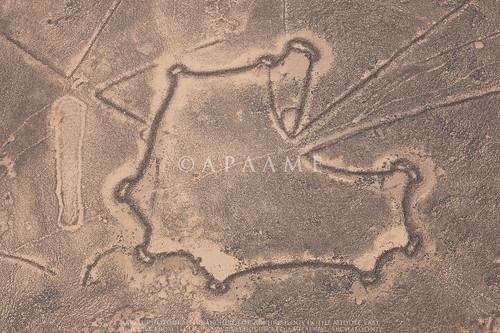
Safawi Kite 99, Safawi Kite 100
The well defined walls of kites on the Jordanian harra - Safawi Kites 99 & 100. APAAME_20081102_KHNQ-0386.
As you may have gathered from the many photographs we have taken in the Jordanian harra (see our Flickr archive), Kites in Jordan are found predominantly on the basalt lavafield. Due to the sharp contrast between the black rock and yellow sands these are often easily discernible in good resolution satellite imagery and even more so in the course of aerial photography conducted each year by the Aerial Archaeology in Jordan project (AAJ). Due to improved availability of good resolution satellite imagery over the Jordanian harra I recently embarked on a review of known features over the landscape in preparation for our upcoming field season in October. Due to the reasons mentioned, the majority of the harra was scrolled over relatively easily on my desktop, but it was not all a walk in the park.

The north western section of the harra was altogether more difficult to review. Our knowledge of site distribution in this area began with those traced on the 1:50,000 K737 maps. This was improved upon through an analysis of the Hunting Aerial Survey photographs undertaken by Prof. David Kennedy in the RSAME project where the information gathered from the aerial survey photographs were transcribed onto acetate copies of the 1:50,000 map sheets. Many of these sites were reviewed through ground survey conducted in the Southern Hauran Survey Project (SHS) in the late 80s and into the 90s, and included a few Kites, and AAJ, beginning in 1997, has also flown over and documented many sites in the region.

Google Earth (GE) has allowed us to utilise an affordable platform through which to easily review sites identified and photographed by the project, as well as investigate new sites for future research and documentation. In its early years the remote areas of Jordan were not a particularly high priority for high resolution imagery however, and many site locations were transferred into GE based on what was originally mapped in the earlier surveys mentioned, or locations estimated from the flight track log of AAJ aerial reconnaissance. These sites were therefore in need of the review I was conducting in order to increase the accuracy of the site location we had recorded, but also to verify whether the site first identified from earlier surveys was indeed correct.

The four map squares in question - Quttein, Hibabiya, Hallabat and Jimal are now in high resolution in GE - a victory you would think that would make life easier, but no. Here the basalt is no longer a deep dark black that contrasts easily for identification, but its age has bleached it and in some cases developed a patina over the surface so that it resembles the colour of the landscape around it. Take satellite imagery in the middle of the day and what you have is a bleached out landscape where you are lucky to identify anything at all. Moreover - this area is increasingly being utilised for agriculture and many sites identified from imagery taken in 1953 are now underneath fields of green. My standard approach of panning back and forth in GE and verifying against our aerial imagery and contrasting to Bing Maps was just not going to cut it today.
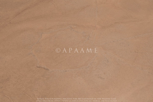
Hibabiya Kite 18
The faint trace of Hibabiya Kite 18 on an oblique aerial photograph. APAAME_20090917_DLK-0749.
Thanks to the laborious work of Research Assistants before me, we have created an overlay in GE of the distribution of all of the Hunting Aerial Survey (HAS) photographs. Using this overlay I was able to go from site to site we had identified and pinned in Google Earth and contrast it to what I could see in the HAS imagery and had been noted on the K737 acetates. Kites were by far the most numerous feature in this landscape on the fertile edge of the harra.

An important lesson was the fact that often some Kites visible on the satellite imagery were in no way or barely visible on the older HAS imagery, and some were visible on neither but clearly visible on the low oblique imagery of the AAJ project. As much as satellite imagery is an easy and resourceful tool, it definitely can not stand alone. Interestingly - and not something we come across often in Jordan, some of the historical GE satellite imagery showed up Kites easily identifiable on the HAS imagery as crop marks in the now fielded landscape. These would not have been so readily identified without the HAS imagery showing us where to look, but it is an important reminder that remote sensing techniques such as identifying crop marks that are applied in more lush landscapes may also be applied in Jordan at the right time of year, especially in agricultural landscapes like the Southern Hauran.

Monday, 23 June 2014

Conferences: ICAANE IX - round-up

This is a regular International Conference on the Archaeology of the Ancient Near East, held in Warsaw in 2011, due to be in Vienna next time, but this year in Basel, Switzerland.

After Registration at Universität Basel on afternoon of Sunday 8th June, we were off to a fast start the next day with plenary lectures followed by four and half days of several simultaneous lectures on various parts and periods of the ANE. Sometimes hard to get from one place to another in time.

As the name implies, ICAANE is mainly devoted to pre-Classical archaeology, though there were several interesting lectures on Petra and the Nabataeans. Also of interest was a (disturbing) 3-hour session on Syria. Don Boyer gave a very informative and superbly professional (as you would expect) talk on his research on the water supply of Roman Gerasa which got a good reception and useful questions and comments.

I would not normally have gone to ICAANE which seldom gives much attention to the Roman Near East. This year, however, Dr. Ueli Brunner (Department of Geography, University of Zurich) – who gave a lecture in UWA about 18 months ago on his work in Yemen, had organised a Workshop on Kites. So I gave a lecture on Kites in the Harret Khaybar of west-central Saudi Arabia. The plan is to publish all these Kites papers as a book – a quick and high-profile publication will stimulate new research.

As always, a good reason for attending is for those conversations and contacts that grease the academic research engine. People you seldom see are right there for days and there is the opportunity to talk at length.

The University and Half-Canton of Basel each laid on a very pleasant reception and Dr Brunner took the Kites group for dinner in a delightful restaurant-pub in the back streets of Kleinbasel.

The weather was HOT – c. 35 every day. But Basel is delightful – 200 years of peace and neutrality is obviously a Good Thing. A little sight-seeing took us all at times to the Rhine where a recreation was to get into the river stream with clothes in an inflated backpack and let the current drift you downstream.

The Boyers and Kennedys joined up one afternoon to take the (free) public transport 12 km east to visit the superb ruins of the Roman city of Augusta Raurica, just outside modern August. You may remember a lecture to the Roman Archaeology Group of Perth on this town by Martina Müller a few years ago. More on this site later.


-DLK

Friday, 2 May 2014

Conference: 9th ICAANE Basel, Switzerland, June 9-13, 2014


Icaane LogoThe 9th biannual International Conference on the Archaeology of the Ancient Near East is coming up in June of this year. The Conference is being hosted by the University of Basel (Kollegiengebäude der Universität Basel)

You can find all the information you need on the conference website: http://9icaane.unibas.ch/

We will be presenting Kites in Saudi Arabia in the 1st session of the workshop Desert Kites - Archaeological Facts, Distribution and Function.
Abstract: Although it has long been known that Kites were to be found in Saudi Arabia, it is only very recently that the availability of high-resolution imagery on Google Earth and Bing Maps has enabled researchers to identify them far more widely and in greater numbers than previously believed. In particular, imagery for the areas around Khaybar and Al-Hiyat revealed over 200. Now the high-resolution imagery has been extended more widely and a fuller picture can be formed. The Kites are varied in size and shape but many are of a distinctive, angular form not found elsewhere in ‘Arabia’. With an increased data set, greater familiarity with the wide variety of other, probably contemporary, stone-built structures in the region, and with the geological and vegetational environment, there is an opportunity to offer a more detailed analysis and interpretation than previously done by Kennedy and Bishop.

You can download the full list of workshops complete with abstracts here: http://9icaane.unibas.ch/ICAANE2014workshopsprovisional.pdf

Tuesday, 4 March 2014

Research - KSA 3925-41 - Samhah Kite 35

I have been able to return to some analysis on the many kites in the vicinity of Khaybar in Saudi Arabia today. The good news is that Google Earth has updated imagery in the area, bad news is it looks like some of the kites are a little worse for wear in the face of development. Fortunately we still have the historical imagery to conduct some analysis on the complete site - a bold example of the Kites typical to this region. What is striking in this example is the very straight walls, and numerous hides lined along the pointed extensions of the head. Another feature is the 'barbed' tails of the kite - almost secondary head enclosures connected to the tails close to the head of the kite.
KSA 1:50,000 map square 3925-41 - Samhah Kite 35 on imagery dated 20030106. Click to enlarge.
KSA 1:50,000 map square 3925-41 - Samhah Kite 35 on imagery dated 20121213. Click to enlarge.

Thursday, 12 September 2013

Research: Harrat Khaybar

For quite some time now I have been working on a large group of kites we found in a high resolution window in Google Earth around the ancient oasis and site of Khaybar. The huge concentration of kites fascinated us, so we have been conducting a comprehensive study and gathering data on the kites. This has included taking measurements, mapping, drawing and creating typologies.

While I have been working away I have constantly been struck by the ‘grass is always greener’ mentality, and wondered what lay behind the fuzzy pixels of the lower resolution imagery around my high resolution window in Google Earth. Well, that was answered for me today by Bing maps. My window has been completely blown open, and though for brevity and time’s sake I shall no doubt have to limit my study to the original window in Google Earth, the additional information provided by the larger context is incredibly helpful.

Firstly, I can confirm my suspicions of patterns:– the amazing series of kites that almost appear strung together by their tails that are located to the east of Khaybar have sister strings to the south of the high resolution window.
A string of Kites from east of Khaybar (drawn: Rebecca Banks).
Secondly, a report with accompanying photography by M. John Roobol and Victor E. Camp in their ‘Explanatory Notes to the Geologic Map of the Cenozoic Lava Fields of Harrats Khaybar, Ithnayn, and Kura, Kingdom of Saudi Arabia’ (1991) that showed what appeared to be a Kite stratified underneath a tongue of Pahoehoe lava of the Habir flow could be identified in the satellite imagery. The area reveals at least one Kite partly overlain by the lava flow – and several other stone structures as well. The Habir flow is ‘historic’ but the exact date is unknown – the eruption date could be anything between the 1st century AD and 1800 (Roobol & Camp: 23).

Wednesday, 28 August 2013

Research: Emily Beke's description of a 'Kite'

Our research into 19th century travellers' accounts of Syria and Transjordan, and more specifically what they encountered in the 'Hinterland of Roman Philadelphia' continues. Every now and then we turn up something fantastic, but not necessarily on our current topic of research.
Portrait of Emily and her husband Charles Tilstone Beke photographed by Ernest Edwards (Lovell Reece, 1867, 'Dr. and Mrs. Beke', in Portraits of Men of Eminence, Vol. 6, London: L. Reeve & Co.: 21. Original in the Natural History Museum, London: 051942).
Recently, we found a description of the function of a kite by Mrs Emily Alston Beke, wife of Charles Tilstone Beke. She wrote the following:
"It is curious how these animals are caught by the Beduins in the desert country lying to the east of Harran. Two walls of considerable length are erected, commencing at some distance from each other, and converging to a point. Before the two ends quite meet, a mound of earth is thrown up between them, and the two walls, being continued beyond this mound, are united by a cross-wall of about half their height; behind this lower wall is a large pit, the earth dug out of which had served to form the mound. Horsemen now contrive to drive a herd of gazelles between the two walls, where they are furthest apart. The timid animals rush forward towards the extremity of the enclosure, at first not seeing the low cross-wall, which is hidden by the mound of earth; and when, at length, they find themselves closed in on both sides, they naturally try to escape by ascending the mound and leaping over the low wall, when they fall into the pit beyond it, and are taken, often as many as twenty or thirty at a time."
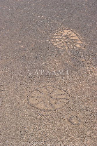
The entry is dated Tuesday December 24th, 1861 when Emily and her husband were visiting a Dr. Wetzstein in Damascus where they were sampling wine made from Helbon/Halbon grapes. The description must be that of a Kite. The description is particularly useful as what we currently know about the function of a kite is almost entirely derived from their remains and some inscriptions, whereas here we seem to have a contemporary account of their use, and what's more, it implies that Kites were still being used to trap gazelle into the 19th century. The area she refers to 'in the desert country lying to the east of Harran' is the northern tip of the Harrat ash-Sham east of Harran al 'Awamid. A large group of kites are located in this area, beginning roughly 15 km east of Harran al 'Awamid (or 40km east of Damascus), which we have located using satellite imagery freely available through Google Earth and Bing Maps. These kites were first photographed by Poidebard - one is published in La Trace de Rome (1934: Pl. XIV) (see Bewley & Kennedy, 2012, 'Historical Aerial Imagery in Jordan and the Wider Middle East', in Hanson & Oltean (Eds), Archaeology from Historical Aerial and Satellite Archives: Fig. 13.2 p. 226).

In exploring Harran in pursuit of a theory about an Old Testament place name, the Bekes discovered an inscribed stone (p. 199 ff.) which was later identified as a Roman milestone (p. 124ff.). Another was later found in a neighbouring village the name of which Emily gives as Ghassule (p. 125). Very unexpected.

Emily was 37 years younger than her husband but a fitting companion and his equal in many respects. Her published diary, and notes in the archival material of her husband show that she is highly intelligent, independent and active woman- accompanying her husband on at least one journey, helping him in his academic pursuits and publications as well as running their household as smoothly as she could with the expenses from research tours and publishing. After her husband's death she remained a staunch advocate for his lifetimes work, continuing to publish his research at considerable cost to her financial position.

Thursday, 1 November 2012

Publications: Kites–new discoveries and a new type

The discovery of an unusual specimen of kite with a limited distribution between Palmyra and Damascus in Syria led to the formulation of this journal article by David L. Kennedy.


Arabian Archaeology and Epigraphy (AAE) cover image

David L. Kennedy (2012) 'Kites–new discoveries and a new type', Arabian Archaeology and Epigraphy 23.2:145-155. You can find it at Wiley Online Library.


The 'sock' kite, fondly at first referred to as a 'Hockey Stick' kite, then (as we were feeling seasonal) a 'Christmas stocking' kite, with its narrow elongated 'shaft' and 'head' off to one side, forms the basis of this article. The discussion encompasses the form, distribution and geography of the new Kite type.

We also cover the extent of our current research on Kites in Arabia, and the article is generously accompanied by useful maps and distribution diagrams of Syria, Jordan and Saudi Arabia, and diagrams of the new Kite type.

Tuesday, 5 June 2012

Flight 20120520: Now online

Our first flight for 2012 is now uploaded to our flickr archive. You can browse the images here.

This flight focused on the stone built structures known as Kites located in the basalt desert of Jordan, but also captured other structures known as Wheels and Pendants. In particular, we were interested in the landscape and other structures surrounding the Kites, and how these features interact.

Here are some highlights. Please click on the images to enlarge (you will be sent to the image on our flickr site).

Hibabiya Kite 55
Hibabiya Kite 55 
 
Amra Kite 22 
 
Ausaji Pendant 16, Ausaji Cairns 9, Ausaji Cairns 8 
 
Ausaji Wadi 1 
 
Ausaji Wheel 20, Ausaji Kite 19, Ausaji Wheel 81

Monday, 21 May 2012

Flight 20120520 - Eurocopter Kite Hunting

Our first flight got off to an early start (take-off at 06.10). With no Huey available we were squeezed into an EC 635 (Eurocopter). It is much more comfortable, easier to move around in, quieter and the headsets all work and are much clearer. On the other hand ... too small for our team, a narrow door with just room enough for two, seats set at right angles so we had to climb down and sit on the floor with our legs dangling out the door.

Mat sizes up the Eurocopter. Photographer: David L. Kennedy

Otherwise it was a very successful flight and the pilot - new to the job, soon picked up on our needs and was very skillful. After 4 hours he had had enough twisting and turning however - neither he nor the co-pilot had had breakfast, he had a headache and it was a safety issue. Hard to argue with. We will ensure we all have breakfast with us next time ... and Panadol.

The 20120520 team. Photographer: David. L. Kennedy.
It was a day for Kites (again). Quite a contrast between the simple Kites west of Azraq in the first stretch and the amazingly complex one later to the east. Time now to download, catalogue and prepare for the second flight on Tuesday.
DLK

Ausaji Kites 53 (left) and 54 (right). APAAME_20120520-DLK-0285. Photographer: David L. Kennedy.

Friday, 13 April 2012

Chronology: Kites and Wheels

Determining the date for an archaeological site is best determined by excavation, but relative chronologies can be determined by examination of a very simple interaction - what lies on top of something else?

In the stone built structures of the Harret al-Shaam, we have been observing what kinds of sites are most likely to overlie others.

In the Jordan section of the Harret al-Shaam it is most likely, where Wheels and Kites are located in the same area, to see a Wheel manipulating or lying over the structure of a Kite. This most often involves the wheel overlying or using the wall of the tail of a kite, but there are also examples of the structure of the head being manipulated or built over by a Wheel. This chronology suggests that Wheels are a later structure than the Kites. In turn it is possible to see Pendants and Corrals overlying Wheels.

Azraq Wheel 11 overlying tail of Kite 21; Azraq Wheel 173 overlying head of Kite 55; Safawi Pendant 4 overlying Wheel 282. Images: Google Earth. Click to enlarge.


Kites > Wheels > Pendants ≥ Corrals

A recent investigation of a group of Kites located on the Harret in Syria, however, does not follow this broad relative chronology. In a tangle involving no less than 14 Kites and 25 Wheels, four Wheels overlie sections of four Kites, while two Kites can be seen to overlie sections of two Wheels.

Ghadir al Hajj tail of Kite 7 overying Wheel 22; Kite 10 overlying Wheel 24; Wheel 25 overling Kite 11, both overlain by corrals. Images: Google Earth. Click to enlarge.

So, simply an exception to the rule? Investigation will have to continue...

Thursday, 5 April 2012

Flickr Featured Sets

Over the last couple of days I have been looking through the Flickr archive and updated a few of our sets.

In 'Tracking Change' we set out to fly over a handfull of sites regularly in the course of our flying seasons to photograph the changes that are occuring, whether they be seasonal, environmental or man made. We have also included a set named 'Development Impacts' which gives examples of the kinds of human activity that are encroaching on Jordan's heritage.
Some sites that have particularly changed over recent years are:
  • Yajuz: a small Roman town on the outskirts of modern day Amman
  • Qasr el-Mshatta: a 'desert castle' located near Queen Alia Airport
  • Jarash: one of the best preserved archaeological sites in Jordan which is the focus of ongoing excavation and reconstruction
  • Azraq Shishan: the oasis of Azraq that was (and is) severly under threat from overuse of its water, but has in recent years become a nature reserve in an effort to bring life back to the dying wetlands.
In 'Featured Sets' we hope to build a collection of sets that will act as introductions to the various site types and time periods that are evident in Jordan's archaeological landscape. Our collections so far include
  • General Showcase: a selection of some of our favourite sites and photos of Jordan
  • Classical Showcase: Classical (Greek and Roman period) sites in Jordan
  • Kites: photographs of the various stone build structures known as Kites
  • Wheels: a selection of the numerous and somewhat enigmatic circular structures known as Wheels
  • Desert 'Castles': popular tourist attraction in Jordan, the scale and layout of these often impressively preserved structures is highly visible from above
  • The Hejaz Railway and World War One: the archaeology of modern conflict is still clear throughout parts of Jordan. This set introduces trenches and railway remains from this period, well known for the Great Arab Revolt and exploits of T. E. Lawrence
  • Biblical Sites: Jordan is the setting of many episodes from the Bible, and this set features some of the known sites mentioned in the Bible that we have visited.
If you want to see more photographs of a particular site, or we haven't featured one you are interested in, please use the search tool at the top right hand corner of Flickr's site window, being sure to select "Search APAAME's Photostream".

If you have any site types or periods that you think we should feature or photograph in future, please let us know!

Wednesday, 21 March 2012

Kites in Turkey

The search for Kites never seems to stop here, and we were recently rewarded with the first Kites found (as far as we know) in Turkey.

These kites were located using Google Earth. They are mostly located on small rocky outcrops. These areas of difficult terrain seems to have mostly escaped the effects of massive agricultural field clearance in the region. Ancient field systems are also visible as faint stone walls on the left of this image.


Click to enlarge image.