Monday 24 December 2012

Slides of Syria

As the year comes to a close, it is inevitable that we reflect on what we have done and what has been happening in the world.

I have been scanning slides from the late 1970s… a lot of slides, of archaeological sites in the Middle East. Most were taken by David K at a time when sites were often in better condition or not yet overgrown by developing villages and towns, so archaeological artefacts in their own right.

While scanning these slides I continually came across evidence of the beautiful archaeological record of Syria, and in the news I daily come across reports of conflict that increasingly and unavoidably is affecting these archaeological sites, whether they are caught in the crossfire or directly targeted by looting.

So, I thought it best to share some of these digitised slides with you and take you to sites that we may not be able to protect now, or visit in the near future, but of which we can hope to preserve evidence and knowledge.

(In no particular order... Please click on an image to enlarge it.)
Basilica, Deir Semaan.
South west church, Deir Semaan.


Deir Semaan (Saint Symeon Monastery or Telanissos) is one of many ruined villages, known collectively as the 'Dead Cities' on the limestone massif west of Aleppo in Syria’s north. These late Roman villages are extraordinarily well preserved, buildings sometimes surviving to two and three stories high, and allowing a superb insight into late Roman town life. These magnificent ruins however have suffered in the crossfire, and also through looting. This short article on the research of Emma Cunliffe, Durham University, includes a witness’s video recording damage to one of these sites, and reports have emerged that the Monastery of Saint Symeon has been damaged by shelling. Link.
Temple of Nebo in foreground with the great temenos of the Temple of Bel in background, Palmyra.
Palmyra is one of the best-known ancient sites in Syria. The city flourished due to its profitable position between the west and east, and became a major Roman city in the 2nd and 3rd centuries AD. Built around an oasis in the middle of the desert, the grandeur and preservation of the site is all the more marked due to its isolation, and it has been a favourite of tourists since the 19th century. A report on the Global Heritage Fund blog details how the site has become caught in the crossfire and is a target for looting. http://globalheritagefund.org/onthewire/blog/palmyras_ruins.
West wall of Halebiyeh looking east from the citadel towards the Euphrates River.
Halebiyeh, or Zenobia, is located on the banks of the Euphrates. The walls extending out from the Citadel of an immense Late Roman fortress city are the most prominent feature of this beautifully preserved site. The astonishing scale and quality of preservation can be gauged by noting David’s white LWB Landover (inside of the city wall in the centre of picture) (cf. D. L. Kennedy and D. N. Riley, Rome’s Desert Frontier from the Air, London (Batsford)).

Section C3 of Dura Europos.
Palmyra gate, Dura Europos.


Dura Europos, also on the banks of the Euphrates River, was preserved in sand until its excavation during the interwar period, prompted by the discovery of remarkably preserved frescos. Even more important was the discovery of a huge cache of papyri which included the largest single collection of papyri for the Roman army anywhere in the Empire, including Egypt.
The Tetrapylon at Damascus, located at one end of Souk al-Hamidiyeh to the west of the Umayyad Mosque in the city centre.
Damascus is the ancient and modern capital of the region and where the archaeological record is hidden in side streets, built into houses, and walked through as part of daily life in a thriving city. As fighting intensifies closer to the ancient city (BBC news article: http://www.bbc.co.uk/news/magazine-20659573) how will the ancient walled city and 1400 year old Umayyad Mosque built over the immense church of St John fare if it breaks through to the heart? The once lively Souks and are now devoid of tourists and suffer from intensifying security raids. One hopes the beautiful Souk al-Hamidiyeh and the numerous early medieval houses tucked in side streets will not suffer the same fate as the ancient heritage listed market place of the city of Aleppo, the Souk al-Madina, which was irreparably damaged in September– see http://www.reuters.com/article/2012/09/30/us-syria-crisis-idUSBRE88J0X720120930
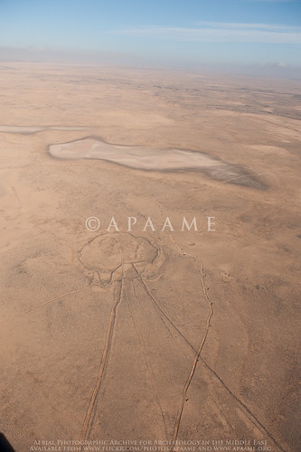
General view (north) of Bostra.
Bostra is in the south of Syria in a region known as the Hauran – a fertile semi-arid landscape on the edge of ancient lava-flows. It was the northern-most city of the Nabataean kingdom that stretched down through its capital at Petra into north-western Saudi Arabia. Nabataea was incorporated into the Roman Empire with Bostra as the capital of the new province of Arabia under Trajan in AD 106. The site is perhaps best known for its Roman theatre built from black basalt rock, but the ruins of the ancient city are also well preserved amongst the streets of the modern town, with towers in some cases standing over two stories high. The town has been damaged by shelling this year.

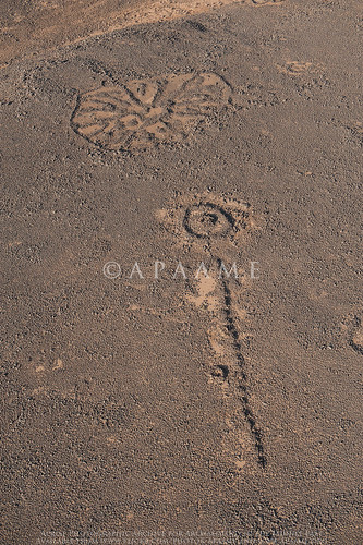
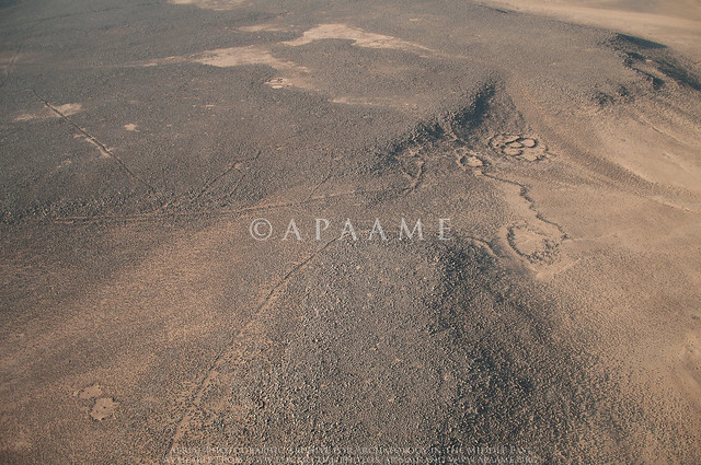
All photographs are © David L. Kennedy and belong to the Aerial Photographic Archive for Archaeology in the Middle East. After the slide collection is catalogued it will be available online at our Flickr archive: link.

I would like to thank David for looking over this blog, and for his continual remarks and encouragement while I develop the APAAME digital collection. Any remaining errors are wholly my own.
-Rebecca Banks 

Links:
Aryn Baker & Majdal Anjar, Syria’s Looted Past: how ancient artefacts are being traded for guns, Time World Sept 12 2012.
http://world.time.com/2012/09/12/syrias-looted-past-how-ancient-artifacts-are-being-traded-for-guns/
Emma Cunliffe’s updates on the Global Heritage Network blog site, one of the latest, which contains links to video footage, is the following:
Emma Cunliffe, No World Heritage Site Safe in Syria, Global Heritage Network Blog, Nov 19 2012.
http://globalheritagenetwork.ning.com/profiles/blogs/no-world-heritage-site-safe-in-syria#_edn16

Tuesday 18 December 2012

Publications - Historical Aerial Imagery in Jordan and the Wider Middle East

Hot off the press!
Robert Bewley and David L. Kennedy, 2013, 'Historical Aerial Imagery in Jordan and the Wider Middle East' pp. 221-242 in: William S. Hanson and Iona A. Oltean (eds) Archaeology from Historical Aerial and Satellite Archives, Springer: New York/Heidelberg/Dordrecht/London.
ISBN: 978-1-4614-4504-3

The book or eBook can be purchased from the Springer website: http://www.springer.com/social+sciences/anthropology+%26+archaeology/book/978-1-4614-4504-3

Friday 14 December 2012

Publications- Bulletins


Bit of a catch up on some bulletins from the last few months:


Bob Bewley with David Kennedy, Mat Dalton & Rebecca Banks, 'Aerial Archaeology in Jordan: 2010-2012', Aerial Archaeology Research Group News, Vol. 45, September 2012: 74-81.
Available to members from their website.

Fiona Baker & David L. Kennedy 'Jarash Hinterland Survey' in: Keller, Porter & Tuttle, 'Newsletter: Archaeology in Jordan, 2010 and 2011 Seasons', American Journal of Archaeology, Vol. 116, No. 4, October 2012: 702-703.
Bulletin of the Council for British Research in the Levant logo
David Kennedy & Bob Bewley, 'The Harret al-Shaam, from Air and Space' in: 'Long-term Landscape Environment and Climate Change Studies, from the Past through to Predictive Models for  Future Developments', Bulletin of the Council for British Research in the Levant, Vol. 7, No. 1, October 2012: 60-62.
Available through IngentaConnect.

Publications - APAAME photo in December issue Antiquity

Safawi Pendant 52, Safawi Wheel 290
APAAME_20120522_DLK-0096. Photograph: David L. Kennedy
Featuring in the latest issue of Antiquity is this photograph taken by David Kennedy on the 22 May 2012 during our last season of flying in Jordan. You can read more about the photograph and its features in the journal's Editorial:
Editorial, Antiquity, Vol 86 No 334 December 2012: 966. http://antiquity.ac.uk/journal.html#editorial

Wednesday 5 December 2012

Workshop - GIS and Near Eastern Archaeology

A Methodology for the Future? The role of GIS technologies within 21st century Near Eastern Archaeology

CBRL November 30th to December 2nd 2012 at the CBRL Institute in Amman, Jordan.


Congratulations to all the organisers of this intimate, perfectly formed workshop as it brought together a small but interested (and interesting) grouping.
An interesting group of workshop attendees - British Institute Director Carol Palmer (front far right); workshop organiser Jennie Bradbury of Durham University (front left of middle); and the author of this blog Bob Bewley (front centre) (Photograph: BI Amman Facebook page).
There were 22 people from wide range of places and backgrounds – a small group but a very useful event for two reasons. The first is the opportunity to share ideas, understand each other’s needs and work on ways of better and more useful collaboration.  For the APAAME project this will involve a closer working relationship between the MEGA-J (national online archaeological database for Jordan) and ourselves.

The second was a more general one of meeting and talking to people who one either wanted to talk to but never managed to find the time, or people one didn’t know and was glad to meet. The ‘regional’ nature of the archaeology was highlighted by the use of GIS – showing the longer terms trends when the masses of data are analysed to show the changing distribution patterns; be it in the prehistoric Roman or medieval periods.

Thursday 1 November 2012

Publications: Kites–new discoveries and a new type

The discovery of an unusual specimen of kite with a limited distribution between Palmyra and Damascus in Syria led to the formulation of this journal article by David L. Kennedy.


Arabian Archaeology and Epigraphy (AAE) cover image

David L. Kennedy (2012) 'Kites–new discoveries and a new type', Arabian Archaeology and Epigraphy 23.2:145-155. You can find it at Wiley Online Library.


The 'sock' kite, fondly at first referred to as a 'Hockey Stick' kite, then (as we were feeling seasonal) a 'Christmas stocking' kite, with its narrow elongated 'shaft' and 'head' off to one side, forms the basis of this article. The discussion encompasses the form, distribution and geography of the new Kite type.

We also cover the extent of our current research on Kites in Arabia, and the article is generously accompanied by useful maps and distribution diagrams of Syria, Jordan and Saudi Arabia, and diagrams of the new Kite type.

Friday 17 August 2012

Guest blog: Gary Rollefson and the Eastern Desert of Jordan

Research in the Eastern Desert of Jordan
2011 and 2012 
Prof. Garry Rollefson, Whitman College
Man made structures in the vicinity of Wisad Pools. Structure W-66 indicated. APAAME_20080909_DLK-0361. Photographer: David L Kennedy. Click to enlarge.
In 2007, when Alex Wasse and I revisited Wisad Pools in Jordan’s panhandle, we were stunned at the density of man-made structures at what appeared to be an enormous necropolis situated around a number of natural pools in a short wadi that collected rainfall during the rainy season. In the same summer we visited M-4 (“Maitland’s Mesa”) in the Wadi al-Qattafi, where there were clear pastoral structures on the top of this mesa as well as a tower tomb and a string of more than 50 rectilinear chambers extending from it along the southern edge of the mesa. In addition, there were numerous structures along the southern, western, and northern slopes, several of which showed striking parallels with nawamis tombs that had been reported from the Sinai and Yemen deserts. Since these two sites are currently characterized by hyperarid climatic condition, conventional wisdom and our own inclinations considered all of the basalt structures to be ritual in nature due to the effort necessary to construct them and to the ephemeral nature of most pastoral architecture. In our mind, these structures were permanent monuments to the dead, whether tumuli or cenotaphs. This interpretation proved to be incorrect, and although there are clear ritual structures at Wadi al-Qattafi and at Wisad Pools, many of the permanent structures are, in fact, domestic dwellings that imply some degree of permanence in occupation.

Tuesday 14 August 2012

APAAME in the Biblical Archaeological Review

Picture
Machaerus. APAAME_20060910_DLK-0005. Photographer: David L. Kennedy
Győző Vörös' article in the Biblical Archaeological Review this month explains some fantastic progress since 2009 at the site of Machaerus in Jordan being conducted by the Hungarian Academy of Arts, in collaboration with the Jordanian Department of Antiquities. The article features some of APAAME's images from the region of Machaerus, as well as some stunning shots by Jane Taylor. You can find the article here: Machaerus: Where Salome Danced and John the Baptist Was Beheaded.
If you would like to see more images of the site of Machaerus, please visit our Flickr Archive.

Free Lecture: Roman Archaeology Group of Perth

Upcoming free lectures run by the Roman Archaeology Group of Perth:

2 Illustrated Lectures

Baths and Bathing in the Roman World
Dr. Sandra Ottley

2012 field trip to Jarash, Jordan
Don Boyer

Saturday 25 August
1:30pm
Social Sciences Lecture Theatre
University of Western Australia

1:30pm - Baths and Bathing in the Roman World
2:30pm - tea break ($7 for RAG Members $10 for non-members)
3:00pm - Annual General Meeting, Roman Archaeology Group of Perth, Inc.
3:30pm - 2012 field trip to Jarash, Jordan

Please let us know of your interest by emailing Norah Cooper (please see flier below).
Next lecture: Summer Lecture Series program coming soon!

To learn more about the Roman Archaeology Group of Perth please visit their webpage.

Tuesday 31 July 2012

Hunting Aerial Photographs - Bodleian Library Oxford

rhodes house library, oxford
Rhodes House Library, Oxford. Photo from Flickr user 'idlethink' http://www.flickr.com/photos/idlethink/387238200/.


While here in Oxford on Sabbatical, my attention was drawn to a huge collection of c. 1.5 million aerial photos held in Rhodes House. They were acquired about 8 years ago and ultimately came from British government agencies operating in many parts of the former British Empire. Most are vertical survey photos, prints and generally of a very high quality. They have been very generally catalogued and organised in some 8000 (sic) boxes. Most are of parts of Africa and East Asia but there is a sizeable minority of c. 50,000 covering parts of Yemen (including Aden), Oman and Saudi Arabia. A separate visit will be needed to the Map Room of the Bodleian Library to consult the maps on which the photo runs are plotted.

-DLK

Wednesday 25 July 2012

Greater Zarqa, Jordan

Google Earth Screen Capture of urban development near Zarqa, north-east of Amman, Jordan. Click to enlarge.
In our last blog post we mentioned the impact of the expansion of the urban areas of Amman. While cataloguing historical imagery in our collection today, I have stumbled upon a perfect example which I was able to overlay in Google Earth after a bit of difficulty finding the location due to the extent the landscape had changed.

The image above is dated 22 August 2011. It does not differ much from the imagery dated eight years earlier below.

Google Earth Screen Capture of the same area as above, dated September 2003. Click to enlarge.
Compare, however with this RAF photograph taken in 1951.
Aerial photograph layered in Google Earth. Photograph V13RAF612 28 June 1951. Click to enlarge.
The contrast between the two images, fifty years apart, shows that the landscape has completely been transformed by the modern urbanisation of greater Amman to the south and Zarqa to the north-east. This specific area is of interest due to the location of el-Hadid (see Kennedy, D.L. 2002, 'Qaryat al-Hadid: a 'Lost' Roman Military Site in Northern Jordan', Levant, 34: 99-110), which you can see pinned in the top right of the screen captures. In the area specifically covered by the RAF photograph, however, we can see no trace of built remains on the surface except fields along the Wadi Zarqa.

Monday 23 July 2012

The not so ancient travels to Rabbath-Ammon

In our current research on the vast hinterland of the ancient city of modern day Amman, Hellenistic Philadelphia, Biblical Rabbath-Ammon, we have been reading many travellers' accounts of exploring the ruins of the lands of Moab and Gilead.
Sketch of Rabbath-Ammon from L. Oliphant, 1880, The Land of Gilead with excursions in the Lebanon, William Blackwood and Sons (Edinburgh/London): 264. Digitised by the Internet Archive.

These historical accounts were mostly written in the 19th century. Some accounts seem to dwell on the flea-bitten sleepless nights in Bedouin accommodation, their finesse, or lack thereof, of dealings with the Arab tribes to secure guides and protection on the perilous journeys to isolated historical sites, and anecdotal commentary on the lifestyle of the 'Musselman', Christian and Bedouin they come across in these territories. Other accounts, such as that of Tristram, are overwhelming concerned with the flora and fauna of the region.

Most important for us, however, are the references to and reports of ruins they come across. Most accounts try and attribute the sites to those towns and cities mentioned in the Bible, but many also refer the sites to passages in Pliny the Elder, Josephus and other ancient writers.

Moreover, as these travellers were making their way through this area well before any urbanisation had occurred, they preserve, sometimes only in passing, the existence of ruins that have long since disappeared. These may be the only such reference to these sites, and it is from these accounts we can hope to reconstruct an idea of the hinterland of Amman - now completely covered in the urban sprawl of an increasingly expanding modern city. Many of these accounts are also accompanied by sketches and maps which further help us identify and locate these sites now erased from the archaeological record, or simply waiting to be refound.

Many of these works are out of copyright and can be found digitised and accessible for free in places such as Google Books, the Internet Archive (http://www.archive.org), and Hathi Trust digital library (http://www.hathitrust.org/).

Tuesday 3 July 2012

Roman Archaeology Group Free Lectures: 21 July

Upcoming free lectures run by the Roman Archaeology Group of Perth:

2 Illustrated Lectures

Palmyra: an ancient oasis between East and West
 Rebecca Banks


The Roman Peloponnese
Kevin O'Toole

Saturday 21 July
1:30pm
Social Sciences Lecture Theatre
University of Western Australia

1:30pm - Palmyra: an ancient oasis between East and West
2:30pm - tea break ($7 for RAG Members $10 for non-members)
3:00pm - The Roman Peloponnese

Please let us know of your interest by emailing Maire Gomes (please see flier below).
Next lecture: Saturday 25th August.

To learn more about the Roman Archaeology Group of Perth please visit their webpage.

Publications: Epistula Newsletter

A short reflection on the 2011 Flying Season in the current issue of Epistula: Newsletter for the Society for the Promotion of Roman Studies, featuring an image of the ancient Roman town of Masuh.
Epistula III, p.6.
You can find out more about the society and their newsletter on their website: http://www.romansociety.org/archaeology/e-newsletter-epistula.html.

Tuesday 26 June 2012

Petition: Protection for Syria's Cultural Heritage

The British Association for Near Eastern Archaeology (BANEA) has launched a petition seeking protection for Syria's cultural heritage.

We hope you can sign it, support it and promote it through any contacts or avenues available to you.
http://www.avaaz.org/en/petition/Save_Syrias_Cultural_Heritage_1/?fPWGUcb&pv=1

The pdf of 'Damage to the Soul: Syria’s Cultural Heritage in Conflict' can be downloaded here: http://ow.ly/bNSk1

TEXT of the petition:
Save Syria’s Cultural Heritage The worsening situation in Syria places thousands of archaeological sites in immediate danger of current and future looting. A full discussion of the sites affected can be found here: Cunliffe, Emma. 2012, Damage to the Soul: Syria’s Cultural Heritage in Conflict. 16 May 2012. Global Heritage Fund. The British Associate of Near Eastern Archaeology (BANEA) and other interested parties call on the British Government, UNESCO and the International Centre for the Study of the Preservation and Restoration of Cultural Property (ICCROM) to protest to all parties to the conflict and petition for:
1. The removal of armed encampments, troops and weaponry from archaeological sites,
2. protection of archaeological sites and museums from looting,
3. recovery of stolen artefacts and the prosecution of the thieves and those who benefit from the thefts.

Updates and information can be found at www.banea.org

Jan Picton
Secretary, Friends of the Petrie Museum. www.petrie.ucl.ac.uk
Teaching Fellow, Institute of Archaeology, UCL. j.picton@ucl.ac.uk
Deputy Director, Gurob Harem Palace Project, www.gurob.org.uk

Thursday 14 June 2012

Flight 20120522: Now online

We have been busy cataloguing the second of our two flights in Jordan last month, and you can now access the photographs on our Flickr archive.


David Kennedy, Mat Dalton and Don Boyer flew five hours in a Eurocopter to capture some 1700 images of archaeological features and the landscape. Here is a selection.

Qattafi Kite 34
Qattafi Kite 34. Note how the guiding walls narrow along the natural curves of the landscape, and the head is hidden behind a ridge.
APAAME_20120522_MND-0005. Photographer: Mat Dalton.
Safawi Pendant 65, Safawi Pendant 64
Looted Cairns. The heads of Safawi Pendants 64 and 65 have both been hollowed out by illicit excavation.
APAAME_20120522_DLK-0312. Photographer: David Kennedy.

Safawi Wheel 88
Safawi Wheel 88 intercepting the tail of Safawi Kite 7. APAAME_20120522_DDB-0242. Photograph: Don Boyer.
Qasr Aseikhim
Qasr Aseikhim. APAAME_20120522_DLK-0653. Photograph: David Kennedy
Azraq Kite 46 (Rees A)
Azraq Kite 46, overlayed by modern agriculture. APAAME_20120522_DDB-0667. Photographer: Don Boyer
Safawi Pendant 67
Safawi Pendant 67 with a well built and in tact head. APAAME_20120522_DLK-0308. Photographer: David Kennedy.

Tuesday 5 June 2012

Flight 20120520: Now online

Our first flight for 2012 is now uploaded to our flickr archive. You can browse the images here.

This flight focused on the stone built structures known as Kites located in the basalt desert of Jordan, but also captured other structures known as Wheels and Pendants. In particular, we were interested in the landscape and other structures surrounding the Kites, and how these features interact.

Here are some highlights. Please click on the images to enlarge (you will be sent to the image on our flickr site).

Hibabiya Kite 55
Hibabiya Kite 55 
 
Amra Kite 22 
 
Ausaji Pendant 16, Ausaji Cairns 9, Ausaji Cairns 8 
 
Ausaji Wadi 1 
 
Ausaji Wheel 20, Ausaji Kite 19, Ausaji Wheel 81

Friday 25 May 2012

Descending the Zoar Ascent

Haim Ben-David at the start of the hike.
Photographer: David Kennedy. Click to enlarge.

Thursday at 4 am we left Amman on a 2.5 hour drive to the point on the northern rim of the Wadi el-Hasa. Our party of five was led by Prof. Haim Ben–David who has hiked up and down some of the more rugged parts of the escarpment overlooking the Dead Sea and Wadi Araba. Several of these tracks follow or intersect some of the more spectacular Roman roads in the Near East. The track that starts just west of Mazar is a mixture of bull-dozed track, Roman road and footpath. In places there are traces of efforts to plough up a few of the flatter bits of ground. Most of the route is steep and rugged.

The direct distance is 8 km; the actual distance zig-zagging is probably twice that. Equally important is that the hike is largely over boulder-strewn ground in which it is usually impossible to stride out – instead the hiker has to be eyes-down and carefully picking footfalls. And it is steep – a vertical drop between start and the town of Safi is about 1.3 km.
A stretch of road with parallel steps.
Photographer: David Kennedy.
Click to enlarge.

Setting off at 06.30 the start was easy and cool; by 08.15 when we stopped to breakfast in a shady place it was hot. An hour more and it was VERY hot and rising. A lot of water was drunk and I needed three coats of factor 30+ sunscreen.

Haim is a skilled guide on the track and with impressive – almost incredible energy. I was impressed to hear he had once walked UP the Ascent – then down the adjacent wadi the next day. By the time we were half way down and at 200 m asl I was incredulous at the thought of walking up this route. Walking down was demanding on the calves; walking up would be a challenge to the lungs.


The Roman road is quite clear in places. The edges are usually a double thickness of roughly square boulders about 3 m apart. In places the path between is divided up by widely-spaced steps. On sharp bends there are supporting walls. We managed to walk along quite lengthy parts of the Roman road but probably the best section is near the end where the current track is some distance away. Instead we had to view the road zig-zagging up a distant slope.
The unreachable but tempting zig-zag of the Roman road near Safi.
Photographer: David Kennedy. Click to enlarge.

We finally reached Safi (-300 m bsl) at 15.30. Not without tears and pain – the undersigned became jelly-legged soon after midday and found walking, much less picking a path between, on and down boulders without losing balance, ‘challenging’. Shade was almost non-existent but the temptation to sit down had to be resisted. Fortunately Haim, Yeshu and Ezer were fitter and kept me going to where the guide had driven round and was ready to meet us. A day to remember. I cannot imagine I would ever do that walk again but I would certainly like to tackle it from the bottom to walk the bit of Roman road we saw but could not reach.
Our track ahead and soon to pass a fortlet on a plateau.
Photographer: David Kennedy. Click to enlarge.

As Haim points out, the engineering of the road implies a government agency rather than any local authority. Yet there are no milestones on the road, no graffiti by exhausted traveller; there is an apparent fortlet and there are at least three open-air mosques. Pottery sherds crop up regularly along the road and they are abundant at a few places.

We had already photographed the fortlet from the air thanks to co-ordinates from Haim. Now we can trace the route more accurately from our GPS track and compare the landscape on the 1953 vertical aerial photos. We can return and photograph it on a future flight. More important, there is scope and a great need for some energetic archaeologist to study the road in detail – especially as parts are being destroyed.

DLK

Thursday 24 May 2012

The Eurocopter: View from inside

The lens of Don Boyer captures David Kennedy and Mat Dalton at work over the landscape of Jordan on Flight 20120520.

Publications: Pioneers above Jordan

David L. Kennedy 2012 'Pioneers above Jordan: revealing a prehistoric landscape', Antiquity 86: 474-491.

Percy Maitland (centre) in Iraq c.1925 (Maitland Family Collection).

Aerial photography is so fundamental an instrument of modern archaeology that we often take it for granted. But its methods are surprisingly specific and its most important experimental theatre was probably the territory of the Levant—and especially the rocky terrain of Jordan. The author, a prominent aerial archaeologist of our own day, takes time off to review the achievements of the pioneers, serving officers who established routes over the desert to deliver mail between Egypt and Iraq. The fabulous ancient landscape they discovered could only be appreciated through the lowlevel window provided by these slow-moving rickety machines and their intrepid pilots. In these days of jet travel, the precious basalt landscape is in danger of slipping off the agenda again—both for researchers and conservers.

Full text: Antiquity.co.uk

Wednesday 23 May 2012

Flight 20120522 Taster- Pendant and Wheel

APAAME_20120522_DLK-0095. Photographer: David L. Kennedy. Click to enlarge.
Fantastic example of a Bullseye Pendant, with a tail constructed of small cairns, and a Wheel, with spokes radiating from a central 'hub'.


Monday 21 May 2012

Flight 20120520 - Eurocopter Kite Hunting

Our first flight got off to an early start (take-off at 06.10). With no Huey available we were squeezed into an EC 635 (Eurocopter). It is much more comfortable, easier to move around in, quieter and the headsets all work and are much clearer. On the other hand ... too small for our team, a narrow door with just room enough for two, seats set at right angles so we had to climb down and sit on the floor with our legs dangling out the door.

Mat sizes up the Eurocopter. Photographer: David L. Kennedy

Otherwise it was a very successful flight and the pilot - new to the job, soon picked up on our needs and was very skillful. After 4 hours he had had enough twisting and turning however - neither he nor the co-pilot had had breakfast, he had a headache and it was a safety issue. Hard to argue with. We will ensure we all have breakfast with us next time ... and Panadol.

The 20120520 team. Photographer: David. L. Kennedy.
It was a day for Kites (again). Quite a contrast between the simple Kites west of Azraq in the first stretch and the amazingly complex one later to the east. Time now to download, catalogue and prepare for the second flight on Tuesday.
DLK

Ausaji Kites 53 (left) and 54 (right). APAAME_20120520-DLK-0285. Photographer: David L. Kennedy.

Friday 18 May 2012

Digitising our Collection - Slides

The Aerial Archaeology in Jordan project has been in action since 1997, but before that David Kennedy was visiting sites in the Near East for his own enjoyment and research. Most of the images he took on the ground were processed into slides.

Slides are a thing of the past, and not the best way to store your negatives, and it is now one of our projects to digitise this collection and add it to our online archive.

The slides I have been starting on are photographs from Syria, taken in the 1970s, and have not been stored in optimal conditions. The 35mm negatives are mounted between thin glass within a slide frame, and then stored in slide sheets in a filing cabinet. Most slides have developed a sticky, oily residue from the interaction with non-archival plastic slide sheets, small spots of mildew have started to appear on the slides, and the colour of the slides has started to degrade, developing a magenta tinge. In some cases, the glass mounting has shattered, scratching the negative.
Slide scan of rock cut tombs in Dawa, North West Syria. c.1978. The remains of the oily residue can be see along the edges of the frame. Photography: David Kennedy. Click to enlarge image.

Slide scan of Qatoura, North West Syria, c.1978. Mildew spots and scratches to the negative can be seen in the blue of the sky above the town. Photograph: David Kennedy. Click to enlarge image.

A preliminary cleaning of the slides to remove what we could of the oily residue could not clean the frame well enough to remove all traces of the residue, and this did not tackle the minor mildew problems. With advice from the State Library of WA Conservator, we will be using a 50:50 solution of Ethanol Absolute and Deionised Distilled Water to clean the slide frames and glass mounting. This same solution can be applied carefully to those negatives that have been effected by mildew - but we must be careful not to let the solution interact with the emulsion side which could cause permanent damage to the slide. The ethanol solution will evaporate quickly and leaves no residue.

Once the slides have been cleaned and scanned - we hope that we will be able to edit the images individually to correct any permanent scars such as scratches, or any traces of dust that may have come through during the scanning process. Colour correction will be used to minimise the effects of the magenta tinge.

We shall let you know of our progress. Any advice is most welcome.

Friday 13 April 2012

Chronology: Kites and Wheels

Determining the date for an archaeological site is best determined by excavation, but relative chronologies can be determined by examination of a very simple interaction - what lies on top of something else?

In the stone built structures of the Harret al-Shaam, we have been observing what kinds of sites are most likely to overlie others.

In the Jordan section of the Harret al-Shaam it is most likely, where Wheels and Kites are located in the same area, to see a Wheel manipulating or lying over the structure of a Kite. This most often involves the wheel overlying or using the wall of the tail of a kite, but there are also examples of the structure of the head being manipulated or built over by a Wheel. This chronology suggests that Wheels are a later structure than the Kites. In turn it is possible to see Pendants and Corrals overlying Wheels.

Azraq Wheel 11 overlying tail of Kite 21; Azraq Wheel 173 overlying head of Kite 55; Safawi Pendant 4 overlying Wheel 282. Images: Google Earth. Click to enlarge.


Kites > Wheels > Pendants ≥ Corrals

A recent investigation of a group of Kites located on the Harret in Syria, however, does not follow this broad relative chronology. In a tangle involving no less than 14 Kites and 25 Wheels, four Wheels overlie sections of four Kites, while two Kites can be seen to overlie sections of two Wheels.

Ghadir al Hajj tail of Kite 7 overying Wheel 22; Kite 10 overlying Wheel 24; Wheel 25 overling Kite 11, both overlain by corrals. Images: Google Earth. Click to enlarge.

So, simply an exception to the rule? Investigation will have to continue...