Tuesday 31 July 2012

Hunting Aerial Photographs - Bodleian Library Oxford

rhodes house library, oxford
Rhodes House Library, Oxford. Photo from Flickr user 'idlethink' http://www.flickr.com/photos/idlethink/387238200/.


While here in Oxford on Sabbatical, my attention was drawn to a huge collection of c. 1.5 million aerial photos held in Rhodes House. They were acquired about 8 years ago and ultimately came from British government agencies operating in many parts of the former British Empire. Most are vertical survey photos, prints and generally of a very high quality. They have been very generally catalogued and organised in some 8000 (sic) boxes. Most are of parts of Africa and East Asia but there is a sizeable minority of c. 50,000 covering parts of Yemen (including Aden), Oman and Saudi Arabia. A separate visit will be needed to the Map Room of the Bodleian Library to consult the maps on which the photo runs are plotted.

-DLK

Wednesday 25 July 2012

Greater Zarqa, Jordan

Google Earth Screen Capture of urban development near Zarqa, north-east of Amman, Jordan. Click to enlarge.
In our last blog post we mentioned the impact of the expansion of the urban areas of Amman. While cataloguing historical imagery in our collection today, I have stumbled upon a perfect example which I was able to overlay in Google Earth after a bit of difficulty finding the location due to the extent the landscape had changed.

The image above is dated 22 August 2011. It does not differ much from the imagery dated eight years earlier below.

Google Earth Screen Capture of the same area as above, dated September 2003. Click to enlarge.
Compare, however with this RAF photograph taken in 1951.
Aerial photograph layered in Google Earth. Photograph V13RAF612 28 June 1951. Click to enlarge.
The contrast between the two images, fifty years apart, shows that the landscape has completely been transformed by the modern urbanisation of greater Amman to the south and Zarqa to the north-east. This specific area is of interest due to the location of el-Hadid (see Kennedy, D.L. 2002, 'Qaryat al-Hadid: a 'Lost' Roman Military Site in Northern Jordan', Levant, 34: 99-110), which you can see pinned in the top right of the screen captures. In the area specifically covered by the RAF photograph, however, we can see no trace of built remains on the surface except fields along the Wadi Zarqa.

Monday 23 July 2012

The not so ancient travels to Rabbath-Ammon

In our current research on the vast hinterland of the ancient city of modern day Amman, Hellenistic Philadelphia, Biblical Rabbath-Ammon, we have been reading many travellers' accounts of exploring the ruins of the lands of Moab and Gilead.
Sketch of Rabbath-Ammon from L. Oliphant, 1880, The Land of Gilead with excursions in the Lebanon, William Blackwood and Sons (Edinburgh/London): 264. Digitised by the Internet Archive.

These historical accounts were mostly written in the 19th century. Some accounts seem to dwell on the flea-bitten sleepless nights in Bedouin accommodation, their finesse, or lack thereof, of dealings with the Arab tribes to secure guides and protection on the perilous journeys to isolated historical sites, and anecdotal commentary on the lifestyle of the 'Musselman', Christian and Bedouin they come across in these territories. Other accounts, such as that of Tristram, are overwhelming concerned with the flora and fauna of the region.

Most important for us, however, are the references to and reports of ruins they come across. Most accounts try and attribute the sites to those towns and cities mentioned in the Bible, but many also refer the sites to passages in Pliny the Elder, Josephus and other ancient writers.

Moreover, as these travellers were making their way through this area well before any urbanisation had occurred, they preserve, sometimes only in passing, the existence of ruins that have long since disappeared. These may be the only such reference to these sites, and it is from these accounts we can hope to reconstruct an idea of the hinterland of Amman - now completely covered in the urban sprawl of an increasingly expanding modern city. Many of these accounts are also accompanied by sketches and maps which further help us identify and locate these sites now erased from the archaeological record, or simply waiting to be refound.

Many of these works are out of copyright and can be found digitised and accessible for free in places such as Google Books, the Internet Archive (http://www.archive.org), and Hathi Trust digital library (http://www.hathitrust.org/).

Tuesday 3 July 2012

Roman Archaeology Group Free Lectures: 21 July

Upcoming free lectures run by the Roman Archaeology Group of Perth:

2 Illustrated Lectures

Palmyra: an ancient oasis between East and West
 Rebecca Banks


The Roman Peloponnese
Kevin O'Toole

Saturday 21 July
1:30pm
Social Sciences Lecture Theatre
University of Western Australia

1:30pm - Palmyra: an ancient oasis between East and West
2:30pm - tea break ($7 for RAG Members $10 for non-members)
3:00pm - The Roman Peloponnese

Please let us know of your interest by emailing Maire Gomes (please see flier below).
Next lecture: Saturday 25th August.

To learn more about the Roman Archaeology Group of Perth please visit their webpage.

Publications: Epistula Newsletter

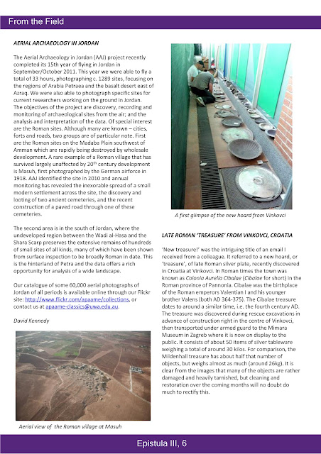
A short reflection on the 2011 Flying Season in the current issue of Epistula: Newsletter for the Society for the Promotion of Roman Studies, featuring an image of the ancient Roman town of Masuh.
Epistula III, p.6.
You can find out more about the society and their newsletter on their website: http://www.romansociety.org/archaeology/e-newsletter-epistula.html.