Showing posts with label Aerial Archaeology in Jordan. Show all posts

Wednesday, 26 October 2016

Jerash Mausoleum 3D view


David Connolly’s excellent 3D view of one of the large - and seriously endangered, monumental tombs beyond the walls of Roman Gerasa. Photographs are a mixture of his ground photographs and others taken from the air as part of the Aerial Archaeology in Jordan project.

Click here to view the Jerash Mausoleum 3D model

He has also made a 3D model of Kh. el-Beddiyeh - an excavated settlement site in the Ajlun Highlands.

Thursday, 29 September 2016

FL201609 - September’s season so far. The Unexpected.

There is no question that the word “unexpected” is the theme of this year’s season, which has been very successful so far.  Unexpected length of annual holidays and holidays for parliamentary elections, and unexpected (and sometimes inexplicable) restrictions on when and where we can fly. None of this is a surprise; after 20 years of working in Jordan the plans we make before we arrive are always changed, but to the eternal credit of the Air Force, pilots and crews, we always achieve the vast majority of what we plan.
Landscape of the Wadi Araba, north of Aqaba. David Kennedy, APAAME_20160918_DLK-0399.
Our opening expedition (18-19 September) was south to Aqaba, but with the unexpected delay following the return to work after the Eid al-Adha, a stronger than expected headwind, and a sick crew man. However despite this we succeeded in flying for over 5 and a half hours, and still had just enough time at the end of the day for a therapeutic swim in the Red Sea, before flying a full four hours back to Amman the following day.
Wadi an Nasifah. Robert Bewley, APAAME_20160919_RHB-0117. 
Expected, but always surprising, is the number and nature of landscapes and sites we photograph. The trip home from Aqaba took us through narrow steep-sided gorges, with strategically located Roman military installations though to dramatic and contrasting geological formations with a variety of prehistoric, Roman and early Islamic sites.
A village on the southern edge of the Ras en-Naqb. Robert Bewley, APAAME_20160919_RHB-0161.
After a brief respite we had two excellent days in the black basalt desert (the Badia) photographing a wide range of sites. The one site that stood out for me - the “Bulls-eye” Cairn. I don’t remember seeing them as clearly defined as those we surveyed this year. The “Bulls-eye” Cairn is another example of just how little we know about the date, distribution or function of many of these sites. However the information we have accumulated means we can start to analyse them, and answer research questions.
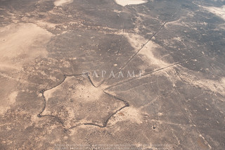
A large 'Bulls-eye' cairn with tail, known also as a 'Pendant'. Robert Bewley, APAAME_20160922_RHB-0538.
As with the work of the National Mapping Programme in England, the contribution of aerial survey and interpretation has been to expand our understanding of the size and nature of the past human populations. Seeing the density of stone structures of all types, representing settlements, hunting sites, and burials, has to mean that in the majority of prehistory there were a sizeable human population in the badia desert region of Jordan. An area, until recently, which has been ignored by archaeologists, looking for richer pickings in the so-called Fertile Crescent; thankfully this is changing and there a number of expeditions working in this region to discover the nature of the sites, their date and function. You can see an example of the contribution of aerial survey in the Badia in this article about Bernd Müller-Neuhof's research: 6,000-year-old Fortresses Found in Jordan Show Surprisingly Advanced Early Society.
Concentration of features on the summit of 'Tell el-Ghusein'. Robert Bewley, APAAME_20160922_RHB-0604. 
It is always an exciting event to be flying in the rift valley along the shores of the Dead Sea, where our fifth flight was located. I don’t usually have the time or inclination to check the altimeter on the GPS but for some reason I clicked on it as we descended from 5,000 ft amsl (above mean sea level) to minus 500 ft, below it.
Our GPS reading -194 feet below mean sea level.
Most fittingly, we were flying over the Museum at the Lowest Place on Earth. This, of course, should be impossible without going under water, but as it is a “mean sea level” which gives us our height, there has to be exceptions. The Dead Sea area as the lowest point on earth (not under water) is one such exception, so we had the unexpected pleasure of flying along at minus 500ft, with the door open and a wonderful (warm) view of this part of the great rift valley.
View of the Rift Valley. Rebecca Banks, APAAME_20160927_REB-0072.
We were also, unexpectedly, approached by a journalist from Associated Press (AP), based in Amman. He has interviewed both David Kennedy and I, and I took him flying for a short trip to show the preparation and process of aerial survey. We look forward to seeing his short film in due course. On this short flight we also had (pre take-off) the unexpected pleasure of a flat battery in the helicopter; external power was wheeled in and we were on our way without much delay.

We are now using a different helicopter, no longer the Huey, but now the Eurocopter or ‘EC’. This has meant getting to know a new squadron, and new pilots. Each day it is a new crew. Sitting having tea after one sortie, high up in the control tower of one of airbases the Captain unexpectedly asked me, slightly reluctantly, “Why are you doing this work?” Behind the question (given a certain lack of interest up to that point) was the inference “it seems to be a complete waste of time.” I explained our reasons, - discovering sites, monitoring change and damage, and making a photographic record. On the next sortie he was able to the see sites in a new light and his orbiting was much more precise. Unfortunately we had another 4 hours of flying and by the end of it the crew were exhausted (as were we) and any positive feelings to archaeology were forgotten for the day.

We have had enthusiastic crew members taking pictures out of the window of archaeological sites and the beautiful Jordanian landscape (and maybe their home villages), but also unexpectedly many, many photographs on the ground, including “selfies.” I am not an enthusiast of the “selfie” phenomenon. I have been surprised by the sophistication of the “selfie world” with extending selfie sticks, the use of sun and shade, and location: a selfie with the helicopter in the background must clearly carry some weight in the purpose for which these photographs are taken (if indeed there is one). Who knows, one day we might even have a selfie album on APAAME, but I hope not.
The dreaded 'selfie stick'.
Unexpectedly our own health came into play to a greater degree than ever before. Aerial reconnaissance requires strength of both body and mind. The weaker either one of those is the stronger the other has to be. It is rare, here, to have full strength in both, either through lack of sleep (dogs barking in the night, the 0400 call to prayer all contributing to short nights) or the after effect of something we’ve eaten, having a devastating effect on one’s digestion. Each member of the team has succumbed, one way or another, to a bug. This has never happened before and we hope for all our sakes it doesn’t happen again.  Fortunately, so far, it has not affected the performance of our well planned (with unexpected changes) flying and making new discoveries.

Less than a week to go, so let us hope for less of the unexpected.

Bob Bewley
28th September 2016

Tuesday, 14 June 2016

AAJ May 2016 - Highs, Lows, and Goodbyes to the Hueys

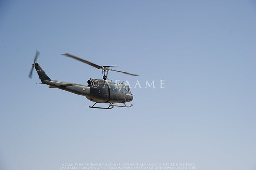
When we are in Jordan we will squeeze in any opportunity to fly, but this year it was particularly important to do a few flights as we have sadly lost the use of the wonderful beast of helicoptering - the Huey, and we had to test our new machines and pilots of the Eurocopters.
Jafr AFB
One of the RJAF Hueys in flight during the 2010 season. Photographer: Don Boyer. APAAME_20101016_DDB-0045.
The Huey has been our principal form of aerial reconnaissance since the Aerial Archaeology in Jordan project started in 1997. The advantages of the Huey were its spacious interior, large opening (once the door was open) and outward facing seats that allowed four photographers to operate together. Given these machines had been in operation during the Vietnam War (see our blog 'I Love the Smell of Nabataea in the Morning'), and one had a bullet hole to prove it, we knew we would have to move on eventually. They had their quirks, like the communication systems being flakey, shaking you about so that you could feel the movement for several hours after landing, and the noise! We felt a pang of grief for the loss of a trusted friend that had transported us over the varied sites and landscapes of Jordan. If anyone has a few million pounds to service a small fleet of Hueys for us, I am sure we could make good use of it!

Thursday, 9 June 2016

FL20160529 - Low clouds over the Kerak Plateau

Aiming for a 7 o’clock take off we left CBRL at 0630, Andrea and I, with the sun rising and some clouds in the west. As we crossed the Hejaz railway en route to Marka we were overtaken by the Squadron Commander, who waved and we followed him; I was wondering which gate to the air base he’d use (as there is more than one). Every year we have gone through a ritual at the gate where the guards don’t have a clue who we are, despite assurances the previous day that the guards have been informed. Today we followed him through a gate we knew existed but have never used; this is the gate where we have been supposed to enter - the gate where the guards have been forewarned each day (by the squadron commanders) prior to arrival. As it was our last day of the season we will not know if we will have “cracked” the gate until September, when we hope to return.

The Madaba Martyrs Church, section of Roman Road and the 'Burnt Palace'. Photographer: Robert Bewley. APAAME_20160529_RHB-0017.

Saturday, 28 May 2016

Flight 20160526 - East into the Badia

The second flight of the 2016 season saw Becc and I heading east to the Azraq area, taking in Qasr Aseikhim, a wonderful and significant multi period hilltop site but which is suffering badly from the bulldozer as access roads make it more accessible.
Qasr Aseikhim showing signs of damage from bulldozing. Photographer: Rebecca Banks. APAAME_20160526_REB-0132.
We then headed to assess the impact of the construction of the Azraq by-pass on the stone built structures on the Harrat al-‘Uwaynid. It was truly depressing seeing what had been destroyed without thorough investigations (a presentation at ICHAJ13 by Romel Garib said a survey had been conducted with the help of Prof. Gary Rollefson, but no excavation); truly a missed opportunity as the area is rich in kite-sites, wheels, and pendants (one of which we have been monitoring and has had its tail smashed through – seemingly unnecessarily). These sites are representative of this part of the basalt plateau, and we know so little about them.

Friday, 27 May 2016

FL20160523 - Clouds in the North

The Aerial Archaeology in Jordan project has just begun its 20th season (after David’s flight in 1997) and it coincides with ICHAJ13- a conference to celebrate and be informed of recent archaeological work in Jordan. Balancing the commitments of the conference with trying to fly was always going to be tricky but the opportunity to undertake aerial surveys should never be missed, especially in this region.

Jordan Valley; Tabaqat Fahl
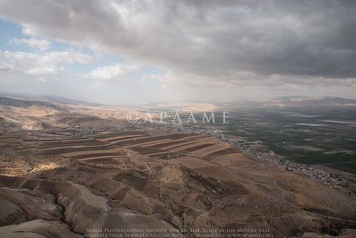
Jordan Valley near Pella. Low cloud made visibility and photography not ideal. Photographer: Robert Bewley. APAAME_20160523_RHB-0219.

Jordan never ceases to surprise, and this year has seen the demise of the Air Force’s Huey helicopters, which we had come to love – despite their the noise, and discomfort too, but also great space and views with the door open, and relatively slow speed. So, this first fight (Andrea Zerbini and I) was also experimental in learning the art of aerial photography in a new machine – the Eurocopter (or EC 635).

Monday, 23 May 2016

Kh. el-Musheirfeh and MEGA-Jordan

The Jordanian village of Kh. el-Musheirfeh lies about 4 km southwest of the major Nabataean/ Roman/ Early Islamic village/ fort/ town of Umm er-Resas. A further 4 km south is the major archaeological site of Lehun on the rim of the great trough of the Wadi Mujib.

The published literature on the site is limited and the two entries in JADIS and now in MEGA-Jordan are confused, confusing and incomplete.

‘MEGA-J 12338 Musheirifa (sic)’ locates a ‘site’ on the south side of the modern village but that turns out to be only the modern village itself.

‘MEGA-J 12349 Musheirfeh (sic)’ is located 2.5 km to the northeast of the village but in an open area with no traces of any archaeological features.

Surprisingly, therefore, the record reports material of several periods - Nabataean, Roman, Byzantine, Islamic, Modern, and lists eight ‘Site Elements’ including a village, cistern, a bas relief and sherd scatters of the periods noted. The source of the information is given in two published references from the 1930s (Glueck and Savignac, below). A brief glance at these two publications confirms the obvious – there is just one site and it lies under and around the modern village. The second MEGA-J entry (12349) should be deleted and the information there should be transferred to the first entry (12338) under that spelling (as on the 1:50,000 map).

Musheirfeh is in fact an important site as the two published reports show. Glueck was there on 2 June 1933; Savignac in late April 1935. The latter knows of Glueck’s first major report on his survey which included this site but – inexplicably, does not refer to what he had published. i.e. the two reports are effectively independent of one another. Putting the two reports together allows a composite picture which can be considerably enhanced and developed by analysis of the satellite imagery on Google Earth and Bing, by interpretation of the survey aerial photographs of 1953 and the recent low-level aerial photographs taken by the Aerial Archaeology in Jordan project, all of which are in the APAAME archive.

Tuesday, 17 May 2016

Preflight work flow – AAJ May 2016

Our bags are packed, flights booked and we’ll be landing in Amman soon for this our 20th year of flying in Jordan (the first season was way back in 1997)!

This May will see a short series of flights, hopefully three in total – one to the north and along the Jordan Valley, one to the East into the Badia, and one to the south concentrating on the fertile Kerak Plateau.

We will also be attending the International Conference of the History and Archaeology of Jordan and look forward to seeing excellent presentations on the projects and research occurring. You can find the program on the conference website http://ichaj.org/

See you in the air!

Friday, 26 February 2016

Publications (Correction): Pioneers Above Jordan

It has just come to our attention that the article
David Kennedy 2012 'Pioneers Above Jordan: revealing a prehistoric landscape', Antiquity 86 (332): 474-491.
contains an error for the image and caption of figure 10.

The image in the text is the following:
Ausaji Kite 28
Ausaji Kite 28. Photographer: David Kennedy (APAAME_20091008_DLK-0167).
The caption should identify the site as 'Ausaji Kite 28'.

The caption in the published text is that for the following image:
Wisad Kite 14
Wisad Kite 14. Photographer: Robert Bewley (APAAME_20091004_RHB-0073).
The caption from the article reads as follows:
Wisad Kite 14 (APAAME 20091004 RHB-0073). A kite surrounded by an immense tangle of walls, few of them visible at ground level. In the top left is the Wisad Police Post on the Airmail Track.

Wednesday, 24 February 2016

Publications: Khatt Shebib

Khatt Shebib
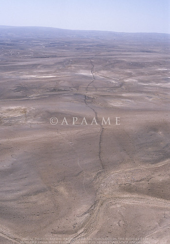
The Khatt Shebib. Photographer: Robert Bewley (APAAME_20051002_RHB-0069).
Recently the academic journal Zeitschrift für Orient-Archäologie published our article on the wall feature in Jordan known as the 'Khatt Shebib'. The content of this article was recently reported on by Owen Jarus in the online science website 'LiveScience' - '93-Mile-Long Ancient Wall in Jordan Puzzles Archaeologists'

The LiveScience feature has led to other media taking up the story. 

The feature was investigated remotely in the course of the active aerial reconnaissance program - the Aerial Archaeology in Jordan project, as well as visited on the ground. The study utilised historical imagery (mainly 1953) and maps, as well as several archaeological survey reports conducted on different sections of the wall, notably those directed by B. MacDonald (Wadi el-Hasa, Tafila to Busayra, and Ayl to Ras an-Naqab Archaeological Surveys), F. Abudanh (in the region of Udruh) and G. Findlater (the Dana Archaeological Survey).

You can find the tagged images of the Khatt Shebib on our Flickr page by following this link.

The synthesis of the information gathered has potentially raised more questions than those that we were able to answer, and we hope this study will soon be followed up by a comprehensive ground investigation of the entire feature and sites directly associated with it which may be dateable.

David Kennedy & Rebecca Banks 2015. 'The Khatt Shebib in Jordan: From the Air and Space', Zeitschrift für Orient-Archäologie 8: 132-154.

Thursday, 15 October 2015

FL20151014 - A fond farewell above Amman

Today was the final day’s flying of the 2015 season; we had hoped to fly at least one more trip but the weather intervened earlier in the week and the option of flying on the 15th was removed when the government announced that the Al Hijri New Year holiday would be on the Thursday, giving the Jordanians a long week-end.
Rebecca Banks and Jane Taylor getting ready for our last flight.
However there was a highlight, in that we were joined by Jane Taylor, author of the High Above Jordan and renowned photographer. It was Jane’s work which gave David Kennedy the inspiration to attempt to start an archaeological flying campaign; she blazed the trail which opened up access to the Royal Jordanian Air Force and she has been a great friend ever since, and supporter of our work.
The excavated site of Al-Kanisah Monastery west of Madaba.
The plan for the day was the greater Amman area, initially heading south for reconnaissance in the Madaba area – such old favourites as Rumeil, still looking in good condition but the terracing along its slopes becoming much more pronounced since we first photographed it in 1998 (see Ancient Jordan from the Air, pages 106-7).
The site of Rumeil.
Then on to Khirbat al-Mudayna, in the Wadi ath-Thamad, a substantial, defended hilltop enclosure, much changed since we were there in 1998 (ibid:112-113). It is an Early Iron age site, with its defences being started in the 9th century BC. The excavations have revealed the first ever excavation of a Moabite temple, and complexity of buildings which could only have been guessed at from its seemingly smooth surface. It may have been the site of Jahaz, the place name in the Bible of the battle between Sihon of Heshbon and the Israelites (Numbers 21, 21-4).
The excavations at Khirbet al-Mudayna.
We returned north to the now metropolitan landscape and were spoilt to a fly past the citadel of ancient Amman, a rare treat as air traffic is so restricted in the city centre.
Amman Citadel.
We refuelled at Marka and said our farewells to Jane, who we hope to see again in the skies above Jordan next year.
Quweismeh Tomb hidden amongst the modern urban fabric of Amman.
We returned to the air, this time just the two of us (Becc and Bob), to an intense 90 minutes of photography of targets, often crammed between roads, houses or hidden in trees. This may be the last chance to photograph some of these sites as the pressure for building land intensifies in Amman. The influx of refugees and others seeking work has made this city one of the fastest growing places in the Middle East.
Qasr Khilda, now sandwiched between urban apartment buildings.
Flying and photographing over cities is the most challenging of all aerial photographic missions; communication between pilot and photographer is key, as the targets are both difficult to spot and are so close together. Add to the mix the noise from “air traffic control” from the airport; continuously managing other traffic and then telling us that we can’t stay there and have to move away. Safety first, thankfully, given the proximity of some large buildings; at one point I was asking the pilot to orbit right – as I was looking out of the side of the helicopter; he replied “but doctor there is a large building in the way....” He is in charge so we went round the building.
"but doctor there is a large building in the way..." - photographing in Amman.
As this was our last flight of the season it is right to commend and thank all the pilots and staff of the RJAF for their professionalism and skill in taking us on these archaeological hunts, and bringing us back safely. We have covered the length and breadth of the country in almost 30 hours flying, and photographed many sites which we have not been seen before; sites under great threat and others which we hope will remain untouched for a long time to come.

FL20151013 - From Wadi Feinan to Wadi Mujib

We were joined on this trip by Isabelle Reuben, archaeologist and resident of Jordan for many years. We started as early as possible as we had a long transit flight down to the Wadi Feinan, some 80 nm south. The pilot treated us to a low-level fly past of Kerak castle, bathed in the orange glow of the rising sun.
Kerak.
A haze layer had settled over the Wadi Feinan but the light was still good enough for our photography. This is an area which has been well surveyed, by many overseas teams and a number of sites have been excavated too. In this instance, our photography was at the request of the University of California, San Diego Edom Lowlands Regional Archaeology Project.
The site of Feinan through the morning haze.
Sites we hadn’t seen before were also photographed, as was even more evidence of looting.
Looting in the Dead Sea valley east of Mazra'a.
Once again our re-fuelling air base was Al-Jafr and flying from the western fertile plateau it was striking just how quickly the agriculturally successful plains give way to almost completely barren basalt-strewn limestone as we fly east.

We had our first experience of a Jordanian wind farm, and on the return from our pit-stop the pilots decided to fly through middle of the them, rather than divert around, so we were able to capture some close ups of the turbines.
A windfarm.
The day was one of contrasts from long transits to intense photography of sites on the summits of dramatic wadis, and a descent into the margins of the Dead Sea and then up to the relative greenery of the fertile Kerak plateau.
The dramatic location of Gosa/Qosa al Hamra.
It is always good to have another, new, pair of eyes in the helicopter; Isabelle was no exception as she knows the landscape of Jordan so well and sees so much more, including the swarm of butterflies at the bottom of the palm tree outside the squadron building at Al-Jafr.
Butterflies at Al-Jafr.

Wednesday, 14 October 2015

FL20151011 - Into the east

The longest day so far in this season’s reconnaissance flights.

We had a very ambitious trip planned to circumnavigate the Badia region, the Panhandle, or what I like to refer to as the “black basalt desert’. The furthest point of our flight is the air base at Ruweishid, some 116 nm from Amman; a place we have come to grudgingly love over the years.

The trip involved three re-fuellings and well over the 70 sites scheduled were photographed; the pilots were two of the best in that we flew higher than is normal (as most helicopter pilot like to fly low) and responded perfectly to our needs, orbiting the sites as directed.

We started the day photographing a site that we had been informed was targeted in what can only be described as a mindless act - a huge scoop taken out of the side of Qasr Mushash by heavy machinery. This is a site we have photographed many times, and seeing it so altered after surviving so many years at the mercy of the elements (it is directly alongside a wadi) is such a shame. We are informed that the Department of Antiquities has been informed of the damage and we hope the site is successfully stabilised.
Qasr Mushash, with the offending gouge clearly evident.
We have done many trips in this region but today we targeted areas in the northern sector as we had not flown so often here (but we had to stay at least 10 nm from the borders). What struck me was that there were a number of small rectangular features and collapsed stone piles in this area; there is of course a plethora of wheels and circular enclosures as well as our favourite “kite” sites, draping the basalt landscape. These rectangular and other structures, which we are told should be referred to as ghurra huts, are most likely to date from the Early Bronze Age.
A cluster of 'Ghurra Huts' in the landscape.
There were places which were particularly important or notable. One was what we loosely referred to as a hillfort; it looks to be fortified – there are clear double faced walls, and it is clearly in a defensible location on a hill top or ridge of basalt. But what is its history, or prehistory? We were accompanied on the flight by Bernd Müller-Neuhof, (of the DAI) who had supplied most of the targets for the day. He plans to visit this site next April and discover more about it.
The fortified 'hill fort'.
The other striking place was what looked to me like a remnant of a small volcano, with 70% of its caldera still intact, or possibly the edge of a basalt flow masquerading as such. Two kites use the outer edges of the caldera slopes at the point where the tails merge to form a narrow neck before the head. The sites obviously made the most of the hill and slope (presumably for hunting). Again this is not a place that has been explored but I am beginning to think a field trip out there next year would be very useful and rewarding.
Two kites flanking and using the geology of the basalt landscape.
The logistics of these longer trips means re-fuelling at numerous different places, the furthest away being Ruweishid; this always adds spice to our day with a variety of cups or glasses of tea or coffee with the local squadrons, and we have learnt to bring our own supply of food too. Starting at seven in the morning and finishing the flying at around two o’clock in the afternoon is a severe test of stamina if there isn’t some nourishment and liquid intake.

Even though our day was long, we had intended to photograph further sites in the south of the Panhandle for the Jebel Qurma Project, but sadly this could not be achieved. There is always next season, Ø¥Ù† شاء الله (Insha'Allah).
The flight team for FL20151011.
Although tired after such a long day it is also very stimulating (and rewarding) to have seen such interesting and often unrecorded archaeological landscapes. We hope that future research can enlighten us as to the nature and origins of these sites in this most dramatic, and now barren, place.

Saturday, 10 October 2015

FL20151007 - Grounded due to weather

Our optimistic preflight preparations before the weather set in. Photograph: Mat Dalton.
The warm spell had gone, and the weather the morning of our scheduled Amman region flight (Wednesday 7 October) was decidedly poor but we sat in the helicopter with the engine turning in hope. Rather than a clearance, however, the rain started in earnest and we decided to post-pone. We had hoped to take an ex-student of David’s flying, who was having a short break in Jordan, but sadly all she experienced was the noise and anticipation of take-off.

The drive back from Marka to the British Institute (in the rain initially) was one of the worst we have ever had to do; climbing the final hills up from Sports City round-about was through low cloud with visibility down to a few metres. But we made it, unlike a few other motorists that day- at least 3 died as a result of the poor conditions across Jordan.

We planned to reschedule the trip to the 8th October but a combination of factors conspired to thwart this happening; the pilot had an exam at 0900 hrs, and the weather forecast continued to not look good. So this trip has now been scheduled for our last of the season on October 14th.

Today the weather is indeed better and we are anticipating taking off for our next flight to the east as scheduled tomorrow morning (11 October).
- Robert Bewley

FL20151005-06 - Migrating south for the archaeology

One of the purposes of our aerial reconnaissance in Jordan is to cover places we haven’t flown before as well as to monitor sites we may have photographed a few years ago. We also respond to requests for targets to be photographed. With all this in mind we organised a two-day trip to stay overnight in Aqaba on the Red Sea, flying from the air base in Marka (Amman).
An example of one of the impressive landscapes we were treated to. APAAME_20151005_REB-0152.
We flew down to the Tafilah-Kerak area, recording many stone-built sites and villages, and of course the odd Roman road, and crossing the very impressive Wadi al-Hasa and Wadi ad-Dana. However the light was not great, until about 8 o’clock, as the weather was on the change. The landscape did its best to distract us from the archaeology- except where the two went hand in hand such as the Iron Age site of Shag Rish dramatically perched above the Dana Nature Reserve to the south.
The Iron Age site of Shag Rish. APAAME_20151005_REB-0134.
We had to refuel at the desert oasis of Al-Jafr and en route spotted an archaeological excavation (in the middle of nowhere), which we presume to be part of the Japanese expedition exploring neolithic sites (Directed by Dr. Sumio Fuji). Arrival at Al-Jafr was a first for our co-pilot, who, despite having been in the RJAF for 6 years had never tasted the delights of Al-Jafr. Courtesy of a small convenience store the pilots indulged us with some Chocolate Milk before we headed south-east to record sites on the high plateau before dropping down into the Wadi Araba.
Excavations north-west of Al-Jafr. APAAME_20151005_DLK-0085.
We had the unexpected bonus of a reasonably high-level flight over Petra (gone are the days when we could descend in the helicopter to take close-ups of the tombs, but look at the photos from 1998 (Flickr album Flight 19980520)).
Petra. APAAME_20151005_DLK-0426.
Jordan was having a warm spell and Aqaba was 37 degrees, and as we were informed as we arrived at the hotel, the sea temperature was 26 degrees. Water has to be that warm to entice me in and very refreshing it was. Drying off on the beach I was joined by our crew-man, who spoke good English and asked why we always photograph the same sites (as he has been on many trips with us). I explained that we didn’t but that we fly very similar areas as there are so many sites, often very close together. He then asked if the sea was "perfidious". I struggled for an answer, but said that if he meant treacherous then yes, but we wouldn’t necessarily use “perfidious” for the sea.
The landscape of Wadi Rum. APAAME_20151006_REB-0013.
The next day was one of the rare days when not only is the archaeology stunning, so was the scenery and the flying. We literally climbed the hills out of Aqaba to the east (and slightly north), and emerged (having dodged a few clouds) into the Wadi Rum. It doesn’t matter which way we looked, into the hazy sun, or with the sun behind us, the scenery was quite enthralling.

The archaeological site of Wadi Rum. APAAME_20151006_REB-0026.
We then aimed for the Hejaz railway to continue where we had left off the previous year, helping the Great Arab Revolt Project (GARP) with its surveys; many Ottoman installations and tent circles are clearly visible. The isolated Hajj Fort of Qal'at Fassu'ah was also a highlight.
Qal'at Fassu'ah. APAAME_20151006_DLK-0097.
An extended break between sites along the Hijaz saw our pilots give us an example of their idea of flying. The pilots decided that the helicopter was a train and they flew at low-level above the tracks making “chuff-chuff” noises. Bored with this, and seeing that the main road to Saudi Arabia adjacent to the railway they decided to pretend to be a lorry, on the wrong side of the road; all the while reassuring us that the oncoming lorry drivers were laughing and waving, thinking how much fun this was for them. We do now have some very “low-level obliques” of vehicles not many feet away.
A lorry driver waving as we flew by. APAAME_20151006_RHB-0137.
We were glad of a pit-stop at Al-Jafr to regain some composure after such 'interesting' flying, and refuel for the helicopter and ourselves, consisting of dates and digestive biscuits sitting in the shade of the Huey.
Qasr Mesheish. The damage, probably done for the building stone, is clearly evident. APAAME_20151006_DLK-0347.
The final leg heading north back to Amman took us to a site Sir Aurel Stein had photographed in the 1930s, Qasr Mesheish – the site was visited by both Musil and Glueck, but has not been researched since to our knowledge. Their opinion was it may have Nabatean origins, perhaps a caravanserai. There are clearly other features nearby, a structure or enclosure with tower, as well as cisterns, and a later(?) cemetery. Unfortunately, the site is clearly suffering extreme damage. Our final target for the day was over the caravanserai of Khan es-Zabib.

The secondary structure at Qasr Mesheish - a tower within a larger enclosure. APAAME_20151006_DLK-0350.
Tired but invigorated after a very special and privileged two-day reconnaissance over southern Jordan, we drank tea (or coffee) with the flight commander to plan the next day’s flight, over the Greater Amman area.

- Robert Bewley and Rebecca Banks

Friday, 2 October 2015

Flight 20151001 - And we’re off the ground

After a very busy and engaging four days taking part in the Protecting the Past Conference at The Jordan Museum, on the first of the month we finally got air borne.

The 'Mafraq-Zerbini' formation. APAAME_20151001_RHB-0240.
There were a few “firsts” on this flight – Andrea Zerbini’s first trip in the Huey helicopter over Jordan, which he survived well and it was very useful to have his knowledge of the sites in this region. After 18 years this was the first time that we discovered (with the useful intervention of the ground crew at Mafraq) that the so-called ‘donkey seat’, which normally faces forward, could be turned through 90 degrees and join the rest of us on the bench. We’ll now refer to this as the “Mafraq-Zerbini’ formation.

The Irbid Bypass in construction. APAAME_20151001_MND-0126.
True to the theme of the Conference “Archaeology, conservation and tourism in the north of Jordan”, our first flight was to the north in the vicinity of Irbid. There is a large bypass being constructed around the west of the city, a concentration of limestone quarries to the south-west, as well as a few sites we had not seen for quite some time – so we thought we would have a look at how the archaeology of the region was faring.

The remaining half of Tell esh-Sheqaq (JADIS:2221018, MEGA-J:11494). APAAME_20151001_REB-0210.
As much as we hate to be a stick in the mud, there is evidence that this region’s archaeology and heritage is under pressure. Many of the small tell sites to the west of Irbid showed evidence of damage from quarrying or the removal of earth for what we presume is agricultural purposes. There were numerous examples of cemeteries having been found and systematically looted. Some of this damage appears to have taken place well in the past, but some was indeed fresh. Our camera also captured exposed excavations, sites in the vicinity of, or being cut by, the new bypass, and many sites precariously close to the edges of limestone quarries.

Samad (JADIS:2220050, MEGA-J:11471). Quarrying can be seen in the distance. APAAME_20151001_REB-0399.
That said, there are so many and diverse sites in this region that there was no shortage of ones that appear not to have changed in the time we have been monitoring them, and they are testimony to the depth of time and culture in this region. It was a great start to this season’s flying and we are grateful to the Royal Jordanian Air Force for their professionalism, skill and hospitality.

Rebecca Banks & Bob Bewley

Wednesday, 8 April 2015

New publication on Maitland's Mesa and Wisad Pools, Jordan.

The "land of conjecture:" New late prehistoric discoveries at Maitland's Mesa and Wisad Pools, Jordan. 


A new publication in the Journal of Field Archaeology features APAAME imagery of Maitland's Mesa (Maitland's Fort).

"Qattafi Mesa 4 (Maitland's Fort)"
APAAME_20100601_SES-0095 © Aerial Photographic Archive for Archaeology in the Middle East.

Abstract:
"Major cultural transformations took place in the southern Levant during the late prehistoric periods (ca. late 7th–4th millennia B.C. ). Agropastoralists expanded into areas previously only sparsely occupied and secondary animal products played an increasingly important economic role. In the arable parts of the southern Levant, the olive in particular became increasingly significant and may have played a part in expanded exchange contacts in the region. Technological expertise developed in craft production, and the volume and diversity of status goods increased, particularly in funerary contexts. Mortuary and other ritual practices became increasingly pronounced. General study syntheses, however, rarely include more than a cursory mention of the more arid regions of the southern Levant (i.e., Negev, eastern and southern Jordan, and Syria). Recent investigations indicate that intensive exploitation of the regions may date to these late prehistoric periods, yet this evidence has been difficult to attribute to specific chronological period or cultural affiliations. The Eastern Badia Archaeological Project investigates two regions for a potential florescence of building and occupation during the late prehistoric periods in the eastern desert of Jordan."

The article will be made available through Maney Online:
Rowan, Y.M., Rollefson, G. O., Wasse, A., Abu-Azizeh, W., Hill, A. C. and Kersel, M. M. (2015) "The ‘‘land of conjecture:’’ New late prehistoric discoveries at Maitland’s Mesa and Wisad Pools, Jordan", Journal of Field Archaeology 40: 176-189"