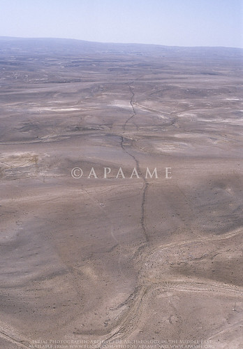
The LiveScience feature has led to other media taking up the story.
The feature was investigated remotely in the course of the active aerial reconnaissance program - the Aerial Archaeology in Jordan project, as well as visited on the ground. The study utilised historical imagery (mainly 1953) and maps, as well as several archaeological survey reports conducted on different sections of the wall, notably those directed by B. MacDonald (Wadi el-Hasa, Tafila to Busayra, and Ayl to Ras an-Naqab Archaeological Surveys), F. Abudanh (in the region of Udruh) and G. Findlater (the Dana Archaeological Survey).
You can find the tagged images of the Khatt Shebib on our Flickr page by following this link.
The synthesis of the information gathered has potentially raised more questions than those that we were able to answer, and we hope this study will soon be followed up by a comprehensive ground investigation of the entire feature and sites directly associated with it which may be dateable.
David Kennedy & Rebecca Banks 2015. 'The Khatt Shebib in Jordan: From the Air and Space', Zeitschrift für Orient-Archäologie 8: 132-154.


Very good and important work, David. I have parts of the Via Nova traced on Google Earth and have explored it in person on my various trips to Jordan. I am having a particulary problem tracing it after it crosses Wadi el-Hasa an climbs to the plateau by Rujm Faridiyah and Duwana before continuing south. Do you know of any maps or digital helps to track it in this area. I would be happy to pay for any photos or helps.Many thanks! Jim (monsonjim@yahoo.com)
ReplyDelete