Showing posts with label Archive. Show all posts

Friday, 3 March 2017

Motion Picture Aerial Archaeology


An earlier blog looked at the flights and photography of archaeological sites in Transjordan and Iraq of Robert Alexander MacLean in Summer 1922. Three years later (1925) MacLean joined a Franco-American expedition excavating at Carthage. One of the Co-Directors was a man with the memorable name of Count Byron Khun de Prorok. Thanks to 35 years of research by Michael Tarabulski, it is possible to trace the life and career … and transformation of Francis Victor Kuhn (= Cohen) (1896-1954) from his birth in Mexico City to prosperous Central European immigrants through the adoption of a name from his favourite romantic poet, the more Hungarian-sounding spelling of his surname to Khun and the doubtful claim to a title. After education in France, Britain and Switzerland, he had worked on excavations in Italy, visited Carthage in 1920 and then in 1922 (still just 26) began the first of three seasons of excavation there. He soon also made a reputation as a galvanizing public lecturer and toured widely, but was eyed with suspicion by professional archaeologists who regarded him as a “showman, dabbler, and dilettante” and ultimately his conduct led to academic scandal and discredit as a tomb robber and to his conviction Atlantis lay beneath the Sahara. There may have been some further personal scandal as his first father-in-law (he married four times) succeeded in ensuring that when his daughter - after just 4 years, separated from then divorced him, de Prorok gave up not just care of the two children but never saw them again; indeed the children even had their personal names changed when adopted by their grandfather (all this from the research of Michael Tarabulski).
 

De Prorok’s reputation as a public speaker was founded in part on his use of motion pictures taken on his fieldtrips and excavations, a technique then in its infancy. More than that, however, he was a pioneer not just in taking aerial photographs for recording and discovery at and around Carthage, but using a movie camera in the air as well. Whether he was the first to do so in the Middle East and North Africa region is unclear. Some of his film was broadcast from time to time by Pathe as part of its popular cinema News programmes. For example, Pathe Review No. 46 of 1926 included “The Lost Empire of Africa: A camera chronicle of the American excavations at ancient Carthage led by the Count de Prorok”.

Neither the Pathe material nor de Prorok’s own copies - perhaps sold-off or discarded in his last years when he was in serious financial difficulties, seems to have survived.

What he did and was trying to achieve is explained in some detail by de Prorok in his 1926 book, Digging for Lost African Gods (40-41) where he differentiates between films (moving pictures) and photographs (still shots) and introduces he nearly as enigmatic colleague:
We took films of what we were doing. It was the first time that archaeological research had been filmed, and the idea did not meet with very great favour at first. Since then, however, the value of the step has been recognised, and it is a common practise in many universities to-day, to use films for instruction. Our photographer was the young Prince Edgard de Waldeck, who had spent a fortnight of intensive training in Paris, preparatory to this task. 

Later (71-2):
These are the things we talked about on the voyage, because we were all  keyed up by the prospect of a great advance. We talked about what we had done, and what we were going to do. Of all our future plans, perhaps two stood out most vividly
The first was the use of the Aeroplane in archaeology. That venture, as an experiment, materialized three years ago [1922], and since then we have continued, year by year, our prospecting from the air.
In 1922, we took our first films and photographs from different heights, which resulted in our being able to trace the great submerged walls of ancient Carthage. Flying above the Gulf of Tunis, we were able to film clearly six miles of submerged wall, showing constructions a hundred and fifty yards from the present shore. I can still remember the interest with which the news was received by the Royal Geographical Society, when I lectured to them on the subject in London.
… Our use of the aeroplane this year is to be more varied. At the moment we are using it to film the whole coast line, especially at a spot where we have located a sunken galley a stupendous find, of which I shall say more later and at the legendary island of Djerba, where we have located a city under the sea

And later still (181):
            The sea has also made a great deal of change on all this peninsula, but it is very difficult to ascertain at what period it encroached on the land. From the splendid film taken from the air by the late Prince deWaldeck, who was killed on his way back from Carthage this June, it is possible to perceive constructions as much as 100 yards out to sea.
This film is a unique documentation in archaeology, it being the first attempt to film submarine ruins and record their position. The film and photographs were taken at a height of 1500 feet and again at 400 feet, and are superior to any record we could have made on the sea surface. One can trace not only the ancient sea-wall, which in parts is at a depth of 30 feet, but one can study the topography of the peninsula to an extraordinary extent. The bed of the Mejerda is clearly outlined, the wall of Theodosius can be followed approximately, and even the Roman allotments are defined. Soundings off Carthage were undertaken in 1898 by M. de Roquefeuil, but only in that portion of the coast where Roman Carthage was built, that is between La Goulette and Cap Carthage.
That there was a port at La Marsa is certain from the film (“el Mersa” means a port). The constructions we perceived underwater are of vast dimensions, and stretch from Cap Carthage north-east to Cap Kamart; but those at Cap Kamart have not been marked on any map. There appears to have been a great port here, recalling that of Alexandria, with an opening, and breakwater at right angles to the present village of La Marsa. There was a port here in Arab days, but the jetty was certainly earlier, either Roman or Punic. We have followed these walls in a small boat as far as Cap Kamart in continuous zigzag lines. From the aeroplane we could distinguish another line farther out at sea at a depth of about 30 feet, but it is difficult to ascertain, until our final soundings are completed, whether this was a part of the first constructions. The authorities of the French Oceanographic Museum at Carthage will charter a special ship to make soundings along the coast to verify the measurements of these constructions for future investigation.
Cicero mentions a fact that historians of Carthage seem entirely to neglect, that the city “which Scipio destroyed was surrounded with ports.” From the air one can easily get an idea where ports may have been, in the Sebkha of Sukhra (Salina of the Ancients), at La Marsa, and lastly in the Lake of Tunis (Stagnum of the Ancients). We also photographed from the air the sunken galley found in 1908 by sponge divers, from which a rich spoil of marbles and bronzes has been recovered for the Museum of Bardo. We hope to examine the Gulf of Tunis this winter on the chance of finding traces of other ancient ships, five hundred of which were known to have perished during the Punic wars.

Long before the publication of this book – re-issued in 2004 with a lengthy biographical essay on de Prorok by Michael Tarabulski, de Prorok had published several articles, gone on an extensive lecture tour (including in 1923 as Norton Memorial Lecturer of the Archaeological Institute of America) and a lecture to The Royal Geographical Society in London on 27 November 1923 on his excavations (published in The Geographical Journal 63.3 (March): 177-187). The last is important, providing further references to his flying and filming and the statement that the lecture was “illustrated with kinematograph films taken by the late Prince de Waldeck” and one photograph of “The exacavation of Thuburbo Majus” captioned as “Enlarged from kinematograph film by the Prince de Waldeck”.
Michael Tarabulski has generously shared his 3+ decades in pursuit of de Prorok including his aerial photographs and aerial movie films. Despite the role of digitization in revealing the contents of old archives, nothing has so far emerged from this flying in Tunisia. No further success has attended a Spanish researcher whose articles have appeared just recently (Garcia Sanchez 2014 and 2016). Nevertheless it seems unlikely all copies of all of these early aerial movie films are lost.

‘Count’ Byron Khun de Proprok is a fascinating character. Even some of those who were most critical of his conduct found him personally charming. Plainly audiences were enchanted – perhaps in part because the tall, handsome and self-confident young man sometimes chose to present himself in pith helmet and fieldwork jodhpurs. His lectures regularly merited reports in The New York Times. Whatever his standing as an archaeologist – mere self-publicising tomb-raider, given to grand-standing perhaps, he was swift not only to apply the very new technique of aerial reconnaissance and photography (at least 3 years before Poidebard commenced his pioneering aerial reconnaissance in Syria) but to take it further with motion pictures which could exploit a growing public taste for cinema and raise awareness of archaeological research.

Many thanks to Michael Tarabulski for generously sharing so much of his research and a detailed correspondence.

Reading:
Garciá Sánchez, J. (2014) “Las excavaciones del conde Byron Khun de Prorok en Cartago (1920-1925): la colina de Juno y la difusión cinematográfica de la arqueología cartaginesa/ The Excavations of Count Byron Khun de Prorok in Carthage (1920-1925): The Hill of Juno and the Cinematographic Dissemination of Carthaginian Archaeology”, Boletín del Seminario de Estudios de Arte y Arqueología 80: 129-163
Garciá Sánchez, J. (2016) “Regreso a la tumba de Tin Hinan: nuevas fuentes en torno a las excavaciones de Byron Khun de Prorok en Abalessa (Ahaggar, Argelia)/ Tin Hinan’s Tomb revisited: new sources relating to the Byron Khun de Prorok’s excavation in Abalessa (Ahaggar, Algeria)”, Cuadernos de Prehistoria y Arqueología Universidad Autónoma de Madrid (CuPAUAM) 42: 187-208
Khun de Prorok, Comte Byron (1924) “Recent researches on the Peninsula of Carthage”, The Geographical Journal 63.3 (March): 177-187
Khun de Prorok, Comte Byron (1926) Digging for Lost African Gods. The Record of Five Years Archaeological Excavation in North Africa, New York and London (Putnam)
Tarabulski, M. (1989) “Recording the past: capturing the history of archaeology on videotape”, in A. L. Christenson (ed.) Tracing Archaeology's Past: The Historiography of Archaeology, Carbondale (Southern Illinois University Press): 179-186
Tarabulski, M. (2004) “The life and death of Byron Khun de Prorok”, in B. Khun de Prorok, Digging for Lost African Gods. Five Years Archaeological Excavation in North Africa, Santa Barbara (The Narrative Press) 251-267.

Of interest are the recent fictionalised account of de Prorok:
Turmel. W. (2015) The Count of the Sahara, London (The Book Folks)
… and an nterview with the author on 18 November 2015


Thursday, 9 February 2017

View Counts for APAAME on Flickr


Thanks to Andrew Wilson for this graph illustrating the steady and accelerating usage of the APAAME archive. As of 9 February it stands at 7,534,945 … a rise of over half a million view counts in four months.


Monday, 10 March 2014

Archive: UPenn Museum of Archaeology and Anthropology Film Archives

"The formidable mountains of Arabia Petraea still loomed miles away."


The Film Archives of the University of Pennsylvania Museum of Archaeology and Anthropology have been digitised and made available online thanks to the generosity of the 'Internet Archive'.

A silent film by Arthur and Kate Tode from 1930 is an interesting glimpse of travel in the Middle East between the wars. There are some stunning views of Petra [4:01] including a rare occurrence of  snowfall [17:05] (apparently the first time it had snowed in Petra in 30 years), footage of the Umayyad Mosque of Damascus [24:02], the Ctesiphon Arch [33:00], the ruins of Babylon [37:14] and Ur [43:00], and also some aerial footage towards the end [50:30].

The Internet Archive site provides a transcript of the silent film's narrative.

You can access the University of Pennsylvania Museum of Archaeology and Anthropology Films collection at The Internet Archive here.

You can access the Museum website here: http://www.penn.museum/archives.html/film-archives.html

Wednesday, 8 January 2014

Flickr Archive: Search issues

Users of our archive hosted on Flickr may have noticed that the interface has gone through some changes recently. Unfortunately this has included what seems a serious glitch in the search tool- basically that you may not get any results at all even if a photograph is named exactly with what you search for (such as 'Umm es-Surab' as I recently found).

My basic experimentation with the problem indicates that a search will find items 'tagged' with the search terms, but not if they are named with that term. If you are having trouble finding a site as a temporary solution I advise that people search for photographs of their site using the georeferenced search tool at www.flickr.com/apaame/map
You can find instructions on how to do this on our YouTube channel: http://youtu.be/rFEF4Vjdo00
If you still have difficulty finding your site, please contact us directly.

Thank you for your patience as we adjust the archive to the changes occurring on the Flickr interface.

Thursday, 12 September 2013

Archive: Ground photographs

If you follow our Flickr archive you will have noticed we have been uploading a large amount of ground photographs over the last couple of days. What, you may ask, is an AERIAL photographic archive doing uploading so many ground photographs?

Well, in short, you cannot make sound conclusions from the aerial photographs unless you go and have a look on the ground – and this is why we have conducted so many ground visits. Additional information can easily be gathered without the need to conduct any formal excavation – such as if stone is worked or not, if there are large amounts of pottery scattered over the site, and whether there are any associated structures not easily visible from the air such as wine presses, cisterns etc.

This means that on our Flickr photostream you may compare the impression you get from a site as seen from the air with how that site appears on the ground. Ground photographs reference numbers are prefixed by APAAMEG (Or you can find them all in the collection here).

Something you may have noticed is that we are continually returning to sites. We revisit sites that are at particular risk or are constantly changing – such as Yajuz and the risks associated with the urban development of Amman, or the ongoing excavation, conservation and restoration projects at Jerash. A good excuse to visit sites again is when the team has a new member.

Something new to our Flickr archive and still being trialled with this most recent upload of ground images is the inclusion of ‘Pleiades’ tags. Pleiades (http://pleiades.stoa.org/) is an open source project developed by the Ancient World Mapping Centre, the Stoa Consortium and the Institute of the Ancient World. The database of sites is developed to act as a continually updated referenced atlas of the ancient world. They list 34,690 places and counting.

Each site has a unique identifier which you use to complete a ‘machine tag’: “Pleiades:depicts=******” if the site is depicted in the photograph, or “Pleaides:atteststo=*****” if the object photographed attests to the existence or location of the site- such as an inscription. There are other combinations too which you can read about on Sean Gillies blog.

By using these tags the Pleiades database recognises that we have photographs of their documented sites, and therefore people accessing their database of sites can easily access our photographs that relate to that site. Everyone ends up a winner! If you have feedback, please don’t forget to let us know.

If you are interested in the Pleiades project, or wish to become a contributor, please visit their website for more info.

Wednesday, 24 July 2013

Searching APAAME Flickr by location

Perhaps one of the easiest way to search for images of a place is to search by its location. You will now be able to search using this method on our Flickr archive because we are currently uploading our geo-referencing metadata with our images. We'll let you know when it is all uploaded - check our Twitter @APAAME.

We geo-tag our images in one of two ways:
  1. a digitised image from the collection is georeferenced based on the site it represents
  2. a digital photograph is georeferenced based on the GPS of the flight path or camera when the photo was taken in real time.
The resulting scatter of location 'dots' will reflect these two methods of geotagging:
  • many photographs may be represented by one 'dot' where they have been georeferenced based on the location of the site
  • sequences of dots may indicate the path taken on a particular flight

To help you search our Flickr archive by location, we have composed this short tutorial.

How to search for a location in Flickr: (to expand images simply click on them)
1. Go to http://www.flickr.com/apaame/map
What www.flickr.com/apaame/map looks like when you first get there.
2. Zoom to the area you are interested in finding photographs for
Here I have zoomed in onto the ancient and modern town of Umm el-Jimal.
3. 'Refresh' the image list (pink dots will populate the map area if there are images for it)
This is where you find the refresh button when you have chosen the area you are interested in.
Notice the cluster of pink dots in the centre of Umm el-Jimal and that the list of photographs has gone down from around 60,000 to 200 or so in this instance.
4. If there are more images listed than what shows on the thread, click on the arrow to the right to scroll through them.
Click on the arrow to the right of the thread to scroll through available images for this area. Notice the distribution of pink dots has changed to suit those images now showing in the thread.
5. If you click on the pink dot that represents photograph/s georeferenced to that point - the thread of images will highlight those images that correspond to that geographic location. Click on an image thumbnail to view a larger thumbnail, and click on the larger thumbnail to open the image in a new window.
Notice the 'dot' clicked on has a white selection cloud around it and the two images for that location are indicated to the left of the thread - one of which has an expanded thumbnail to allow you a better look.

Note: the map will only show the locations of those images that are visible in the thread, not all the images in the archive. To access all of the images for the viewable area you must scroll through the thread.

We hope this quick tutorial has been helpful. If you would like some clarification, or think we should include something else, please let us know. Likewise, if you have any pointers for us.

More tutorials about how to use our archive are available on our YouTube feed: http://www.youtube.com/playlist?list=PLhsAYi0XrGzZg75WIYZEEWqdJ0h1kxQpx

Monday, 24 December 2012

Slides of Syria

As the year comes to a close, it is inevitable that we reflect on what we have done and what has been happening in the world.

I have been scanning slides from the late 1970s… a lot of slides, of archaeological sites in the Middle East. Most were taken by David K at a time when sites were often in better condition or not yet overgrown by developing villages and towns, so archaeological artefacts in their own right.

While scanning these slides I continually came across evidence of the beautiful archaeological record of Syria, and in the news I daily come across reports of conflict that increasingly and unavoidably is affecting these archaeological sites, whether they are caught in the crossfire or directly targeted by looting.

So, I thought it best to share some of these digitised slides with you and take you to sites that we may not be able to protect now, or visit in the near future, but of which we can hope to preserve evidence and knowledge.

(In no particular order... Please click on an image to enlarge it.)
Basilica, Deir Semaan.
South west church, Deir Semaan.


Deir Semaan (Saint Symeon Monastery or Telanissos) is one of many ruined villages, known collectively as the 'Dead Cities' on the limestone massif west of Aleppo in Syria’s north. These late Roman villages are extraordinarily well preserved, buildings sometimes surviving to two and three stories high, and allowing a superb insight into late Roman town life. These magnificent ruins however have suffered in the crossfire, and also through looting. This short article on the research of Emma Cunliffe, Durham University, includes a witness’s video recording damage to one of these sites, and reports have emerged that the Monastery of Saint Symeon has been damaged by shelling. Link.
Temple of Nebo in foreground with the great temenos of the Temple of Bel in background, Palmyra.
Palmyra is one of the best-known ancient sites in Syria. The city flourished due to its profitable position between the west and east, and became a major Roman city in the 2nd and 3rd centuries AD. Built around an oasis in the middle of the desert, the grandeur and preservation of the site is all the more marked due to its isolation, and it has been a favourite of tourists since the 19th century. A report on the Global Heritage Fund blog details how the site has become caught in the crossfire and is a target for looting. http://globalheritagefund.org/onthewire/blog/palmyras_ruins.
West wall of Halebiyeh looking east from the citadel towards the Euphrates River.
Halebiyeh, or Zenobia, is located on the banks of the Euphrates. The walls extending out from the Citadel of an immense Late Roman fortress city are the most prominent feature of this beautifully preserved site. The astonishing scale and quality of preservation can be gauged by noting David’s white LWB Landover (inside of the city wall in the centre of picture) (cf. D. L. Kennedy and D. N. Riley, Rome’s Desert Frontier from the Air, London (Batsford)).

Section C3 of Dura Europos.
Palmyra gate, Dura Europos.


Dura Europos, also on the banks of the Euphrates River, was preserved in sand until its excavation during the interwar period, prompted by the discovery of remarkably preserved frescos. Even more important was the discovery of a huge cache of papyri which included the largest single collection of papyri for the Roman army anywhere in the Empire, including Egypt.
The Tetrapylon at Damascus, located at one end of Souk al-Hamidiyeh to the west of the Umayyad Mosque in the city centre.
Damascus is the ancient and modern capital of the region and where the archaeological record is hidden in side streets, built into houses, and walked through as part of daily life in a thriving city. As fighting intensifies closer to the ancient city (BBC news article: http://www.bbc.co.uk/news/magazine-20659573) how will the ancient walled city and 1400 year old Umayyad Mosque built over the immense church of St John fare if it breaks through to the heart? The once lively Souks and are now devoid of tourists and suffer from intensifying security raids. One hopes the beautiful Souk al-Hamidiyeh and the numerous early medieval houses tucked in side streets will not suffer the same fate as the ancient heritage listed market place of the city of Aleppo, the Souk al-Madina, which was irreparably damaged in September– see http://www.reuters.com/article/2012/09/30/us-syria-crisis-idUSBRE88J0X720120930
General view (north) of Bostra.
Bostra is in the south of Syria in a region known as the Hauran – a fertile semi-arid landscape on the edge of ancient lava-flows. It was the northern-most city of the Nabataean kingdom that stretched down through its capital at Petra into north-western Saudi Arabia. Nabataea was incorporated into the Roman Empire with Bostra as the capital of the new province of Arabia under Trajan in AD 106. The site is perhaps best known for its Roman theatre built from black basalt rock, but the ruins of the ancient city are also well preserved amongst the streets of the modern town, with towers in some cases standing over two stories high. The town has been damaged by shelling this year.

All photographs are © David L. Kennedy and belong to the Aerial Photographic Archive for Archaeology in the Middle East. After the slide collection is catalogued it will be available online at our Flickr archive: link.

I would like to thank David for looking over this blog, and for his continual remarks and encouragement while I develop the APAAME digital collection. Any remaining errors are wholly my own.
-Rebecca Banks 

Links:
Aryn Baker & Majdal Anjar, Syria’s Looted Past: how ancient artefacts are being traded for guns, Time World Sept 12 2012.
http://world.time.com/2012/09/12/syrias-looted-past-how-ancient-artifacts-are-being-traded-for-guns/
Emma Cunliffe’s updates on the Global Heritage Network blog site, one of the latest, which contains links to video footage, is the following:
Emma Cunliffe, No World Heritage Site Safe in Syria, Global Heritage Network Blog, Nov 19 2012.
http://globalheritagenetwork.ning.com/profiles/blogs/no-world-heritage-site-safe-in-syria#_edn16

Thursday, 14 June 2012

Flight 20120522: Now online

We have been busy cataloguing the second of our two flights in Jordan last month, and you can now access the photographs on our Flickr archive.


David Kennedy, Mat Dalton and Don Boyer flew five hours in a Eurocopter to capture some 1700 images of archaeological features and the landscape. Here is a selection.

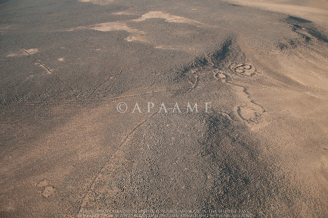
Qattafi Kite 34
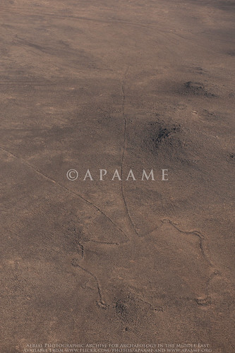
Qattafi Kite 34. Note how the guiding walls narrow along the natural curves of the landscape, and the head is hidden behind a ridge.
APAAME_20120522_MND-0005. Photographer: Mat Dalton.
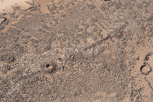
Safawi Pendant 65, Safawi Pendant 64
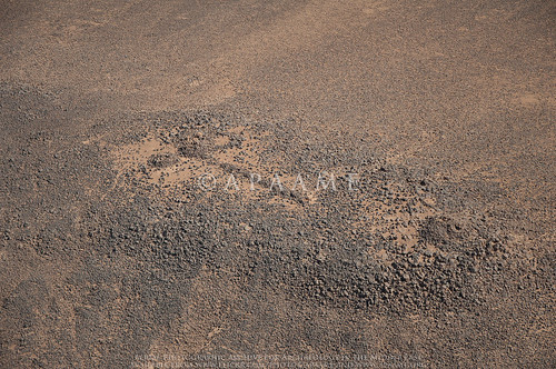
Looted Cairns. The heads of Safawi Pendants 64 and 65 have both been hollowed out by illicit excavation.
APAAME_20120522_DLK-0312. Photographer: David Kennedy.

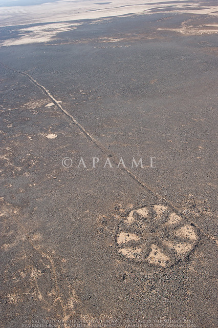
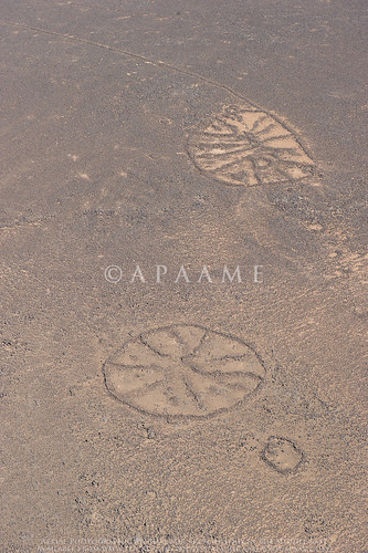
Safawi Wheel 88
Safawi Wheel 88 intercepting the tail of Safawi Kite 7. APAAME_20120522_DDB-0242. Photograph: Don Boyer.
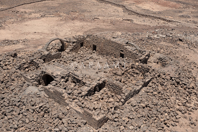
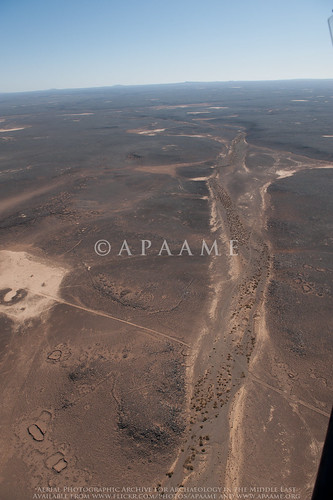
Qasr Aseikhim
Qasr Aseikhim. APAAME_20120522_DLK-0653. Photograph: David Kennedy
Azraq Kite 46 (Rees A)
Azraq Kite 46, overlayed by modern agriculture. APAAME_20120522_DDB-0667. Photographer: Don Boyer
Safawi Pendant 67
Safawi Pendant 67 with a well built and in tact head. APAAME_20120522_DLK-0308. Photographer: David Kennedy.

Tuesday, 5 June 2012

Flight 20120520: Now online

Our first flight for 2012 is now uploaded to our flickr archive. You can browse the images here.

This flight focused on the stone built structures known as Kites located in the basalt desert of Jordan, but also captured other structures known as Wheels and Pendants. In particular, we were interested in the landscape and other structures surrounding the Kites, and how these features interact.

Here are some highlights. Please click on the images to enlarge (you will be sent to the image on our flickr site).

Hibabiya Kite 55
Hibabiya Kite 55 
 
Amra Kite 22 
 
Ausaji Pendant 16, Ausaji Cairns 9, Ausaji Cairns 8 
 
Ausaji Wadi 1 
 
Ausaji Wheel 20, Ausaji Kite 19, Ausaji Wheel 81

Friday, 18 May 2012

Digitising our Collection - Slides

The Aerial Archaeology in Jordan project has been in action since 1997, but before that David Kennedy was visiting sites in the Near East for his own enjoyment and research. Most of the images he took on the ground were processed into slides.

Slides are a thing of the past, and not the best way to store your negatives, and it is now one of our projects to digitise this collection and add it to our online archive.

The slides I have been starting on are photographs from Syria, taken in the 1970s, and have not been stored in optimal conditions. The 35mm negatives are mounted between thin glass within a slide frame, and then stored in slide sheets in a filing cabinet. Most slides have developed a sticky, oily residue from the interaction with non-archival plastic slide sheets, small spots of mildew have started to appear on the slides, and the colour of the slides has started to degrade, developing a magenta tinge. In some cases, the glass mounting has shattered, scratching the negative.
Slide scan of rock cut tombs in Dawa, North West Syria. c.1978. The remains of the oily residue can be see along the edges of the frame. Photography: David Kennedy. Click to enlarge image.

Slide scan of Qatoura, North West Syria, c.1978. Mildew spots and scratches to the negative can be seen in the blue of the sky above the town. Photograph: David Kennedy. Click to enlarge image.

A preliminary cleaning of the slides to remove what we could of the oily residue could not clean the frame well enough to remove all traces of the residue, and this did not tackle the minor mildew problems. With advice from the State Library of WA Conservator, we will be using a 50:50 solution of Ethanol Absolute and Deionised Distilled Water to clean the slide frames and glass mounting. This same solution can be applied carefully to those negatives that have been effected by mildew - but we must be careful not to let the solution interact with the emulsion side which could cause permanent damage to the slide. The ethanol solution will evaporate quickly and leaves no residue.

Once the slides have been cleaned and scanned - we hope that we will be able to edit the images individually to correct any permanent scars such as scratches, or any traces of dust that may have come through during the scanning process. Colour correction will be used to minimise the effects of the magenta tinge.

We shall let you know of our progress. Any advice is most welcome.

Thursday, 5 April 2012

Flickr Featured Sets

Over the last couple of days I have been looking through the Flickr archive and updated a few of our sets.

In 'Tracking Change' we set out to fly over a handfull of sites regularly in the course of our flying seasons to photograph the changes that are occuring, whether they be seasonal, environmental or man made. We have also included a set named 'Development Impacts' which gives examples of the kinds of human activity that are encroaching on Jordan's heritage.
Some sites that have particularly changed over recent years are:
  • Yajuz: a small Roman town on the outskirts of modern day Amman
  • Qasr el-Mshatta: a 'desert castle' located near Queen Alia Airport
  • Jarash: one of the best preserved archaeological sites in Jordan which is the focus of ongoing excavation and reconstruction
  • Azraq Shishan: the oasis of Azraq that was (and is) severly under threat from overuse of its water, but has in recent years become a nature reserve in an effort to bring life back to the dying wetlands.
In 'Featured Sets' we hope to build a collection of sets that will act as introductions to the various site types and time periods that are evident in Jordan's archaeological landscape. Our collections so far include
  • General Showcase: a selection of some of our favourite sites and photos of Jordan
  • Classical Showcase: Classical (Greek and Roman period) sites in Jordan
  • Kites: photographs of the various stone build structures known as Kites
  • Wheels: a selection of the numerous and somewhat enigmatic circular structures known as Wheels
  • Desert 'Castles': popular tourist attraction in Jordan, the scale and layout of these often impressively preserved structures is highly visible from above
  • The Hejaz Railway and World War One: the archaeology of modern conflict is still clear throughout parts of Jordan. This set introduces trenches and railway remains from this period, well known for the Great Arab Revolt and exploits of T. E. Lawrence
  • Biblical Sites: Jordan is the setting of many episodes from the Bible, and this set features some of the known sites mentioned in the Bible that we have visited.
If you want to see more photographs of a particular site, or we haven't featured one you are interested in, please use the search tool at the top right hand corner of Flickr's site window, being sure to select "Search APAAME's Photostream".

If you have any site types or periods that you think we should feature or photograph in future, please let us know!

Wednesday, 18 January 2012

Hunting in Archives

I spent an hour in the English Heritage archive in Swindon looking at the Aerofilms folder on 'Asia and Jordan' - which I had seen before but last time it was only a quick look; I have made some notes (which I need to type up) but I also took a few digital images - with permission!

When I know exactly how many images there may be (I reckon under 100) - and how APAAME might be able to obtain scans/digital photos I'll be in touch again.  All the photos are prefixed with F - which is for 'Foreign'; when I asked if there were negatives - the answer was 'No', so - until that is sorted out - we may only have copies of the prints (if that can be agreed).

My interpretation of how these photos were taken is that they were done by the photographers (in 1953) when doing the 'vertical survey' (Hunting Aerial Survey) - but (as we do too) taking photos as they approach or take off, and also en route.  There are also many ground shots of the 'field trips'.

Bob