Showing posts with label 2011 flying season. Show all posts

Wednesday, 16 November 2011

Final flight of the season online!

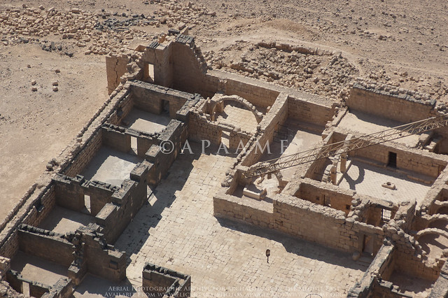
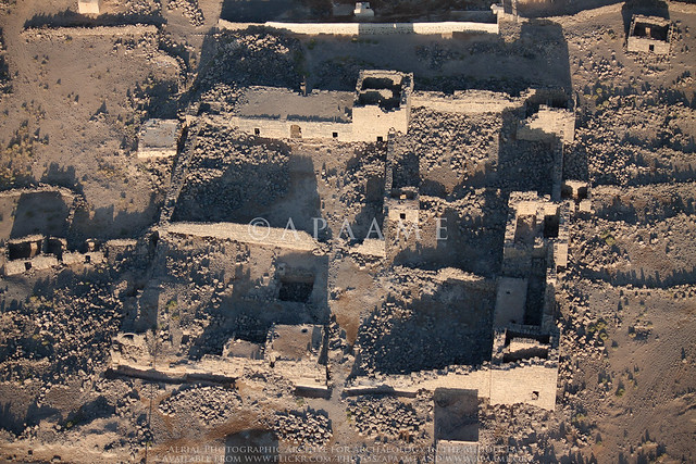
The last flight of the 2011 season (and one of our largest ever with 3282 photographs) is now online at our Flickr site. This flight took us out into the beautiful desert mesa landscapes beyond Azraq, and then into a previously unvisited area of the basalt country. We revisited some old friends (Maitland's fort and Tell A - impressive sites originally named by RAF pilots on the Cairo-Baghdad airmail route in the 1920s) and photographed hundreds more sites for the first time, including some unexpected kites not visible in Google Earth. Here's a sample:

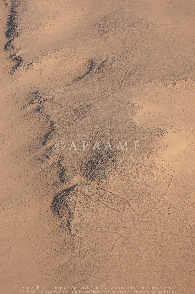
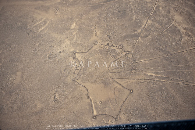
Nukheila Kite 1, Nukheila Kite 2
Nukheila Kite 1, Nukheila Kite 2. APAAME_20111027_MND-0447 Photographed by Mat Dalton

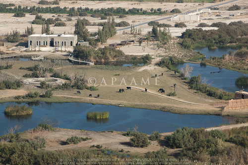
Azraq Shishan Pools
Azraq Shishan Pools. APAAME_20111027_MND-0447 Photographed by Mat Dalton

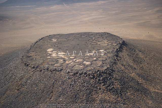
Qattafi Mesa 4 (Maitland's Fort), Qataffi Pendant 4
'Maitland's Fort'. APAAME_20111027_DDB-0611 Photographed by Don Boyer

Thursday, 3 November 2011

Homeward bound

Tomorrow will see our last day in Amman for this year's season of flying. It has been a spectacular six weeks with over 30 hours of flying undertaken and over 10 000 photographs taken. We would like to thank the British Institute, Amman (BI) and the Royal Jordanian Air Force (RJAF) for once again accomodating us in Jordan and for their continual enthusiasm for our project. We would also like to thank the many individuals that make this project a success, both on the ground and in the air, and the colleagues who have approached us and taken our flying in new directions.

Wednesday, 2 November 2011

Invisible kites

On our last flight, 20111027, we found something we never knew we had lost, a series of kites across the desert of Jordan that had almost been completely swallowed by the desert sands. These kites were not visible on satellite imagery available through Google Earth and Bing Maps which we use for a preliminary survey of the area before we fly. It was only through low level aerial reconnaisance that we were made aware of their presence. The state of preservation of these kites is so poor that they again disappeared when viewed at low oblique levels and would be completely invisible to anyone driving or walking past.
APAAME_20111027_REB-0360.
APAAME_20111027_REB-0362.


Friday, 28 October 2011

And that's a wrap!

A very successful last flight (20111027) yesterday for this visit to Jordan. The clouds from the past couple of days cleared and the pilots were magnificent, as usual, with a very smooth day of flying over the basalt had by all. Some areas were extremely dense in wheels, pendants, kites and cairns and this resulted in a huge 3500 pictures taken.

Thursday, 27 October 2011

New Helicopter Spotted...


While at Ruwayshid Air Force Base the team spotted this recently developed North Korean helicopter. What it lacks in style it makes up for in range.

-DLK

Tuesday, 25 October 2011

Successful Flight 20111024

Yesterday was a long six hours in the air, but the results speak for themselves. We are currently cataloguing but here is a sneak peak at what shall be up on our flickr archive shortly.

APAAME_20111024_REB-0030.

Qasr Burqu. APAAME_20111024_REB-0091.

Ar-Risha. APAAME_20111024_REB-0101.

Wheel. APAAME_20111024_REB-0195.

Tuesday, 18 October 2011

Roadtripping to Mesa Country

We awoke in the very small hours of Sunday morning to set out to a special area of Jordan - Mesa Country.

East of Azraq on the edge of the Harrat ash-Sham lie a series of Basalt mesas (flat topped hills). On and around these mesas are an assortment of stone built structures - Wheels, Kites, Cairns, Tower Tombs and Pendants, which in this region were first described in the 1920s by pilots of the Royal Air Force on the Cairo-Baghdad airmail route. It was this landscape that we set out to investigate.

We broke from the main road at dawn and watched the sun rise over the desert as we rattled our way slowly down a questionable track - often no more than a pair of wheel ruts over the pebbly desert floor. Our first stopping point was a couple of Wheels surrounded by Cairn Rings. These were almost unrecognisable from the road, but as we got closer the walls began to be apparent. One was nestled in the slope of the hill while the other lay prominently on top of a rise of basalt boulders. Between these Wheels was a Bullseye Cairn - unfortunately illicitly excavated - but still associated with some Safaitic inscriptions and flint artefacts.

Wheel
Rajil Wheel with Cairn Ring in the early morning sun. Photographed by Rebecca Banks.
We then returned to our trusty 4WDs (the tyres were unfortunately not so trusty) and continued on our way east. We knew we were getting close when the landscape changed to this:

Mesas
Mesas in the Qattafi area. Photographed by Rebecca Banks
On the agenda was climbing four of this group of Mesas - Qattafi Mesa 2 (named 'Tell A' by Rees, an RAF pilot), Mesa 3, 'Maitland's Fort' (Mesa 4, again named by an RAF pilot) and Mesa 7 or 'Boyer's Butte' as we have come to know it. It sounds easy, but when you have one of these sitting infront of you, you begin to doubt your fearless leader. After a bit of courage and some concentration not to put your weight on the wrong boulder, you reach the top and the view is absolutely breathtaking. Not a living soul in sight, and the only noise is the wind.

The most prominent features of these mesas are Tower Tomb Cairns, visible as small 'pimples' on their surfaces, easily visible from surprisingly far away. The size of the rounded basalt boulders on these mesas provide the perfect building material to construct these large burial mounds and other features. On two of the mesas, these Tower Tombs were incorporated into Pendants - a tail of smaller cairns connected to the larger burial cairn at the head. Other cairns also littered the surface of the mesas, but it was predominantly the Tower Tombs that had associated inscriptions, varying from ancient to modern.

Tower Tomb Cairn
Tower Tomb on Qattafi Mesa 7. Photographed by Rebecca Banks

Inscription Qattafi Pendant 3
Inscription associated with Qattafi Pendant 3 on Mesa 2. Photographed by Rebecca Banks
Unfortunately many of the cairns we came across had been illicitly excavated, with the interiors hollowed out by those looking for burials and assosciated grave goods. As a result it will be very difficult to verify how many of these cairns were indeed used for burials, or whether they served another purpose.

Qattafi Pendant 4 Head
An illictly excavated cairn (Qattafi Pendant 4) on 'Maitland's Fort'. Photographed by Rebecca Banks
Driving out into this country has its rewards, but the journey is not to be taken lightly. The rough terrain means that a punctured tyre is more than likely, and the lack of mobile phone reception makes a satellite telephone a must! Thankfully this time we suffered from only one punctured tyre...

Karen points the finger
Our Pajero after running afoul of a wayward stone. Photographed by Rebecca Banks.

Monday, 17 October 2011

Over al-Murayghat

A dolmen at al-Murayghat (with 1m scale). Photograph kindly provided by Stephen Savage.

We had been asked to look at an area of limestone south-west of Madaba in this season’s flying, because of the threat to the dolmen landscapes from quarrying. In previous years we have always found it difficult to locate and photograph the dolmen (Bronze-age megalithic tomb structures), because they are generally quite small and made of the same stone which surrounds them. However on Monday we were lucky with the light and these images show the impending threat. The request for theses images was from Steve Savage, who also provided some ground shots. We will be doing all we can to see if these fragile remains can be saved from the inexorable quarrying in the vicinity. On the aerial images the small rocky features are the dolmen, and the quarry speaks for itself.

-Bob

Extensive quarrying at al-Murayghat. Photographed by Bob Bewley

A series of dolmen at al-Murayghat from the air. Photographed by Bob Bewley
Wednesday, 12 October 2011

Flight 20111004 on flickr!

Our last sortie but one, Flight 20111004 is now up for viewing. On a beautifully clear Autumn morning, this trip saw us fly deep into the eastern deserts of Jordan as far as the limestone plateau of the pandhandle, where we recorded rare flint mine complexes in the Ruwaishid region under study by Dr Bernd Müller-Neuhof. Other targets included a number of spectacular Roman fortresses (including Qasr el-Hallabat mentioned by Bob Bewley a few days ago), the enigmatic prehistoric settlement of Jawa and, for the first time this season, a selection of 'Works of the Old Men' in the basalt country, including several kites. Here's a sample:

Deir el-Kahf
The Roman fortress of Deir el-Kahf. APAAME_20111004_SNR-0024 photographed by Simon Rutter

Ausaji Kite 3
The 'head' (and killing area) of Ausaji Kite 3, an enormous trap for migratory animals. APAAME_20111004_DLK-0167 photographed by David Kennedy

Qasr el-Hallabat
The fortress of Qasr el-Hallabat, in the process of restoration by a Spanish team lead by Dr Ignacio Arce. APAAME_20111004_MND-0463 photographed by Mat Dalton.

Tuesday, 11 October 2011

How to exit a Huey


Mat Dalton and Don Boyer show us how to duck and run. Photographer: Bob Bewley

Flight 4 - Cataloguing

The southern portion of sites flown over in Flight 4 20111010 as pinned in Google Earth. Image: Google Earth.
We are madly cataloguing our photos from Flight 4 today before we go back in the air for Flight 5 on Thursday.

The AAJ and the RJAF

RJAF pilots (from left) Lt. Colonel Farouk and Lt. Colonel Husam with a poster presented to the squadron in thanks for making the Aerial Archaeology in Jordan Project a success since 1997. Photographed by Bob Bewley.

Saturday, 8 October 2011

Flight 20111002 now on Flickr!

The dust has now cleared and we were able to undertake a very successful flight around the north-west of Jordan. 2000 photos of over 80 sites have been added to the archive, and are now viewable at our flickr site in the set Flight 20111002.

Here's a sample of some of the sites we were able to visit:

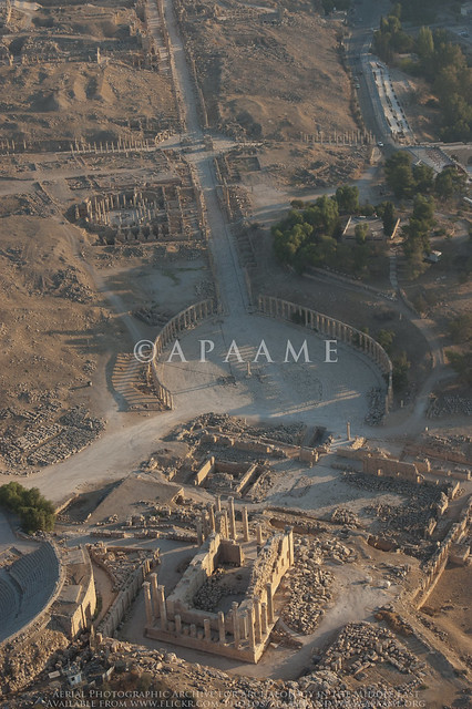
Jarash Oval Piazza, Jerash T of Zeus, Jarash South Tetrapylon, Jarash Cardo, Jarash Macellum
The Oval Piazza, Temple of Zeus, South Tetrapylon, Cardo and Macellum at Jarash (ancient Garasa). APAAME_20111002_MND-0060 Photographed by Mat Dalton

Rasoun
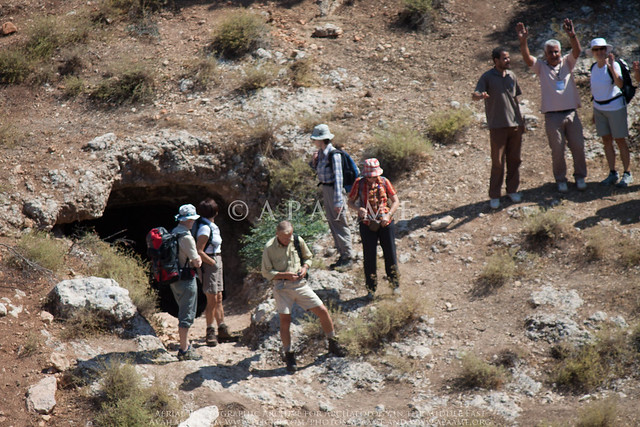
Tourists at Rasoun ancient cemetery. APAAME_20111002_SNR-0278 Photographed by Simon Rutter

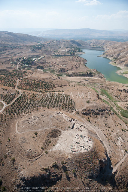
Tall Zira'a
Tall Zira'a, on the Wadi al-Arab. APAAME_20111002_DLK-0766 Photographed by David Kennedy

Thursday, 29 September 2011

Azraq Camera

Much of the work behind each flight begins several days before with the preparation of the flight plan. A list of all the sites we intend to visit is compiled and entered on Google Earth. The route for the flight is then uploaded into two Garmin GPS96C receivers that we will use to navigate on the flight.

An APAAME Nikon D70


The APAAME team use Nikon cameras when photographing sites from the air. Usually the team have two Nikon D70s with 28-105mm Nikkor lenses and at least one Nikon D3 with a 24-70mm Nikkor lens on each flight. The preferred technique for aerial photography is to shoot in shutter priority mode with shutter speeds in the range of 1/500s to 1/1000s of a second.

The photographs themselves are obviously of reduced value without their associated metadata (such as latitude and longitude), so a great deal of work is done post flight to ensure that the images are correctly tagged and cataloged. The D3s have GPS capability (using Geopic II), which is attached via the hot-shoe and cable.

To geoencode the photographs taken by the D70s, we first record the time displayed by the GPS receivers by photographing them with each camera at the start of the flight. This allows us to correct the time data associated with each image to make it consistent and accurate. The GPS position of each photograph is then automatically added by matching the time of image capture to the position on the track log from the GPS receiver, using HoudahGeo software. Finally, the images are loaded into Adobe Lightroom 3 for any necessary corrective actions before being uploaded to Flickr.

Wednesday, 28 September 2011

I Love the Smell of Nabataea in the Morning

This morning the team made a short but glorious flight in a Bell UH-1H Iroquois from 8 Squadron, Royal Jordanian Air Force - crewed by Lt. Col. Husam and 2nd Lt. Salem.

This particular aircraft - 809 - was acquired by the RJAF in 1995, before which it had a long and storied career with the US Army. 809 is a Model 205 long fuselage variant that was delivered from the factory in Fort Worth, Texas in 1970.

The aircraft bore the number 68-15284 in US service and is a Vietnam veteran, having seen action at Lai Khe in 1970-71 with the 227th Assault Helicopter Battalion of the 1st Cavalry Division (Airmobile). It also acquired striking artwork and the name of "Chickenman America" during its tour of duty.

809/284 is piece of flying history and we feel grateful to be able to experience it in the expert hands of the RJAF.

Planet dust...

Three Bell UH-1 'Hueys' on the tarmac at RJAF air base Marka - a crewman straps
down the rotors on our chopper (809) following the abortive take-off and landing.

In an eloquent reminder of how best-laid archaeological plans can change overnight, our first flight of the year has been cut down to a 5 minute tour of Amman due to the sudden arrival of an unseasonably large cloud of dust from the Syrian desert. Having taken off in our UH-1 'Huey', the magnitude of the cloud soon became apparent, and our experienced pilot Lt. Colonel Husam returned to Marka immediately.

Dust obscures the control tower at Marka air base.

We are now back at base camp, eagerly watching the weather radars at http://oiswww.eumetsat.org/IPPS/html/MSG/RGB/DUST/EASTERNAFRICA/index.htm. With any luck the worst of the dust will have moved west overnight, and we'll be able to fly our planned route tomorrow.

Dust plumes (in pink) over Jordan as of 10am. Image from http://oiswww.eumetsat.org

Tuesday, 27 September 2011

Let the flying begin

The long wait for our next flying season is almost over. David, Simon and myself have arrived in Jordan and have pitched base camp in the laboratory of the British Institute in Amman. We set out for Marka Air Force Base at 5:30am tomorrow morning (most archaeological sites appear at their best in raking morning light), and will fly over more than 100 targets in the north-west corner of Jordan, photographing many of them from the air for the first time.

The British Institute in Amman from above
APAAME_20100601_DDB-0575


David has sent me his list of target sites for this flight, some of which he has noted from academic articles and reports, and others that have been requested by researchers interested in specific aspects of Jordan's history. We are also revisiting several sites - including Jarash (ancient Gerasa) and Umm el Jimal ('The Mother of Camels' - a roman town) - that we have already photographed, to record new excavations and details the impact of continuing development that affects many sites in Jordan.

Route planning using Google Earth

All of these sites are put into an overall flight plan using MacGPS pro, and are then loaded into our two avionic GPS units, which allow us to navigate and direct the pilots to each site in turn. We generally fly in a circle over each site to allow us to photograph it from every angle. We aim to have the photographs up on our online archive as soon as possible (usually within a couple of days), so keep an eye out for these!

Simon Rutter tests out one of our Nikon D70s in preparation for the next morning's flight