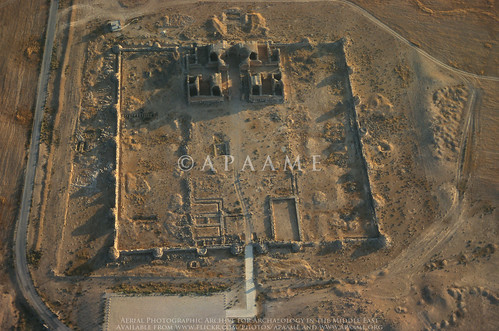
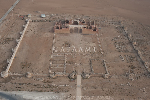
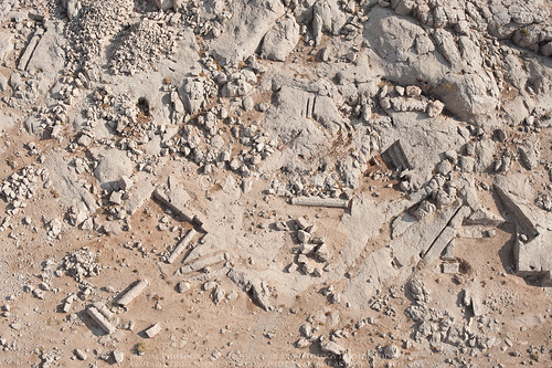
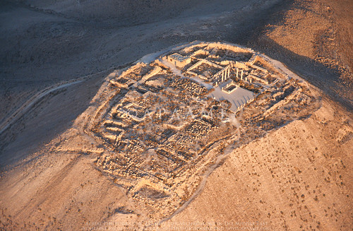
Showing posts with label 2014 Flying Season. Show all posts

Thursday, 29 January 2015

Flight 20141019 - A new Edomite Stronghold

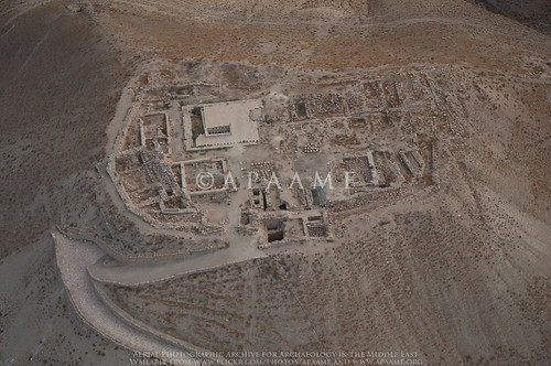
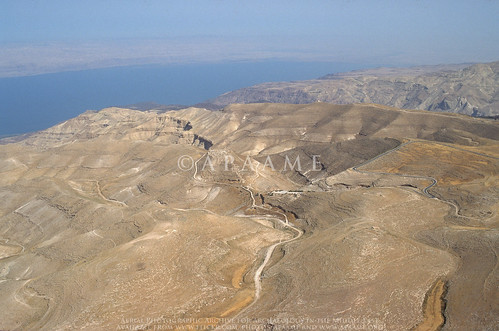
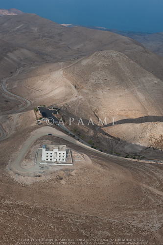
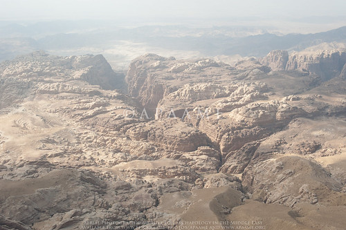
On Flight 20141019 from Amman to Aqaba six photographs were taken of the dramatic landscape looking west from Qasr Rajif over Wadi Suweid cutting through the sandstone peaks. Unbeknownst to us at the time, the photographs capture the site of an Edomite Fortress.
Wadi Suweid; el-Manktaa (Edomite Fortress)
'el-Manktaa' (Edomite Fortress) - APAAME_20141019_RHB-0287.
Prof. Chaim Ben David alerted us to the existence of the site, known as 'el-Manktaa' to the Bedouins, after he viewed the photographs on our Flickr. His ready knowledge and identification of the site probably due to the fact he had coincidentally visited it just a few months earlier.
The bridge to the site as seen from the wadi valley below. Photograph by Boaz Langford, courtesy of Chaim Ben David.
Following information from fellow hikers Eli Raz and Lior Enmar, who were aware of the phenomenon of Edomite mountain strongholds, in July 2014 Chaim visited two new, apparently as yet undocumented mountain strongholds in the sandstone area below the village of Rajef. The sites are about three kilometers south of Qseir, the southernmost known stronghold until this latest discovery.
Crossing the bridge to the site. Photograph by Boaz Langford, courtesy of Chaim Ben David.
The isolation of the site in the landscape is easily discernible on Google Maps (click here to go to the location). The small Bedouin constructed bridge used by Chaim and his companions to cross into the site can just be seen on the satellite imagery across the fissure that marks the western boundary of the stronghold. Structures are not readily visible on the satellite imagery, or on the low level obliques taken by AAJ, but photographs taken by Boaz Langford from the visit with Chaim show collapsed stone built structures.

Evidence of stone structures at the site. Photograph by Boaz Langford, courtesy of Chaim Ben David.
Chaim’s information means that we can add the coordinates of these sites to future AAJ flight routes, so that the site may be captured in full instead of in a lucky low level oblique landscape shot. Moreover, our better understanding of this type of site means in future we will be better able to discern these sites from the air. Chaim has offered his knowledge to the identification of many sites taken during the Aerial Archaeology in Jordan project's seasons of flying, and taken us on a couple of his amazing hikes across the landscape to investigate features further. Many thanks!

Following is an excerpt from Chaim Ben-David’s forthcoming publication in ARAM Periodical:
“You who live in the clefts of the rocks” (Jer.49:16): 
Edomite Mountain Strongholds in Southern Jordan

Tuesday, 13 January 2015

Goodbye 2014

What a year it has been!

6 flights of aerial reconnaissance as part of the Aerial Archaeology in Jordan Project 2014
9,522 aerial photographs taken as part of the Aerial Archaeology in Jordan Project 2014
3,216 slides/film digitised
17,344 images cataloged and uploaded to our Flickr archive

Conferences attended:
Presentations:
Publications:
Submissions:
  • David Kennedy and Rebecca Banks, 'The Khatt Shebib in Jordan: from air and space', Zeitschrift für Orient-Archäologie
  • David L. Kennedy and Brett D. Hirsch, 'Prime Suspect: William Cowper Prime in the Holy Land and the identity of 'An American' in Harper's New Monthly Magazine, 1858', Palestine Exploration Quarterly
  • David Kennedy, Rebecca Banks and Matthew Dalton, 'Kites in Saudi Arabia'

Friday, 21 November 2014

Flying 2014 - New sites photographed

The 2014 AAJ flying season is well and truly behind us, the photograph cataloguing completed, and we can now start to really look and analyse what we have captured.

We have often been asked “When will the Aerial Archaeology in Jordan project be finished?”. Despite flying annually in Jordan since 1997, AAJ is far from finished; it is a long-term programme and unique in the region. It has been a series of voyages of discovery as we find new sites every year and we record changes in the landscape, as well as working with other archaeologists in the region, who request aerial reconnaissance over their site or area.

In 2014 we covered a huge area of Jordan, north-south, east-west (limited only by the range of the helicopter or the borders of neighbouring countries).

Our flights are usually predetermined by a list of sites that we have identified (partially thanks to the input of many colleagues working in Jordan) as needing new photography or that have not been photographed before. Flying between these sites we often catch glimpses of other sites, and occasionally these turn out to be something new too! We do an initial check of these ‘new’ sites against historical maps (such as the K737 series 1:50,000 maps) and the MEGA-Jordan database to try and identify the sites. Occasionally, a new site for us appears to be a new discovery- such as the possible Roman Column Quarry from Flight 20141013, which is always exciting and is just the start of a process of investigation and research.

Here is a taste of what is new in our database from this year’s flying:

Two sites near Zarqa we couldn’t believe we hadn’t photographed before were Jneneh and Kh. al-Batrawy.
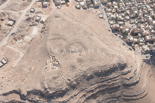
Khirbet al-Batrawy
Khirbet al-Batrawy - © APAAME_20141012_RHB-0034. Photographer: Robert Bewley.
Udhma, north of Amman, has half been destroyed by modern development.
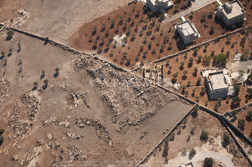
Udhma
Udhma - © APAAME_20141012_MND-0096. Photographer: Matthew Dalton.
Tells of the Jordan Valley – Tell el Qos, Ammata, Hammeh, and Tall Abu ez Zeighan, also, new excavations at Tell el-Hammam.
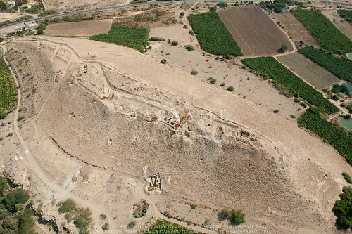
Tell el-Hammam; Kafrein Trenches 2
Tell el-Hammam - © APAAME_20141028_DLK-0365. Photographer: David Kennedy.
Nearby up the wadi from the Kafrein Dam is the site of Suwwan.
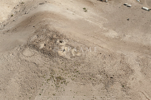
Suwwan
Suwwan - ©APAAME_20141028_DLK-0386. Photographer: David Kennedy.
Sometimes sites can be overlooked because of their vicinity to a ‘big name’ site, but we do not want to be guilty of this mistake. Sites in the vicinity of MachaerusAtaruz, Aruda, Khirbat ed Deir and El-Quraiyat, and Umm er-ResasUmm er-Resas Ruin 1 and 2, were additions this year.
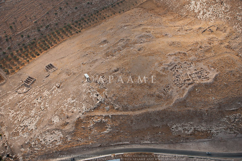
Ataruz (Attarus)
Ataruz - © APAAME_20141013_REB-0051. Photographer: Rebecca Banks.
A rare foray to the Southern Dead Sea Basin captured many sites previously not photographed by us. A highlight included the Wadi Hamarash excavations suggested to us by Prof. Adamantios Sampson, not least because of what an interesting squeeze it was for the Helicopter in the Wadi valley.
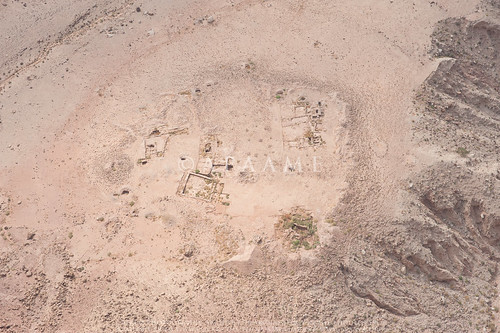
Wadi Hamarash Neolithic Site (Site 1)
Wadi Hamarash Neolithic Site (Site 1) - © APAAME_20141013_REB-0286. Photographer: Rebecca Banks.
Mtakalash ar-Rababa, an interesting site which was snapped just in passing.
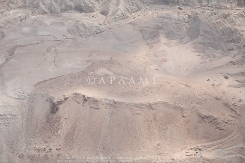
Mtakalash ar-Rababa
Mtakalash ar-Rababa - © APAAME_20141013_MND-0507. Photographer: Matthew Dalton.
We also photographed the shelter for Deir Ain Abata being erected over the site.
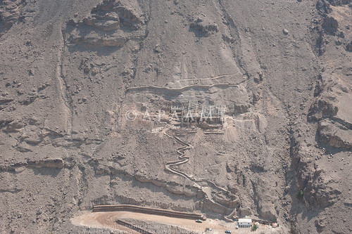
Deir Ain Abata
Deir Ain Abata - © APAAME_20141013_REB-0333. Photographer: Rebecca Banks.
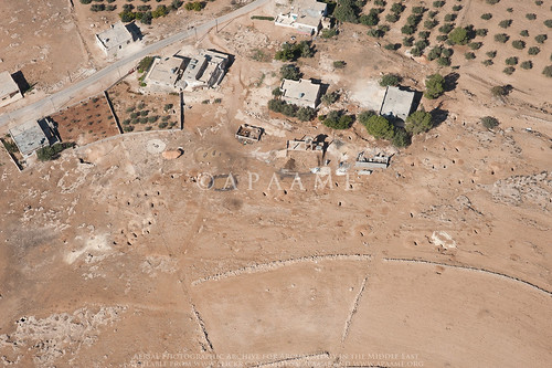
Flying to and from Marka Airport in Amman over the fertile hinterland is always a busy time with sites numerous and close together- sites are often just photographed ‘in passing’. This year the keen eyes of Mat spied what appears to be a possible Tomb (Amman Tomb 5), and a large concentration of rubble underneath an olive plantation that is likely a settlement or village of some description (Amman Village? 1). Neither site is recorded in MEGA-Jordan or on the K737 maps, but the village is clearly visible on Hunting Aerial Survey photographs of 1953 taken before the olive grove existed. A revisit on the 6th and last flight has confirmed both sites are indeed of interest.
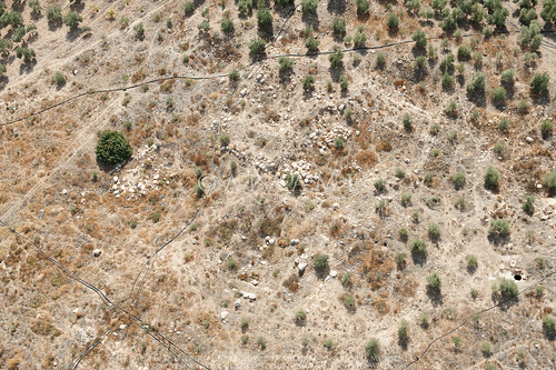
Amman Village? 1
Building rubble and cistern evident at site 'Amman Village? 1'. © APAAME_20141028_DLK-0282. Photographer: David Kennedy.
Our flight to Aqaba was a very productive two days as we rarely get to fly so far south. Despite delays and difficulties caused by the weather many sites were photographed for the first time, some highlights included:

Kh. Titn sites recommended to us by Kristoffer Damgaard.
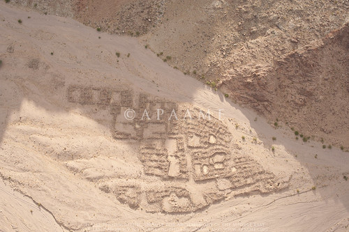
Kh. Titn 2 (Large Cluster)
Kh. Titn 2 (Large Cluster) - © APAAME_20141020_RHB-0069. Photographer: Robert Bewley.
The keen eyes of Don Boyer through poor visibility alerted us to the existence of Mlehleb.
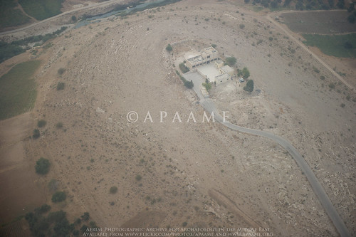
Mlehleb
Mlehleb - © APAAME_20141019_DDB-0006. Photographer: Don Boyer.
The amazing fort ‘Aina Fort 1’, (edit: thank you to Haim Ben David for information regarding this site - it is identified as el-Medeiyneh by Glueck (1935, 104-1-6, 181)) and a smaller fort ‘Tafila Fortlet 1’.
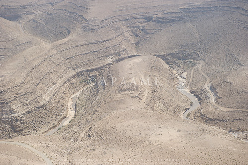
Tafila Fortlet? 1
'Tafila Fortlet? 1' - © APAAME_20141019_DDB-0244. Photographer: Don Boyer.
The ancient site underneath the modern town of Buseira (Busayra) suggested to us by a University of California, Berkeley, team.
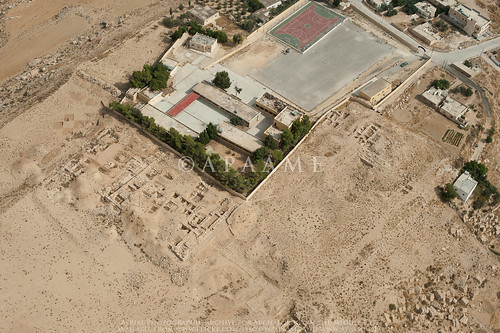
Buseira
Buseira (Busayra) - © APAAME_20141019_RHB-0256. Photographer: Robert Bewley.
Railway enthusiasts should enjoy this year's flying along the southern portion of the Hedjaz Railway in Jordan.
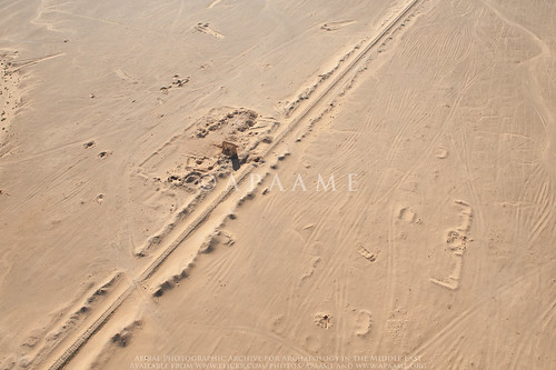
Mahattat er-Ramla
Mahattat er-Ramla on the Hedjaz Railway. © APAAME_20141020_DLK-0221. Photographer: David Kennedy.
Particularly striking were the Ottoman defensive structures positioned at strategic points along its length.
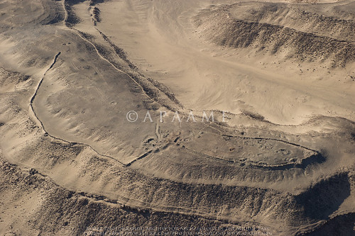
Mudawwara Northern Redoubt
Mudawwarra Northern Redoubt - © APAAME_20141020_DDB-0164. Photographer: Don Boyer.
A treat for Romanist David Kennedy was the Roman Fort at Gharandal, and the long stretch of the Via Nova Traiana investigated (see blog - The Via Nova Traiana in Central Jordan), but also the unexpected traces of Roman Roads photographed in passing.
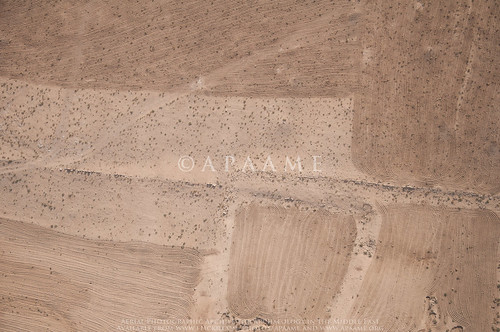
Umm er-Resas Roman Road 1
A stretch of possible Roman Road near Umm er-Resas. © APAAME_20141013_MND-0244. Photographer: Matthew Dalton.
Research into the site of Muwaqqar by David Kennedy led us to investigate possible sites ‘Sahab Ruin 9 and 10’ located nearby which were identified from satellite imagery. Neither site is recorded in MEGA-Jordan or on older maps to our knowledge, but the photographs show they are possibly substantive sites.
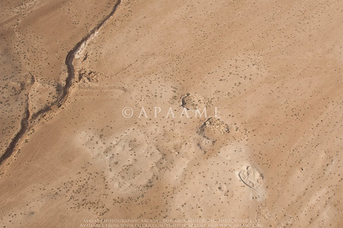
Sahab Ruin 10
'Sahab Ruin 10' - © APAAME_20141028_TPH-0125. Photographer: Travis Hearn.
These photographs are a record of these sites, but also a starting point or addition to the research into the many periods of history, heritage and archaeology in Jordan. Please feel free to leave comments on the Flickr image pages regarding site identification and information.

We owe a debt of gratitude to so many but without our funders, especially The Packard Humanities Institute and the Seven Pillars of Wisdom Trust, we would not be able to continue. We are very grateful to our hosts the Council for British Research in the Levant (CBRL) in Amman, and especially Nadja. The Royal Jordanian Air Force and their superb pilots ‘make it happen’ and could not be more helpful, hospitable and safe. David, Bob, Becc, Mat, Travis and Don all made this an exceptional year and we hope for many more.

You can find all of the 2014 Flying Season photographs on our Flickr '2014 Flights' collection page: https://www.flickr.com/photos/apaame/collections/72157646490200724/

Friday, 31 October 2014

Fortnight of Firsts - Flight 20141028


I was very fortunate to be invited to join the Aerial Archaeology in Jordan 2014 flying programme this year. It has been a fortnight of ‘firsts’ for me. My first visit to Jordan, first visit to a Roman site, and a my first time in a helicopter – something I am particularly proud of as one who is terrified of flying, even on commercial aeroplanes. Taking photos from the open-door side of a Huey was not something I imagined I would be able to do.

As the helicopter rose up out of Marka Air Force Base, and the view of Amman began to unfold before our eyes, my fear turned to fascination and excitement. The bird’s eye view, whether of a modern city or an archaeological site, gives a unique perspective on the connexion between the various different elements that together make up those larger networks we usually only ever see from ground level.


View of Amman © APAAME_20141028_TPH-0004

Trying to espy a site from above and then photograph it was a very rewarding experience. Undertaking the flight only increased the respect I have for the dedication David Kennedy and Robert Bewley have for recording as much of Jordan’s immense and varied archaeological treasures as they have thus far been able. No doubt this respect and gratitude is a sentiment that future generations, especially Jordanians, will share.

Of the sites we photographed two were particularly memorable for me – the recently spotted, possibly Roman, quarry with columns, under threat of being consumed by the adjacent modern quarry and Qasr el-Maduna, an imposing desert castle.

Sahab Quarry © APAAME_20141028_TPH-0010


Qasr el-Maduna © APAAME_20141028_TPH-0069

While much work goes on behind the scenes, including cataloguing photos and making them available through our Flickr page, I have also had time for a visit to Gerasa (Jerash), Azraq Oasis, and, this morning, a ground visit to an endangered Roman town, Yajuz, just outside of Amman – this is one example, yet certainly much of Jordan’s heritage is under threat. 

I have thoroughly enjoyed joining the team in Jordan, my time in Amman has been made pleasurable and stress-free thanks to the support of APAAME, the BIA (British Institute in Amman) and the Jordanians I have had the pleasure to meet with, all of whom are wonderful ambassadors for their country – much good could come of tourism to Jordan’s remarkable historical sites. As Jordan faces various challenges, hopefully the opportunities to preserve (and market) its heritage are not lost.


Wednesday, 29 October 2014

Flight 20141028: Endangered Archaeology – Yajuz

Yajuz in 1998. © APAAME_19980517_DLK-0031.
Yajuz is a small town of the Roman period lying about 10 km (sld) from the centre of Roman Philadelphia (Amman). Excavation has revealed three churches with mosaic pavements, several major residential buildings, an area with major wine presses and a large tomb nearby. The full extent is unclear but is probably 15-20 hectares. A major settlement in the hinterland of Philadelphia, probably one of several but unusual in that it has not been overlain by the expansion of Amman.

The Roman highway from Philadelphia to Gerasa (Jarash) passes by its eastern fringe (Blue). The road has been well-known for over a century and numerous milestones have been recorded. The first stage of about 10 Roman miles is now hard to trace amongst the rapid recent sprawl of Amman and many of the milestones have been broken up, buried or pushed away by development. Yajuz itself seemed safe, protected by its status as a site excavated extensively over many years and marked by boards set up by the Department of Antiquities of Jordan.
Google Earth screen capture of Yajuz site with areas of interest indicated.
In the last decade that status has come under threat as massive new housing projects have sprung up all around, major highways have sliced past making it an attractive commuter suburb and the price of land has continued to soar. APAAME’s flying programme – Aerial Archaeology in Jordan, has regularly monitored the site, a task made easier by its proximity to a regular route for us returning to the airfield at Marka. In 2010 we singled the site out as a place that deserved special protection and development as a tourist destination (Kennedy and Bewley 2010: 199-201).
New Apartment blocks at 'A'. © APAAME_20141029_DLK-0503.
Houses at SE corner of Yajuz at 'B'. © APAAME_20130414_RHB-0468.

It is clear the site is being slowly but steadily eaten away by development. The blue-roofed building which had already intruded into the site over a decade ago has now – since April 2013, been joined by a two large blocks of apartments (A). At the southeast corner two houses were cut into the site several years ago (B). Now another house is being constructed cutting into the north edge (C).

House in North of site at 'C'. © APAAME_20141029_DLK-0512.
Unless steps are taken immediately, Yajuz will join the catalogue of other small towns around Philadelphia, still notable ruins in the 19th and early 20th century which are now largely lost. 


- David Kennedy

Kennedy & Bewley (2010) 'Archives and Aerial Imagery in Jordan', in Cowley, Standring and Abicht (Eds) Landscapes through the Lens, Oxford: 193-206.


Friday, 24 October 2014

Flights 20141012-13 - Blink and you will miss it

One of the main aims of the Aerial Archaeology in Jordan Project is to photographically record archaeology in Jordan – a record through which it can be monitored.

This year has provided some highs and lows.

Reconstruction work has occurred at Qasr el-Mshatta near Queen Alia International Airport.
Qasr el-Mshatta
Qasr el-Mshatta in 1998. © APAAME_19980513_RHB-0054.
Qasr el-Mshatta
Qasr el-Mshatta in 2014. © APAAME_20141013_RHB-0012.

A possible Roman column quarry has somehow survived (so far) amongst a massive modern limestone quarry – and a ground visit found another quarry site on an adjacent hill. But how long will they survive the expanding modern quarry?

Sahab Quarry 1
Quarry. © APAAME_20141013_RHB-0467.
Two of the original columns of Machaerus have been restored and inaccurate representations removed.
Machaerus
Machaerus in 2006. © APAAME_20060910_DLK-0005.
Machaerus
Machaerus in 2014. © APAAME_20141013_MND-0086.
The building of a pilgrim hotel has destroyed one of the Roman siege camps (Roman Camp P) surrounding the site of Machaerus. The location no doubt was chosen for its excellent view over the ancient site. It is likely that very reason had once made it the ideal location from which the commander of the Roman siege forces possibly directed his assault.

Machaerus
 Machaerus in 1998. The faint trace of Roman Camp P can be seen on the peak in middle ground right. © APAAME_19980517_RHB-0071.
Machaerus
Pilgrim Hotel in foreground of Machaerus in 2014. © APAAME_20141013_RHB-0032.
Necropoli have been the target of looters since Antiquity, but modern looting is also evident – individual shafts at Khirbet Ain, honeycombing of hillsides at Pella and the systematic looting of Dead Sea sites Fifi, Al-Nage’a and Bab edh-Dhra.

Kh Ain Cemetery
Looting shafts at Khirbet Ain. © APAAME_20141012_REB-0235.
Pella
Looting shafts in the hillsides around Pella. © APAAME_20141012_MND-0384.
Fifi Cemetery
Systematic looting of Fifi. © APAAME_20141013_REB-0277.

Tuesday, 21 October 2014

Flights 20141019-20 - The Aqaba Trip

Sunday 19th
Much forethought and planning had gone into this two-day trip by David and Becc so it was doubly disappointing that Becc was stricken by a bug and couldn’t join us, and the weather had turned decidedly autumnal. However Don agreed to join us for a boy’s trip to the Red Sea. Low pressure, low clouds and poor visibility meant our first attempt to fly south was thwarted, and after 45 minutes we returned to Marka. We were told the weather would get worse, but indomitable as ever we pressed the case for getting to Al-Jafr (many miles south-east and it is always clear there). So after a delay we set off for a very successful (if long) day. David has already written up two of the highlights (see post for Flight 20141019) - the Via Nova Traina; and the ancient Aina fort overlooking the Wadi el-Hasa, with stunning views and a truly commanding position. We both wondered why we had never photographed this very well preserved and important site before?
The Gharandal Roman Fort. © APAAME_20141019_DLK-0418.
The cold was beginning to have its effect, and we were grateful for the re-fuelling stops at Jafr, but not much re-fuelling for the pilots and crew; luckily Becc had provided us some dates, chocolate biscuits, nuts and Werther’s Originals (the later being a staple on these flight over many years). The final leg of the day was very rewarding as we descended into the (warm) Wadi Araba to photograph the Roman fort at Gharandhal and then land at Aqaba. There was just time for the quickest of dips in the Red Sea before an early meal and early night.
Ayla - ancient Aqaba. © APAAME_20141020_RHB-0033.

Monday 20th
Threatening clouds to the west, including some rain, greeted us at take-off (despite the cold) – even this far south – but our first targets were of ancient Aqaba, the original city being called Ayla, and now a heritage park, well watered and surprisingly green.

Transfixing landscapes east of Aqaba. © APAAME_20141020_RHB-0094.
We were then transfixed by the landscapes we were flying over; a geological tour de force and a wonder to behold; impossible to capture the scale and enormity of this wind-sand-blown desert with teeth-like pillars of rock randomly placed.
Landscape west of Mudawwarra. © APAAME_20141020_RHB-0119.
As we flew on the landscape changed to a darker basalt rock where the formations were like fingers spreading out into the desert. All testament to millennia of erosion and change.

The ghost line of the Hedjaz Railway. © APAAME_20141020_RHB-0170.
From there we approached the Hedjaz railway, and some stunning ancient hill-top enclosures, forts of as yet unknown date, but very well preserved. At this point the railway there is only a ghost of the track and sleepers – the station and platforms deserted and almost covered over with sand. Then a huge loop in the system as climbs up a steep gradient, and new track, and a real railway; presumably in use by a mining company to shift huge quantities of minerals. On the summit another stunning defended hill-top enclosure- Fassu'ah Ridge Fort; the pilots commented that it looked like looters “were looking for gold”, but we have been informed that the collapsed trenches are from former fieldwork by the Great Arab Revolt Project.
Fassu'ah Ridge Fort above Mahattat Hitiya. © APAAME_20141020_RHB-0236.
Detail of Fassu'ah Ridge Fort. © APAAME_20141020_RHB-0249.
By now the strong westerly wind was affecting our schedule, and the longer time taken to return to Jafr for refuel meant fewer targets were photographed than we hoped; let’s hope for more flying time next year. Even at Jafr the cool wind meant we had to find a wind break, and a snack lunch in the helicopter, before a final foray to look for a group of sites in a landscape never visited before in the far east of the country. We knew that locating them (in the midday sun) would be difficult but only on arrival did we discover just how ephemeral these particular “kites” would be. We saw all but two of the sites, but only just.
Huey lunch with Don Boyer and David Kennedy. © APAAME_20141020_RHB-0325.
A final re-fuel and the long slog back to Marka and (my) farewells to the crew and squadron commanders “until the next time” – there is one more flight planned for this season for David and the team in Amman.