Showing posts with label Syria. Show all posts

Wednesday, 2 November 2016

‘View Counts’ on APAAME’s Flickr Site

Since its establishment in 2009, what Flickr calls ‘View Counts’ have reached 7.153 million. After a slow start the number now rises by about a million every few months and the site has 452 ‘Followers’.

A sign of the times is that the all-time most viewed photograph is one of Aleppo, seen 3850 times. Not one taken by our team but the work of No 1 Squadron of the Australian Flying Corps on 23 October 1918 from 7000 feet. It is labelled ‘Aleppo from SW’. The original print is held in The National Archives at Kew in the UK.

The flight – just two and half weeks before the Armistice in Europe, was in the period after the collapse of Ottoman forces in Palestine, Transjordan and southern Syria and 23 days after the Australian Light Horse entered Damascus on 1 October. The photograph is one of several taken by the AFC at that time over Lebanon and Syria (including Damascus on 17 October).

-DLK
APAAME_19181023_TNA_RAFAINN_CN5-2 part2 (193)

Monday, 27 July 2015

Historical Imagery - Dumeir: IWM German First World War Official Exchange Collection

The Imperial War Museum in London includes a group of photographs obtained by exchange from Germany after the First World War of places photographed by their personnel in the Palestine Front region: the GERMAN FIRST WORLD WAR OFFICIAL EXCHANGE COLLECTION.

This one (Q 86279) is labelled as ‘The Old Temple near Amman”. That is plainly incorrect and the environment suggests somewhere with modern use of mud-brick. Thanks to Rebecca Banks’ sharp eye, the correct identification is a temple - still well-preserved (till recently at least), at Dmeir/Dumeir northeast of Damascus.

http://www.iwm.org.uk/collections/item/object/205330314

Ross Burns describes the monument in the following passage from 'Monuments of Syria':
"It was dedicated as a temple to Zeus Hypsistos in 245 during the reign of the Emperor Philip the Arab (Emperor 244-9) who was born in the Hauran region of Syria (*Shahba)... There may thus have been some changes of plan during the long construction period. An earlier altar dedicated to the Semitic deity, Baal-Shamin, in AD 94 (now in the Institut du Monde Arabe in Paris) indicates that a Nabataean religious building previously stood on the site.
The genesis and original purpose of the building are not clear. The shape is highly unusual. Construction may have commenced as a public fountain or as a staging post on the intersection of two important caravan routes (hence the quadrilateral plan and four entrances). Perhaps it was even an elaborate triumphal arch... The argument for seeing it as a temple, at least in its final form, is underlined by the use of corner towers and staircases giving access to the roof for ritual purposes in the Syro-Phoenician tradition... It was fortified in the Arab period; the arch on the rear wall [seen in this photograph] remains completely filled in with stones and defensive devices." 
Ross Burns (1999) Monuments of Syria: an historical guide (Rev. ed.), I. B. Tauris Publishers: London, New York: 115-116.
You can see more recent photographs of the site on the Ross Burns' website of the same name.

Photographs of the condition of the site after a period of bombardment in the current civil war can be seen on the website of the Association for the Protection of Syrian Archaeology.

-DLK

Friday, 31 October 2014

Research - Jordan 'Big Circles' Publicity

We are receiving a lot of hits and publicity from the Owen Jarus 'Ancient Stone Circles in Mideast Baffle Archaeologists' article published on LiveScience yesterday (30 Oct. 2014). 

DailyMail Online have also followed up with their article 'Mystery of Jordan's Big Circles: Ancient Stone Rings in the Desert have left archaeologists baffled' (Victoria Woollaston, 30 Oct. 2014).

If you are interested in accessing the original article by Prof. David Kennedy in Zeitschrift für Orient-Archäologie 6 please see our blog for publication details: Publications: Remote Sensing and ‘Big Circles’ A New Type of Prehistoric Site in Jordan and Syria 

The Syrian 'Big Circle' was discovered and investigated by Graham Phillip and Jennie Bradbury and published in the journal Levant, you can access their article through Maney Online: 'Pre-Classical Activity in the Basalt Landscape of the Homs Region, Syria: Implications for the Development of 'Sub-Optimal' Zones in the Levant During the Chalcolithic-Early Bronze Age'.

If you are interested in seeing more photographs taken in the course of our investigation of the structures on the ground and from the air, please visit our Flickr page and search for 'Big Circle'.

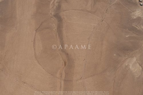
Circle 6
Jordan Big Circle 6. © APAAME_20090930_DLK-0263.

Thursday, 9 January 2014

Website: Monuments of Syria

http://monumentsofsyria.com/
The eyes of the world seem fixed on Syria presently, it is a tragedy that it could not be for different reasons than those of the conflict currently destabilising the lives of so many.

Ross Burns, author of 'Monuments of Syria' and 'Damascus- a history', has recently launched an accompanying website to his published work on Syria. 'Monuments of Syria' provides an index of historical places and sites with photographs. It provides a valuable insight to many sites of historical interest that few currently are able to visit. Here, so many periods, civilisations and faiths are represented.
"Few countries can match Syria in the richness of its historical remains. In the zone west of Aleppo, for example, over 600 Byzantine-era villages survive, often with multiple churches with walls up to their rooflines. There is practically no era not represented in Syria. Palmyra, the great caravan city at the westernmost point of the Silk Road, still slumbers in the desert, its beautifully carved limestone as crisp and dramatic as 2000 years ago. Magnificent reminders of the folly of past confrontations, including the Crusades, survive in the great fortifications that are scattered across the country — the Krak des Chevaliers; the great Islamic citadel that crowns Aleppo; the refuges of the ‘Assassins’ hidden away in the coastal mountains; or the Damascus Citadel that sustained the long Muslim resistance to the Crusades. Not to be overlooked are the many mosques and madrasas, often tucked away quietly in backstreets or buried within the busy suqs (markets) of the major centres."
Through efforts like this much knowledge is kept alive, for Syrians and the world alike. Hopefully when the spectre of war departs from the land the corpus will be expanded and studied further.
Visit http://monumentsofsyria.com/

Friday, 1 November 2013

The Online Corpus of the Inscriptions of Ancient North Arabia

Inscription in the vicinity of the Cairn of Hani, Jordan. Photograph: David L. Kennedy, APAAMEG_20091014_DLK-0017.
This week APAAME has made over 200 ground photographs available to the Online Corpus of the Inscriptions of Ancient North Arabia (formerly the Safaitic Database Online) for inclusion in their database. The photographs were originally taken during follow up ground visits to sites after they had been photographed from the air. The majority of the photographs were taken in the 'Black Desert' or Harret al-Shaam in Jordan and many of the inscriptions were associated with features we were interested in, such as Wheels, Pendants and Cairns. As the APAAME team are not experts in Safaitic or Hismaic, let alone Dadanitic or Taymanitic, we are enthusiastic that these photographs will be made available in a database designed for their study.

For more information on the inscription database please see the passage below made available to us from the project, or visit the project website HERE.

If you wish to see some of the many photographs of inscriptions we have taken, please visit our Flickr site where we have tagged the majority with 'inscription': http://www.flickr.com/photos/apaame/tags/inscription/.

OCIANA (Online Corpus of the Inscriptions of Ancient North Arabia)

From the early first millennium BC to around the fourth century AD, literacy was extremely widespread among both the settled and nomadic populations of the Arabian Peninsula and they have left us tens of thousands of inscriptions and graffiti. Since the late nineteenth century, approximately 48,000 of these have been recorded by travellers and scholars and have appeared in hundreds of articles, books, and unpublished dissertations in a number of different languages. This makes it extremely difficult for all but a handful of specialists to keep track of and use the rich material they contain. Moreover, any visit to the deserts of southern Syria, eastern and southern Jordan and the western two-thirds of Saudi Arabia reveals that there are thousands more inscriptions waiting to be recorded.

The OCIANA project, is based at the Khalili Research Centre, Oriental Institute, University of Oxford, and directed by Professor Jeremy Johns and Michael Macdonald. It will create an online Corpus of all the pre-Islamic inscriptions of north and central Arabia, both those in the various Ancient North Arabian dialects and scripts, and those in Old (i.e. pre-Islamic) Arabic. A project at the University of Pisa (the Digital Archive for the Study of pre-Islamic Arabian Inscriptions, DASI) is producing an online corpus of the inscriptions of pre-Islamic South Arabia, and the two projects are working closely together so that it will be possible to search the information in both corpora through the same portal.

In 2012, the first phase of OCIANA, funded by a grant from the John Fell Fund at the University of Oxford, launched a demonstration site in which a corpus of 3420 previously unpublished Safaitic inscriptions was made available online with readings, translations, commentaries, ancillary information, tracings, and photographs (see http://www.ociana.org.uk). In January 2013, the project received a large grant from the AHRC for Phase II which will last three and a half years from 1st October 2013. In this phase, the Dadanitic, Taymanitic, the rest of the Safaitic, Hismaic, and Old Arabic inscriptions will be entered and tagged, with all available ancillary information and with photographs whenever these are available. Phase III will see the entry of all the approximately 13,000 Thamudic inscriptions.

Wednesday, 28 August 2013

Research: Emily Beke's description of a 'Kite'

Our research into 19th century travellers' accounts of Syria and Transjordan, and more specifically what they encountered in the 'Hinterland of Roman Philadelphia' continues. Every now and then we turn up something fantastic, but not necessarily on our current topic of research.
Portrait of Emily and her husband Charles Tilstone Beke photographed by Ernest Edwards (Lovell Reece, 1867, 'Dr. and Mrs. Beke', in Portraits of Men of Eminence, Vol. 6, London: L. Reeve & Co.: 21. Original in the Natural History Museum, London: 051942).
Recently, we found a description of the function of a kite by Mrs Emily Alston Beke, wife of Charles Tilstone Beke. She wrote the following:
"It is curious how these animals are caught by the Beduins in the desert country lying to the east of Harran. Two walls of considerable length are erected, commencing at some distance from each other, and converging to a point. Before the two ends quite meet, a mound of earth is thrown up between them, and the two walls, being continued beyond this mound, are united by a cross-wall of about half their height; behind this lower wall is a large pit, the earth dug out of which had served to form the mound. Horsemen now contrive to drive a herd of gazelles between the two walls, where they are furthest apart. The timid animals rush forward towards the extremity of the enclosure, at first not seeing the low cross-wall, which is hidden by the mound of earth; and when, at length, they find themselves closed in on both sides, they naturally try to escape by ascending the mound and leaping over the low wall, when they fall into the pit beyond it, and are taken, often as many as twenty or thirty at a time."

The entry is dated Tuesday December 24th, 1861 when Emily and her husband were visiting a Dr. Wetzstein in Damascus where they were sampling wine made from Helbon/Halbon grapes. The description must be that of a Kite. The description is particularly useful as what we currently know about the function of a kite is almost entirely derived from their remains and some inscriptions, whereas here we seem to have a contemporary account of their use, and what's more, it implies that Kites were still being used to trap gazelle into the 19th century. The area she refers to 'in the desert country lying to the east of Harran' is the northern tip of the Harrat ash-Sham east of Harran al 'Awamid. A large group of kites are located in this area, beginning roughly 15 km east of Harran al 'Awamid (or 40km east of Damascus), which we have located using satellite imagery freely available through Google Earth and Bing Maps. These kites were first photographed by Poidebard - one is published in La Trace de Rome (1934: Pl. XIV) (see Bewley & Kennedy, 2012, 'Historical Aerial Imagery in Jordan and the Wider Middle East', in Hanson & Oltean (Eds), Archaeology from Historical Aerial and Satellite Archives: Fig. 13.2 p. 226).

In exploring Harran in pursuit of a theory about an Old Testament place name, the Bekes discovered an inscribed stone (p. 199 ff.) which was later identified as a Roman milestone (p. 124ff.). Another was later found in a neighbouring village the name of which Emily gives as Ghassule (p. 125). Very unexpected.

Emily was 37 years younger than her husband but a fitting companion and his equal in many respects. Her published diary, and notes in the archival material of her husband show that she is highly intelligent, independent and active woman- accompanying her husband on at least one journey, helping him in his academic pursuits and publications as well as running their household as smoothly as she could with the expenses from research tours and publishing. After her husband's death she remained a staunch advocate for his lifetimes work, continuing to publish his research at considerable cost to her financial position.

Monday, 24 December 2012

Slides of Syria

As the year comes to a close, it is inevitable that we reflect on what we have done and what has been happening in the world.

I have been scanning slides from the late 1970s… a lot of slides, of archaeological sites in the Middle East. Most were taken by David K at a time when sites were often in better condition or not yet overgrown by developing villages and towns, so archaeological artefacts in their own right.

While scanning these slides I continually came across evidence of the beautiful archaeological record of Syria, and in the news I daily come across reports of conflict that increasingly and unavoidably is affecting these archaeological sites, whether they are caught in the crossfire or directly targeted by looting.

So, I thought it best to share some of these digitised slides with you and take you to sites that we may not be able to protect now, or visit in the near future, but of which we can hope to preserve evidence and knowledge.

(In no particular order... Please click on an image to enlarge it.)
Basilica, Deir Semaan.
South west church, Deir Semaan.


Deir Semaan (Saint Symeon Monastery or Telanissos) is one of many ruined villages, known collectively as the 'Dead Cities' on the limestone massif west of Aleppo in Syria’s north. These late Roman villages are extraordinarily well preserved, buildings sometimes surviving to two and three stories high, and allowing a superb insight into late Roman town life. These magnificent ruins however have suffered in the crossfire, and also through looting. This short article on the research of Emma Cunliffe, Durham University, includes a witness’s video recording damage to one of these sites, and reports have emerged that the Monastery of Saint Symeon has been damaged by shelling. Link.
Temple of Nebo in foreground with the great temenos of the Temple of Bel in background, Palmyra.
Palmyra is one of the best-known ancient sites in Syria. The city flourished due to its profitable position between the west and east, and became a major Roman city in the 2nd and 3rd centuries AD. Built around an oasis in the middle of the desert, the grandeur and preservation of the site is all the more marked due to its isolation, and it has been a favourite of tourists since the 19th century. A report on the Global Heritage Fund blog details how the site has become caught in the crossfire and is a target for looting. http://globalheritagefund.org/onthewire/blog/palmyras_ruins.
West wall of Halebiyeh looking east from the citadel towards the Euphrates River.
Halebiyeh, or Zenobia, is located on the banks of the Euphrates. The walls extending out from the Citadel of an immense Late Roman fortress city are the most prominent feature of this beautifully preserved site. The astonishing scale and quality of preservation can be gauged by noting David’s white LWB Landover (inside of the city wall in the centre of picture) (cf. D. L. Kennedy and D. N. Riley, Rome’s Desert Frontier from the Air, London (Batsford)).

Section C3 of Dura Europos.
Palmyra gate, Dura Europos.


Dura Europos, also on the banks of the Euphrates River, was preserved in sand until its excavation during the interwar period, prompted by the discovery of remarkably preserved frescos. Even more important was the discovery of a huge cache of papyri which included the largest single collection of papyri for the Roman army anywhere in the Empire, including Egypt.
The Tetrapylon at Damascus, located at one end of Souk al-Hamidiyeh to the west of the Umayyad Mosque in the city centre.
Damascus is the ancient and modern capital of the region and where the archaeological record is hidden in side streets, built into houses, and walked through as part of daily life in a thriving city. As fighting intensifies closer to the ancient city (BBC news article: http://www.bbc.co.uk/news/magazine-20659573) how will the ancient walled city and 1400 year old Umayyad Mosque built over the immense church of St John fare if it breaks through to the heart? The once lively Souks and are now devoid of tourists and suffer from intensifying security raids. One hopes the beautiful Souk al-Hamidiyeh and the numerous early medieval houses tucked in side streets will not suffer the same fate as the ancient heritage listed market place of the city of Aleppo, the Souk al-Madina, which was irreparably damaged in September– see http://www.reuters.com/article/2012/09/30/us-syria-crisis-idUSBRE88J0X720120930
General view (north) of Bostra.
Bostra is in the south of Syria in a region known as the Hauran – a fertile semi-arid landscape on the edge of ancient lava-flows. It was the northern-most city of the Nabataean kingdom that stretched down through its capital at Petra into north-western Saudi Arabia. Nabataea was incorporated into the Roman Empire with Bostra as the capital of the new province of Arabia under Trajan in AD 106. The site is perhaps best known for its Roman theatre built from black basalt rock, but the ruins of the ancient city are also well preserved amongst the streets of the modern town, with towers in some cases standing over two stories high. The town has been damaged by shelling this year.

All photographs are © David L. Kennedy and belong to the Aerial Photographic Archive for Archaeology in the Middle East. After the slide collection is catalogued it will be available online at our Flickr archive: link.

I would like to thank David for looking over this blog, and for his continual remarks and encouragement while I develop the APAAME digital collection. Any remaining errors are wholly my own.
-Rebecca Banks 

Links:
Aryn Baker & Majdal Anjar, Syria’s Looted Past: how ancient artefacts are being traded for guns, Time World Sept 12 2012.
http://world.time.com/2012/09/12/syrias-looted-past-how-ancient-artifacts-are-being-traded-for-guns/
Emma Cunliffe’s updates on the Global Heritage Network blog site, one of the latest, which contains links to video footage, is the following:
Emma Cunliffe, No World Heritage Site Safe in Syria, Global Heritage Network Blog, Nov 19 2012.
http://globalheritagenetwork.ning.com/profiles/blogs/no-world-heritage-site-safe-in-syria#_edn16

Thursday, 1 November 2012

Publications: Kites–new discoveries and a new type

The discovery of an unusual specimen of kite with a limited distribution between Palmyra and Damascus in Syria led to the formulation of this journal article by David L. Kennedy.


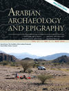
Arabian Archaeology and Epigraphy (AAE) cover image

David L. Kennedy (2012) 'Kites–new discoveries and a new type', Arabian Archaeology and Epigraphy 23.2:145-155. You can find it at Wiley Online Library.


The 'sock' kite, fondly at first referred to as a 'Hockey Stick' kite, then (as we were feeling seasonal) a 'Christmas stocking' kite, with its narrow elongated 'shaft' and 'head' off to one side, forms the basis of this article. The discussion encompasses the form, distribution and geography of the new Kite type.

We also cover the extent of our current research on Kites in Arabia, and the article is generously accompanied by useful maps and distribution diagrams of Syria, Jordan and Saudi Arabia, and diagrams of the new Kite type.

Tuesday, 3 July 2012

Roman Archaeology Group Free Lectures: 21 July

Upcoming free lectures run by the Roman Archaeology Group of Perth:

2 Illustrated Lectures

Palmyra: an ancient oasis between East and West
 Rebecca Banks


The Roman Peloponnese
Kevin O'Toole

Saturday 21 July
1:30pm
Social Sciences Lecture Theatre
University of Western Australia

1:30pm - Palmyra: an ancient oasis between East and West
2:30pm - tea break ($7 for RAG Members $10 for non-members)
3:00pm - The Roman Peloponnese

Please let us know of your interest by emailing Maire Gomes (please see flier below).
Next lecture: Saturday 25th August.

To learn more about the Roman Archaeology Group of Perth please visit their webpage.

Tuesday, 26 June 2012

Petition: Protection for Syria's Cultural Heritage

The British Association for Near Eastern Archaeology (BANEA) has launched a petition seeking protection for Syria's cultural heritage.

We hope you can sign it, support it and promote it through any contacts or avenues available to you.
http://www.avaaz.org/en/petition/Save_Syrias_Cultural_Heritage_1/?fPWGUcb&pv=1

The pdf of 'Damage to the Soul: Syria’s Cultural Heritage in Conflict' can be downloaded here: http://ow.ly/bNSk1

TEXT of the petition:
Save Syria’s Cultural Heritage The worsening situation in Syria places thousands of archaeological sites in immediate danger of current and future looting. A full discussion of the sites affected can be found here: Cunliffe, Emma. 2012, Damage to the Soul: Syria’s Cultural Heritage in Conflict. 16 May 2012. Global Heritage Fund. The British Associate of Near Eastern Archaeology (BANEA) and other interested parties call on the British Government, UNESCO and the International Centre for the Study of the Preservation and Restoration of Cultural Property (ICCROM) to protest to all parties to the conflict and petition for:
1. The removal of armed encampments, troops and weaponry from archaeological sites,
2. protection of archaeological sites and museums from looting,
3. recovery of stolen artefacts and the prosecution of the thieves and those who benefit from the thefts.

Updates and information can be found at www.banea.org

Jan Picton
Secretary, Friends of the Petrie Museum. www.petrie.ucl.ac.uk
Teaching Fellow, Institute of Archaeology, UCL. j.picton@ucl.ac.uk
Deputy Director, Gurob Harem Palace Project, www.gurob.org.uk

Friday, 18 May 2012

Digitising our Collection - Slides

The Aerial Archaeology in Jordan project has been in action since 1997, but before that David Kennedy was visiting sites in the Near East for his own enjoyment and research. Most of the images he took on the ground were processed into slides.

Slides are a thing of the past, and not the best way to store your negatives, and it is now one of our projects to digitise this collection and add it to our online archive.

The slides I have been starting on are photographs from Syria, taken in the 1970s, and have not been stored in optimal conditions. The 35mm negatives are mounted between thin glass within a slide frame, and then stored in slide sheets in a filing cabinet. Most slides have developed a sticky, oily residue from the interaction with non-archival plastic slide sheets, small spots of mildew have started to appear on the slides, and the colour of the slides has started to degrade, developing a magenta tinge. In some cases, the glass mounting has shattered, scratching the negative.
Slide scan of rock cut tombs in Dawa, North West Syria. c.1978. The remains of the oily residue can be see along the edges of the frame. Photography: David Kennedy. Click to enlarge image.

Slide scan of Qatoura, North West Syria, c.1978. Mildew spots and scratches to the negative can be seen in the blue of the sky above the town. Photograph: David Kennedy. Click to enlarge image.

A preliminary cleaning of the slides to remove what we could of the oily residue could not clean the frame well enough to remove all traces of the residue, and this did not tackle the minor mildew problems. With advice from the State Library of WA Conservator, we will be using a 50:50 solution of Ethanol Absolute and Deionised Distilled Water to clean the slide frames and glass mounting. This same solution can be applied carefully to those negatives that have been effected by mildew - but we must be careful not to let the solution interact with the emulsion side which could cause permanent damage to the slide. The ethanol solution will evaporate quickly and leaves no residue.

Once the slides have been cleaned and scanned - we hope that we will be able to edit the images individually to correct any permanent scars such as scratches, or any traces of dust that may have come through during the scanning process. Colour correction will be used to minimise the effects of the magenta tinge.

We shall let you know of our progress. Any advice is most welcome.

Friday, 13 April 2012

Chronology: Kites and Wheels

Determining the date for an archaeological site is best determined by excavation, but relative chronologies can be determined by examination of a very simple interaction - what lies on top of something else?

In the stone built structures of the Harret al-Shaam, we have been observing what kinds of sites are most likely to overlie others.

In the Jordan section of the Harret al-Shaam it is most likely, where Wheels and Kites are located in the same area, to see a Wheel manipulating or lying over the structure of a Kite. This most often involves the wheel overlying or using the wall of the tail of a kite, but there are also examples of the structure of the head being manipulated or built over by a Wheel. This chronology suggests that Wheels are a later structure than the Kites. In turn it is possible to see Pendants and Corrals overlying Wheels.

Azraq Wheel 11 overlying tail of Kite 21; Azraq Wheel 173 overlying head of Kite 55; Safawi Pendant 4 overlying Wheel 282. Images: Google Earth. Click to enlarge.


Kites > Wheels > Pendants ≥ Corrals

A recent investigation of a group of Kites located on the Harret in Syria, however, does not follow this broad relative chronology. In a tangle involving no less than 14 Kites and 25 Wheels, four Wheels overlie sections of four Kites, while two Kites can be seen to overlie sections of two Wheels.

Ghadir al Hajj tail of Kite 7 overying Wheel 22; Kite 10 overlying Wheel 24; Wheel 25 overling Kite 11, both overlain by corrals. Images: Google Earth. Click to enlarge.

So, simply an exception to the rule? Investigation will have to continue...

Thursday, 15 December 2011

Syrian Kites

Having been distracted by Jordan and the wondrous Harrat ash-Sham, it is only recently that we returned to monitoring what high-resolution imagery had become available in Syria. A large section of imagery north east of Tadmur (Palmyra) has kept us busy with these stunning kites, as well as a few pendants and bullseye cairns.
Bullseye Cairns along a ridge, Syria.

A cluster of Kites, Syria.

Two Pendants along a ridge, Syria.

Tuesday, 27 September 2011

The Renewal of Arabian Fauna

Captive breeding programs have seen some species come back from the brink of extinction. The Environment Agency-Abu Dhabi has recently announced they are ready to release the Arabian Oryx, known locally as the 'Al Maha', back into the wild (link to ABC Environment Feature Article), and local nature reserves such as the Ajloun Forest Reserve have been acting to reintroduce other species such as Roe Deer which had become locally extinct in Jordan (see The Royal Society for the Conservation of Nature, Jordan, Website).

The stone structures known as Kites are believed to have been traditionally used for hunting these local ungulates (hoofed mammals) of Arabia, including gazelle, deer, oryx and onager, as well as ostrich. We know the wild population dwindled rapidly in the early 20th century due to human and environmental factors, such as hunting and reduction of natural habitat. Accessing the impact on the population caused by hunting using Kites is more difficult to access as no sites have been found directly linking Kites with the slaughter of these animals, but an excavation of a fourth millenium BC deposit of bones found in North-eastern Syria published in an article in PNAS may provide some insight into how hunting using Kites may have impacted the Persian Gazelle population in antiquity.

Tuesday, 30 August 2011

Big Circles

Image: Google Earth. Please click to enlarge.

Philip and Bradbury (2010) published a large nearly perfect circular enclosure in their survey of the region surrounding Homs in Syria. In the satellite imagery dated to April 2003 in Google Earth its full circuit is almost completely visible and can be measured at over 340m in diameter. The survey dated the site from associated material evidence to the 4th or early 3rd millennia BC. The most recent imagery in August 2010 shows that all trace of the site has been obliterated by the increasing use of the region for agriculture.

Philip and Bradbury note no other circles of similar size in Syria, or further afield in Jordan – their largest counterparts are c. 100 m. However, several – perhaps as many as 12, are known, all of them in Jordan, and a few have been published.

All but one of these unusual sites have been found from aerial photographs or satellite imagery. The characteristic feature of these Big Circles is their size – apart from one that is c. 220-250m in diameter, all of the others are in the range of c. 350-450m with several almost exactly 400m. Most are near-perfect circles, they have low encircling walls, no clear evidence for any original break in the circuit and no certain evidence of any internal structures. The slender evidence tends to point – as with the Syrian example, to a prehistoric date

We are currently mapping, describing and analyzing these sites as an aerial archaeological research project. If you've got any ideas, please feel free to drop us a comment!

-D.L. Kennedy, R.E. Banks

This blog entry was derived from an in progress publication by D.L. Kennedy 'Big Circles'. For further information please consult: Philip, G. and Bradbury, J. (2010) 'Pre-Classical activity in the basalt landscape of the Homs Region, Syria', Levant, 42.2: 136-169.

Monday, 15 August 2011

What a find!

Image: Google Earth

Today we came across a region of northern Syria while using Google Earth that is amazingly complex. Despite this area being currently used for agriculture, the numerous stone built structures and remnants of previous land use have survived the hoe. Here is a small window to give you a taste of this tantalising area! What can you see? (Click on the image to see a larger version)

Tuesday, 9 August 2011

The Harret al-Shaam and aerial reconnaissance


Approximate extent of the Harret al-Shaam. Drawn by Mat Dalton.

The Harret al-Shaam is the most northerly of the basalt lavafields that mark the Arabian landscape from Syria in the north, down the western side of the Arabian Peninsula to Yemen in the South. The Harrat Ash-Sham, which itself stretches from Syria through Jordan and into Saudi Arabia, was first noted to contain remarkable stone structures visible from the air by the RAF pilots that flew across it on the airmail route from Cairo to Baghdad.

It is only recently that a more systematic aerial survey of the Harrat over Jordan has been started (Kennedy, D. L., Bewley, R. H., 2009. Aerial Archaeology in Jordan. Antiquity. 83, 69–81) but most countries in the greater Arabia area will not allow aerial reconnaissance or provide aerial imagery. Virtual globes such as Google Earth however provide accessible high resolution satellite imagery for sections of this expansive archaeological landscape which are being continually updated.

The original known distribution of the stone structures first captured in the lenses of RAF pilots, thought to be only located in the basalt lavafields of Jordan, has now been expanded dramatically. Google Earth has allowed for the number of Kites identified on the Harrat ash-Sham alone to increase dramatically - the most recent count (early 2011) was for c. 1600 Kites.
Distribution of the principle lava-fields. Drawn by Stafford Smith.