Friday 31 October 2014

Research - Jordan 'Big Circles' Publicity

We are receiving a lot of hits and publicity from the Owen Jarus 'Ancient Stone Circles in Mideast Baffle Archaeologists' article published on LiveScience yesterday (30 Oct. 2014). 

DailyMail Online have also followed up with their article 'Mystery of Jordan's Big Circles: Ancient Stone Rings in the Desert have left archaeologists baffled' (Victoria Woollaston, 30 Oct. 2014).

If you are interested in accessing the original article by Prof. David Kennedy in Zeitschrift für Orient-Archäologie 6 please see our blog for publication details: Publications: Remote Sensing and ‘Big Circles’ A New Type of Prehistoric Site in Jordan and Syria 

The Syrian 'Big Circle' was discovered and investigated by Graham Phillip and Jennie Bradbury and published in the journal Levant, you can access their article through Maney Online: 'Pre-Classical Activity in the Basalt Landscape of the Homs Region, Syria: Implications for the Development of 'Sub-Optimal' Zones in the Levant During the Chalcolithic-Early Bronze Age'.

If you are interested in seeing more photographs taken in the course of our investigation of the structures on the ground and from the air, please visit our Flickr page and search for 'Big Circle'.

Circle 6
Jordan Big Circle 6. © APAAME_20090930_DLK-0263.

Fortnight of Firsts - Flight 20141028


I was very fortunate to be invited to join the Aerial Archaeology in Jordan 2014 flying programme this year. It has been a fortnight of ‘firsts’ for me. My first visit to Jordan, first visit to a Roman site, and a my first time in a helicopter – something I am particularly proud of as one who is terrified of flying, even on commercial aeroplanes. Taking photos from the open-door side of a Huey was not something I imagined I would be able to do.

As the helicopter rose up out of Marka Air Force Base, and the view of Amman began to unfold before our eyes, my fear turned to fascination and excitement. The bird’s eye view, whether of a modern city or an archaeological site, gives a unique perspective on the connexion between the various different elements that together make up those larger networks we usually only ever see from ground level.


View of Amman © APAAME_20141028_TPH-0004

Trying to espy a site from above and then photograph it was a very rewarding experience. Undertaking the flight only increased the respect I have for the dedication David Kennedy and Robert Bewley have for recording as much of Jordan’s immense and varied archaeological treasures as they have thus far been able. No doubt this respect and gratitude is a sentiment that future generations, especially Jordanians, will share.

Of the sites we photographed two were particularly memorable for me – the recently spotted, possibly Roman, quarry with columns, under threat of being consumed by the adjacent modern quarry and Qasr el-Maduna, an imposing desert castle.

Sahab Quarry © APAAME_20141028_TPH-0010


Qasr el-Maduna © APAAME_20141028_TPH-0069

While much work goes on behind the scenes, including cataloguing photos and making them available through our Flickr page, I have also had time for a visit to Gerasa (Jerash), Azraq Oasis, and, this morning, a ground visit to an endangered Roman town, Yajuz, just outside of Amman – this is one example, yet certainly much of Jordan’s heritage is under threat. 

I have thoroughly enjoyed joining the team in Jordan, my time in Amman has been made pleasurable and stress-free thanks to the support of APAAME, the BIA (British Institute in Amman) and the Jordanians I have had the pleasure to meet with, all of whom are wonderful ambassadors for their country – much good could come of tourism to Jordan’s remarkable historical sites. As Jordan faces various challenges, hopefully the opportunities to preserve (and market) its heritage are not lost.


Wednesday 29 October 2014

Flight 20141028: Endangered Archaeology – Yajuz

Yajuz in 1998. © APAAME_19980517_DLK-0031.
Yajuz is a small town of the Roman period lying about 10 km (sld) from the centre of Roman Philadelphia (Amman). Excavation has revealed three churches with mosaic pavements, several major residential buildings, an area with major wine presses and a large tomb nearby. The full extent is unclear but is probably 15-20 hectares. A major settlement in the hinterland of Philadelphia, probably one of several but unusual in that it has not been overlain by the expansion of Amman.

The Roman highway from Philadelphia to Gerasa (Jarash) passes by its eastern fringe (Blue). The road has been well-known for over a century and numerous milestones have been recorded. The first stage of about 10 Roman miles is now hard to trace amongst the rapid recent sprawl of Amman and many of the milestones have been broken up, buried or pushed away by development. Yajuz itself seemed safe, protected by its status as a site excavated extensively over many years and marked by boards set up by the Department of Antiquities of Jordan.
Google Earth screen capture of Yajuz site with areas of interest indicated.
In the last decade that status has come under threat as massive new housing projects have sprung up all around, major highways have sliced past making it an attractive commuter suburb and the price of land has continued to soar. APAAME’s flying programme – Aerial Archaeology in Jordan, has regularly monitored the site, a task made easier by its proximity to a regular route for us returning to the airfield at Marka. In 2010 we singled the site out as a place that deserved special protection and development as a tourist destination (Kennedy and Bewley 2010: 199-201).
New Apartment blocks at 'A'. © APAAME_20141029_DLK-0503.
Houses at SE corner of Yajuz at 'B'. © APAAME_20130414_RHB-0468.

It is clear the site is being slowly but steadily eaten away by development. The blue-roofed building which had already intruded into the site over a decade ago has now – since April 2013, been joined by a two large blocks of apartments (A). At the southeast corner two houses were cut into the site several years ago (B). Now another house is being constructed cutting into the north edge (C).

House in North of site at 'C'. © APAAME_20141029_DLK-0512.
Unless steps are taken immediately, Yajuz will join the catalogue of other small towns around Philadelphia, still notable ruins in the 19th and early 20th century which are now largely lost. 


- David Kennedy

Kennedy & Bewley (2010) 'Archives and Aerial Imagery in Jordan', in Cowley, Standring and Abicht (Eds) Landscapes through the Lens, Oxford: 193-206.


Saturday 25 October 2014

Filming in Azraq

Friday 24th October. Up before sunrise, left Amman with a film crew and headed east to Azraq.

David Kennedy on the Umayyad reservoir wall - Azraq Wetland Reserve.
The day began with some shooting at Azraq Wetland Reserve. While there we took the opportunity to photograph the Umayyad reservoir wall. Sadly the oasis has greatly diminished in size in the last twenty years. Despite the Water authority pumping 1.5 to 2.5 million cubic metres of water into the wetlands each year, it is not enough to replenish the excessive pumping of water out of the oasis and, sadly, it is still shrinking in size.

Filming at Azraq Wheel 82
From there we headed out into the basalt desert to visit a Wheel and a Kite. We drove as far as the 4WD could take us across the mudflats, from there a somewhat arduous trek across the volcanic rocks to the site of interest. Even in this rather remote location we saw signs of recent looting – a bucket and pick axe inside the Wheel!


Looter's tools - Azraq Wheel 82
As one can see from the ground photo above, these stone structures don’t look very impressive, if they are noticed at all, when on foot. However, when seen from above, through aerial photography or satellite imagery, a very different picture emerges.
Azraq Wheel Group B. © APAAME_19970527_DLK-0157
Azraq Kite 81, Wheels 191, 192, 193. ©APAAME_20120522_DLK-0589
Returning to the Azraq Lodge (converted former British military hospital) in the evening for some final recording before heading back to Amman for a well earned dinner. 

Friday 24 October 2014

Flights 20141012-13 - Blink and you will miss it

One of the main aims of the Aerial Archaeology in Jordan Project is to photographically record archaeology in Jordan – a record through which it can be monitored.

This year has provided some highs and lows.

Reconstruction work has occurred at Qasr el-Mshatta near Queen Alia International Airport.
Qasr el-Mshatta
Qasr el-Mshatta in 1998. © APAAME_19980513_RHB-0054.
Qasr el-Mshatta
Qasr el-Mshatta in 2014. © APAAME_20141013_RHB-0012.

A possible Roman column quarry has somehow survived (so far) amongst a massive modern limestone quarry – and a ground visit found another quarry site on an adjacent hill. But how long will they survive the expanding modern quarry?

Sahab Quarry 1
Quarry. © APAAME_20141013_RHB-0467.
Two of the original columns of Machaerus have been restored and inaccurate representations removed.
Machaerus
Machaerus in 2006. © APAAME_20060910_DLK-0005.
Machaerus
Machaerus in 2014. © APAAME_20141013_MND-0086.
The building of a pilgrim hotel has destroyed one of the Roman siege camps (Roman Camp P) surrounding the site of Machaerus. The location no doubt was chosen for its excellent view over the ancient site. It is likely that very reason had once made it the ideal location from which the commander of the Roman siege forces possibly directed his assault.

Machaerus
 Machaerus in 1998. The faint trace of Roman Camp P can be seen on the peak in middle ground right. © APAAME_19980517_RHB-0071.
Machaerus
Pilgrim Hotel in foreground of Machaerus in 2014. © APAAME_20141013_RHB-0032.
Necropoli have been the target of looters since Antiquity, but modern looting is also evident – individual shafts at Khirbet Ain, honeycombing of hillsides at Pella and the systematic looting of Dead Sea sites Fifi, Al-Nage’a and Bab edh-Dhra.

Kh Ain Cemetery
Looting shafts at Khirbet Ain. © APAAME_20141012_REB-0235.
Pella
Looting shafts in the hillsides around Pella. © APAAME_20141012_MND-0384.
Fifi Cemetery
Systematic looting of Fifi. © APAAME_20141013_REB-0277.

Thursday 23 October 2014

Research: Gilbert Insall - Pioneer over Jordan … and Sinai and Iraq

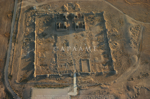
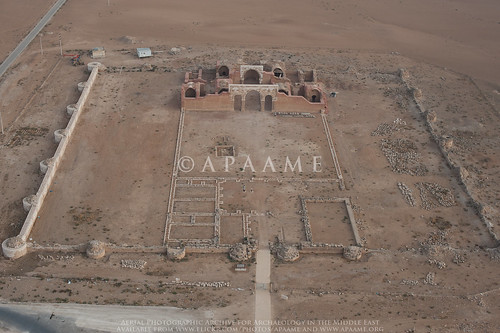
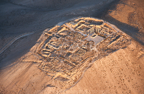
Our recent flights over the Jordanian Panhandle have been a reminder of the RAF pioneers who discovered, photographed and published Kites in the 1920s. One of the principle trio was Gilbert Insall.

Insall had published a photograph of a Kite in 1929 (which has now been ‘rediscovered’ – Blog 'The First Kites') taken while he was commanding a squadron in Iraq. Several years later he was back in the Middle East as Station Commander of RAF Abu Sueir in Egypt, a Flying Training School. Edward Mole, the Chief Engineer at Abu Sueir in 1937-8, subsequently published a delightful autobiography of his RAF career including flights made with Insall. By then Insall was 42 and his enthusiasm for archaeology as undiminished. Mole records that Insall frequently flew out over Sinai, located sites, landed and set-to with the shovel and pick he carried with him. In case the C.O. got into trouble, Mole sometimes flew with him in another aircraft and was roped into the digging.
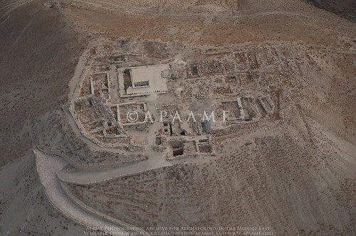
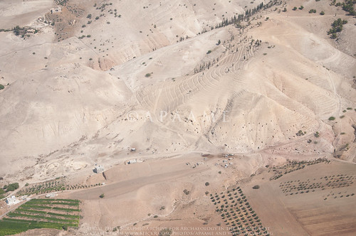
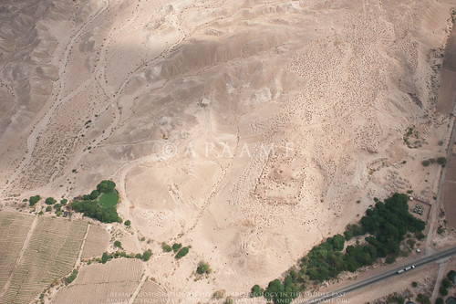
From above, the pattern of an old settlement could clearly be seen on the desert sand, and on sighting one, Insall would land nearby and dig for objects.

Later still, Insall and Mole flew together to Baghdad to visit RAF friends.
We set off together in two Audax aircraft to make the long trip across the featureless Arabian desert. There were no radio navigation aids in those days, but all we had to do was to find and follow the oil pipe line which ran straight as a die for hundreds of miles. We took with us all necessary desert flying equipment – emergency rations, water bottles, first aid kits – and Ghoolie Chits.

Interesting that by 1937-8, the air route across the Jordanian Panhandle had evidently shifted from the track and furrow ploughed for the RAF-pioneered Airmail Route of 12 years before along the southern fringe of the lavafield, to the much more straightforward line of the new oil pipeline further north. This was evidently the route followed by Imperial Airways when it took over the Airmail task from the RAF and explains the series of circular route-markers with numbers from (at least) 24 to 16 (as you flew east) (For an example see Flight 20141015 blog).

In Iraq, Insall had Mole fly him over Samarra so he could photograph it from the air – as he had had done when he flew Crawford there in 1928. Hopefully his aerial photos survive – his son had an RAF flying career, too, and is now a noted writer on archaeological work in Oman.

Abu Sueir, Sir P Sassoon, G Cpt Insall VC Inspecting Junior Term 1936.
On a personal note, Insall senior was the Station Commander at Abu Sueir when my father learned to fly there in 1936 and officiated at his Passing Out Parade.

- David Kennedy

Insall, G. S. M. (1929) “The aeroplane in archaeology”, Journal of the RAF College, Cranwell 9.2: 174-175.
Mole, E. (1984) Happy Landings, Shrewsbury.
Kennedy, D. L. (2012) “Pioneers Above Jordan. Revealing a prehistoric landscape”, Antiquity 86: 474-491.

Wednesday 22 October 2014

Flights 20141019-20 - The Aqaba Trip

Sunday 19th
Much forethought and planning had gone into this two-day trip by David and Becc so it was doubly disappointing that Becc was stricken by a bug and couldn’t join us, and the weather had turned decidedly autumnal. However Don agreed to join us for a boy’s trip to the Red Sea. Low pressure, low clouds and poor visibility meant our first attempt to fly south was thwarted, and after 45 minutes we returned to Marka. We were told the weather would get worse, but indomitable as ever we pressed the case for getting to Al-Jafr (many miles south-east and it is always clear there). So after a delay we set off for a very successful (if long) day. David has already written up two of the highlights (see post for Flight 20141019) - the Via Nova Traina; and the ancient Aina fort overlooking the Wadi el-Hasa, with stunning views and a truly commanding position. We both wondered why we had never photographed this very well preserved and important site before?
The Gharandal Roman Fort. © APAAME_20141019_DLK-0418.
The cold was beginning to have its effect, and we were grateful for the re-fuelling stops at Jafr, but not much re-fuelling for the pilots and crew; luckily Becc had provided us some dates, chocolate biscuits, nuts and Werther’s Originals (the later being a staple on these flight over many years). The final leg of the day was very rewarding as we descended into the (warm) Wadi Araba to photograph the Roman fort at Gharandhal and then land at Aqaba. There was just time for the quickest of dips in the Red Sea before an early meal and early night.
Ayla - ancient Aqaba. © APAAME_20141020_RHB-0033.

Monday 20th
Threatening clouds to the west, including some rain, greeted us at take-off (despite the cold) – even this far south – but our first targets were of ancient Aqaba, the original city being called Ayla, and now a heritage park, well watered and surprisingly green.

Transfixing landscapes east of Aqaba. © APAAME_20141020_RHB-0094.
We were then transfixed by the landscapes we were flying over; a geological tour de force and a wonder to behold; impossible to capture the scale and enormity of this wind-sand-blown desert with teeth-like pillars of rock randomly placed.
Landscape west of Mudawwarra. © APAAME_20141020_RHB-0119.
As we flew on the landscape changed to a darker basalt rock where the formations were like fingers spreading out into the desert. All testament to millennia of erosion and change.

The ghost line of the Hedjaz Railway. © APAAME_20141020_RHB-0170.
From there we approached the Hedjaz railway, and some stunning ancient hill-top enclosures, forts of as yet unknown date, but very well preserved. At this point the railway there is only a ghost of the track and sleepers – the station and platforms deserted and almost covered over with sand. Then a huge loop in the system as climbs up a steep gradient, and new track, and a real railway; presumably in use by a mining company to shift huge quantities of minerals. On the summit another stunning defended hill-top enclosure- Fassu'ah Ridge Fort; the pilots commented that it looked like looters “were looking for gold”, but we have been informed that the collapsed trenches are from former fieldwork by the Great Arab Revolt Project.
Fassu'ah Ridge Fort above Mahattat Hitiya. © APAAME_20141020_RHB-0236.
Detail of Fassu'ah Ridge Fort. © APAAME_20141020_RHB-0249.
By now the strong westerly wind was affecting our schedule, and the longer time taken to return to Jafr for refuel meant fewer targets were photographed than we hoped; let’s hope for more flying time next year. Even at Jafr the cool wind meant we had to find a wind break, and a snack lunch in the helicopter, before a final foray to look for a group of sites in a landscape never visited before in the far east of the country. We knew that locating them (in the midday sun) would be difficult but only on arrival did we discover just how ephemeral these particular “kites” would be. We saw all but two of the sites, but only just.
Huey lunch with Don Boyer and David Kennedy. © APAAME_20141020_RHB-0325.
A final re-fuel and the long slog back to Marka and (my) farewells to the crew and squadron commanders “until the next time” – there is one more flight planned for this season for David and the team in Amman.

Monday 20 October 2014

Flight 20141019 - The Via Nova Traiana in Central Jordan

The great Roman highway ran from Syria down the length of the Emperor Trajan’s new province of Arabia to Aila (Aqaba) on the Red Sea. Nineteenth century western travellers and explorers ‘east of Jordan’ regularly reported following it for mile after mile and noting many of the hundreds of milestones still to be seen. In the twentieth century it suffered badly with great stretches disappearing beneath modern roads or ploughed away by farmers and developers; milestones have been smashed or bulldozed aside. Happily there are still places one can see stretches surviving, usually in the more remote parts of modern Jordan.
Bulldozing damage to Rujm el-Faridiyyeh. © APAAME_20141019_DLK-0180
Our flight yesterday (Sunday) included Rujm el-Faridiyyeh, a Roman road-station on the Via Nova just south of the Wadi el-Hasa. It was the subject of a striking RAF aerial photograph of 1937 and was drawn in the course of Burton MacDonald’s Wadi el-Hasa Survey (1988) 30 years ago (Kennedy and Riley, Rome’s Desert Frontier, 1990: 86-9). Sadly we found that even on this fairly isolated stretch of the plateau, a bulldozer has (again) been at work – for no apparent reason as there is no development at that point.
Milestation along the VNT. © APAAME_20141019_DLK-0203.
On the other hand, the road appears today almost intact and showing far more strikingly as a classic Roman road than even the old RAF photo had suggested. Our experience in Jordan over the course of several attempts since we began in 1997, is that Roman roads are often quite difficult to re-discover from the air unless well-preserved. Not so this time. From the air we could clearly trace the road running for at least 5 kilometres (about 3 Roman miles) and with intermittent stretches thereafter. As MacDonald could describe from his ground visit in the 1980s, you can still see the side kerbs and the central spine of the substructure (which is what survives). Particularly interesting was the cluster of milestones at one Milestation, some still standing after some 1800 years.
VNT and Tower. © APAAME_20141019_DLK-0189.
There is a need to re-visit on the ground this superb stretch of road which is coming under increased threat from agriculture and some building nearby. Even more important is to trace it beyond the remains of the bridge across the stream of the Wadi el-Hasa and up the steep slope to the northern plateau. Hints of the line reported over a century ago are still visible from the air. More striking are the collapsed towers in its vicinity and – best of all, an apparently newly discovered fort. As it lies on a promontory overlong the Roman road it may be Nabataean and/ or Roman.

Aina Fort 1. © APAAME_20141019_DDB-0137.
- David Kennedy

Edit November 26, 2014: Aina Fort 1 is Kh. al-Medeineh (on the Wadi al-Hasa) - Glueck's site 222 in Explorations of Eastern Palestine II (1935): 104-5. Thank you to Dr. Haim Ben David for the info.

Friday 17 October 2014

Flight 20141015 - The Longest Day?

Flight track log from 20141015 - the survey of the basalt near Uweinid we conducted is particularly prominent.
A day’s flying always starts with the rigmarole of having to get through the security gate at Marka airbase. This year we were waved through on the first day as I was being asked if I wanted ‘Eight Squadron” and I said yes; not really knowing the exact details of what had just happened (as my Arabic is non-existent). The second day I blew it but today, having learnt what the question would be, and having memorized the Arabic for 8 Squadron, we sailed through. It has taken 16 years for this refined level of communication to be achieved – just as it has taken all these years to train a generation of young Huey pilots to understand what on earth these crazy archaeologists are doing orbiting sites hour after hour. Our pilots are now even taking their own pictures as they are becoming interested in what we see. All our orbits are to the right (as we sit on the right) but today was a “first” in that the pilot did a orbit to the left, especially for the co-pilot (seated on the left) to see what we had been looking at.

Qasr el-Uweinid. © `APAAME_20141015_RHB-0050.

So, what did we see? With over 2,000 images taken by the three of us (Bob, Becc and Mat) in 7.5 hours (see flight trace of today’s excursions) the highlights are particularly difficult to select. Our aim was to survey parts of the black basalt desert in the eastern part of Jordan, starting at Azraq and heading as far east as Ruweishid. Predominantly our targets in this region are prehistoric sites, but Qasr Uweinid always stands out as such a wonderfully situated Roman fort, on a promontory.
A Pendant with a close shave. © APAAME_20141015_RHB-0123.
Mainly we are photographing “Pendant”, “Kite” and “Wheel” sites – all named according to their shape; their date and function are less well known. The most striking Pendant (almost certainly a burial site) was this one – so nearly completely obliterated by a competing road bulldozed through since we last photographed.
A kite with wheel enclosure built over it. © APAAME_20141015_RHB-0463.

There were many Kites but the light this time of year highlights them so well – and rare to have both a Wheel and a Kite so entwined.

YAMOUK written in basalt across a mud pan landing ground. © APAAME_20141015_RHB-0303.
However it was the twentieth century remains which really took our breath away. In preparing for the flight Becc had marked two former RAF installations, visible on Google Earth but we had no idea what would survive. They are remnants from the time when Jordan was under a British mandate (then known as Transjordan), and the creation of the Cairo to Baghdad Airmail Routes. The first to be photographed was a landing ground with name "YARMOUK" created in stone, inlaid in the sand, to one side of the “runway”. The runway consisted of a very long stone-defined landing strip on the hard surface of the mudflat. To our amazement there seems to be almost no recent disturbance, a faint trace of the odd 4x4 wheel track, so prevalent elsewhere, but no sign of a bulldozer, thankfully.
The 'KENSINGTON' landing ground. © APAAME_20141015_RHB-0441.
The second site was one of the circular markers for the Cairo to Baghdad Airmail Route (one of the routes is described in R. Hill’s book on the subject from 1929) – number 17, but curiously this site also has inscribed in the sand the name "KENSINGTON". Both the number and the name are clearly visible on Google Earth. Our flight confirmed there has been little recent disturbance and we could also see what we interpret to be the remains of what must have been a camp, rectilinear stone-built platforms for tents. It is very unlikely any of the pilots from this period (1920s-1940s) are still alive but it would be fascinating to find out if any diaries exist of life at “Kensington”.

Remains of a camp near "Kensington". © APAAME_20141015_RHB-0443.

So, why the longest day? We left the Institute in Amman at 0630, and started flying at about 0715 and didn’t get back to Marka, after a long transit flight from Ruweishid, until almost 5 pm. Normally we do 4 to 6 hours flying (2 or 3 sorties) but today it was 4 separate flights, 3 re-fuellings for the aircraft but very little “fuel” for the pilots or ourselves and a total of 7.5 hours flying.
- Robert Bewley